5:00 PM
SEVERE THUNDERSTORM WATCH
(5:00 PM 5/8/24)
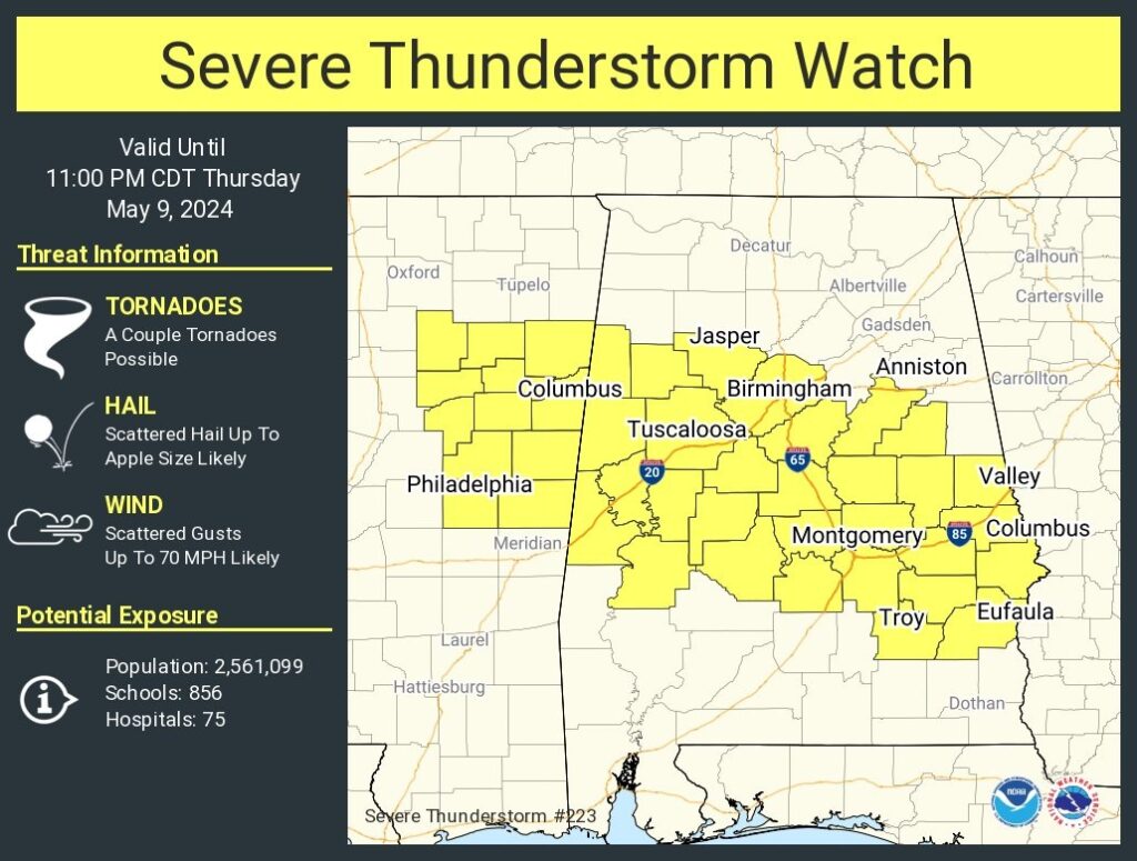
Severe Thunderstorm Watch covers central and south Alabama until 11PM. Damaging wind gusts to 70+ mph. Hail the size as apples, possible. A couple of tornadoes possible. This does not include the significant overnight threat. A widespread significant wind damage threat from an explosive overnight complex of severe storms in the wee hours. Damaging winds is the main threat. Tornadoes can’t be ruled out.
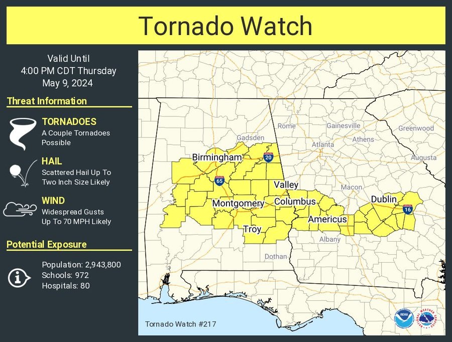
Tornado watch for much of central Alabama until 4 PM. Essentially from about Birmingham southward to Troy, including Montgomery. Wind gust to 70 mph, hail the size of limes or eggs, a couple of tornadoes possible.
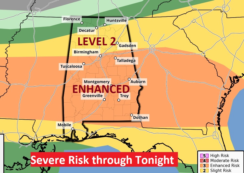
Good morning! Showers and storms are likely today, tonight into early Friday. Multiple rounds of severe weather are likely. The first round could be late this morning. Another round is likely late tonight in the overnight hours into Friday morning. Much of the area in now in an ENHANCED Level 3 Severe Risk. The main threat is damaging winds and the potential for large hail. The tornado threat is not zero, but it is relatively small. Much cooler air will follow. We’ll be in the 50’s Friday and Saturday night. Saturday’s high will be in the upper 70’s. Mother’s Day looks beautiful. Here’s my brief forecast Discussion.
TODAY: Showers and storms are likely. Could be multiple rounds of severe weather. Especially late this morning and in the overnight hours tonight into Friday morning. Breezy today and tonight. High today 87. Low tonight 68.
Today’s severe weather risk has been upgraded. Much of our area is now in and ENHANCED level 3 Severe Risk, The main threat is damaging winds and the potential for large hail. The tornado threat is not zero, but it is relatively small. This is the day 1 outlook through 7AM Friday.
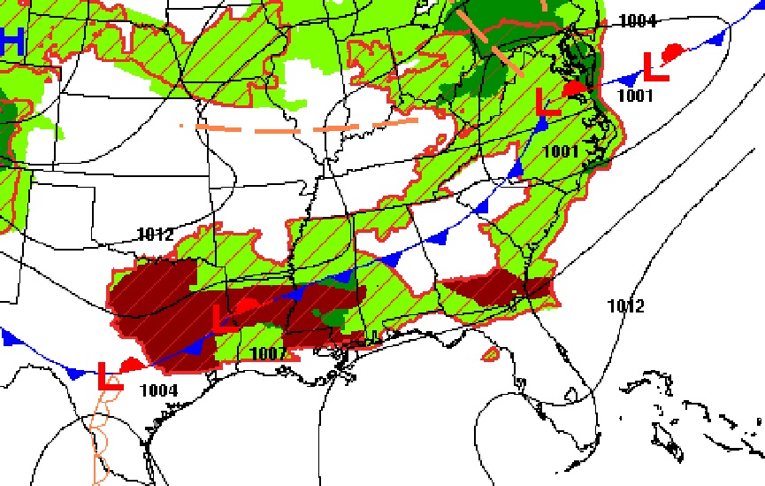
Strong cool front sagging southward will be todays weather maker. It’s a complex weather scenario.
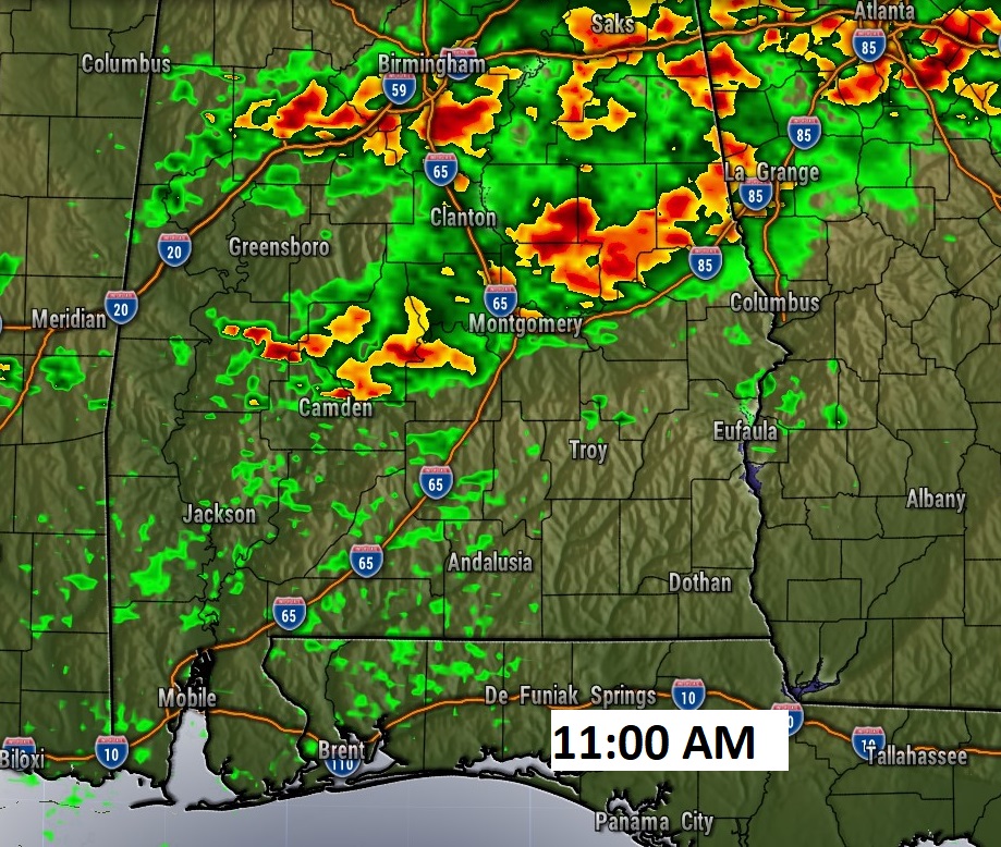
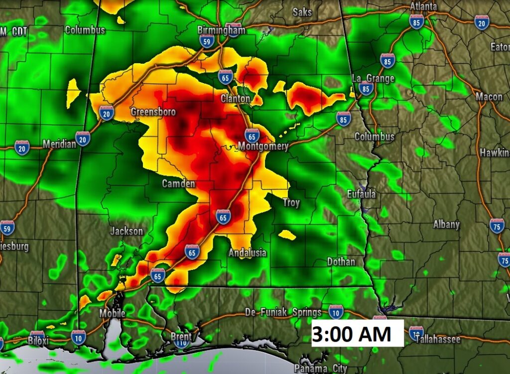
FUTURE RADAR: It’s a very complicated set-up with many unknowns. But, multiple rounds of severe weather seems likely. The first round could be this morning. Perhaps late morning in our part of central Alabama. Another round is likely late tonight in the overnight hours into Friday morning. As you look at Future Radar, don’t take the times literally. The models are struggling to pin down the details.
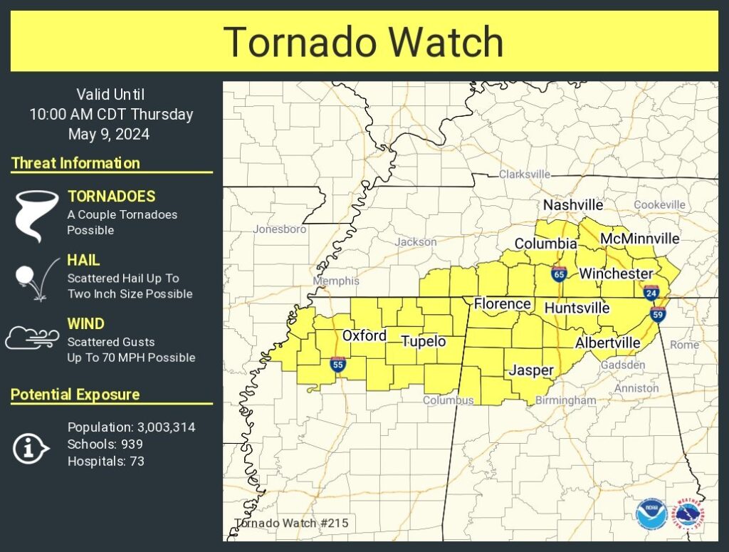
First Alabama Tornado Watch of the day, covers north Alabama through 10AM.
Here’s the Day 2 Severe outlook after 7AM Friday morning.
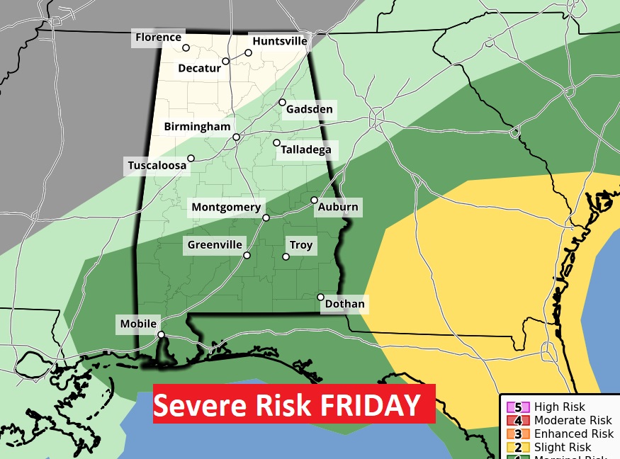
NEXT FEW DAYS: Showers & storms will be ongoing Friday morning. Some of the storms will be strong possibly severe. Much cooler air will follow. Friday’s high 83. 50’s Friday and Saturday night. Saturday’s high will be in the upper 70’s. Looks like a pretty nice Mother’s Day weekend forecast. High Sunday 83. Risk of showers and storms returns Monday. Tuesday looks stormy.
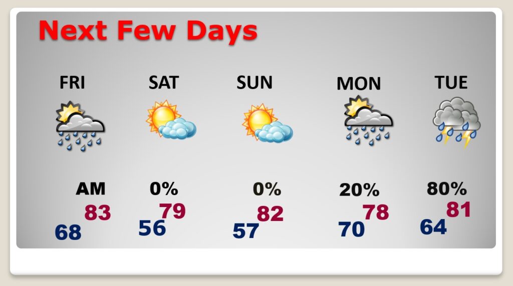
.
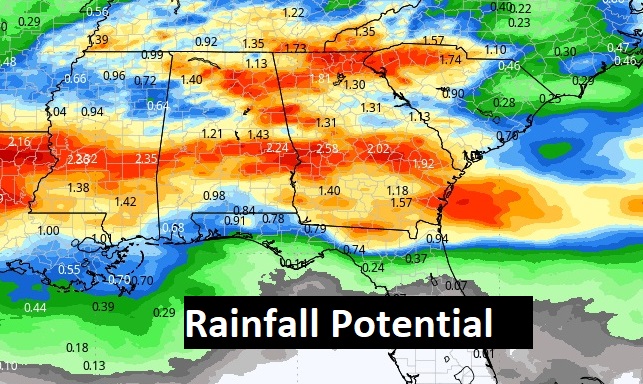
Here’s the expected rainfall.
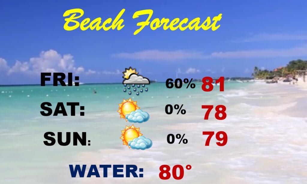
BEACH FORECAST: Showers and storms will dominate the Friday forecast. Possibly severe. The rest of the Mother’s Day weekend forecast looks nice.
Thanks for reading the blog. There will be another complete Blog update and video forecast discussion tomorrow morning. This morning, everything is normal including LIVE on the Radio from 6 to 9AM on NewsTalk 93.1 – WACV. Have a nice day!
–Rich
