
**For some unknown reason, my WORLD PRESS editor is not functioning correctly, this morning. I do not know what’s wrong. Bear with me. The post looks different this morning. I will effort to fix this before tomorrow’s blog update.
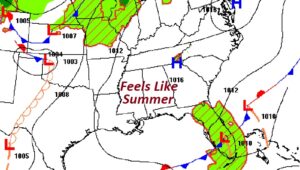
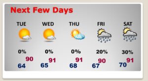
Good morning! This new week is starting on a very nice note. Very warm and dry. Lots of sunshine. Summerlike for much of this week. We’re headed to the upper 80’s today, and closer 90 for each of the next few days though the end of the week. We should be dry through Thursday. small rain chance returns Friday. Scattered storms Saturday.
TODAY: Mostly sunny. Dry and very warm. Mid to upper 80’s today. East wind at 5 to 10 mph. Generally clear and
comfortable tonight. Low 64.
NEXT FEW DAYS: Dry and warm with mostly skies through
Thursday. Daytime highs near 90 each day. Summerlike.
We should be dry through Thursday. A Small rain chance returns
Friday. Scattered storms on Saturday.
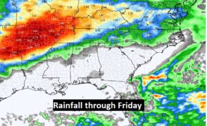
After soaking rains in the last few days, this week we get a chance to
dry out. The Montgomery Airport had 3.70” over the weekend.
Just twelve days till the official start of hurricane season in the Atlantic basin. 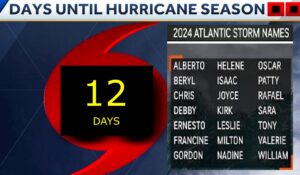
Thanks for reading the blog. There will be
another complete Blog update and video forecast discussion tomorrow
morning. This morning, everything is normal including LIVE on the Radio
from 6 to 9AM on NewsTalk 93.1 – WACV. Have a nice day!
–Rich