
Good Morning! The atmosphere is moist and primed for a generous supply of showers and storms today. Some storms could produce very gusty wind, heavy downpours and dangerous lightning. The heat index reached a season high of 107 Friday. Expect more dangerous heat indices for the weekend and early next week. In fact I wouldn’t be surprised if we see a Heat Advisory, especially by Sunday. Meanwhile, the tropics are coming alive. Tropical Storm Beryl, in the Tropical Atlantic could become a Hurricane later today. It could reach the islands of the Lesser Anilities by Monday. Then, where does it go? I have the latest track information from NHC. They are tracking three tropical features. Have a nice weekend!
TODAY: A Sun/cloud mix. Hot and humid again. High in the low to mid 90’s. A generous supply of Scattered random storms will develop, especially by afternoon and evening. Low tonight 74.
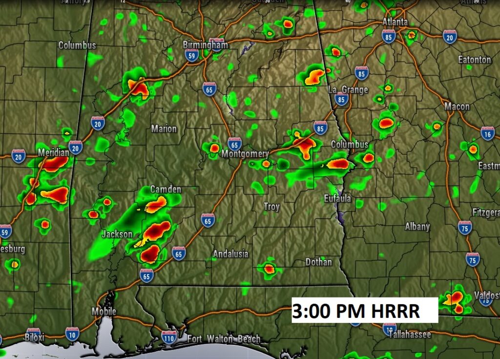
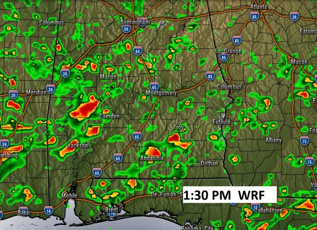
FUTURE RADAR: Here’s a couple of hi-res model examples. I think the WRF Model may be TOO aggressive at 1:30PM. Ad the HRRR model may not be aggressive enough at 3:00 PM. The truth probably lies in-between.
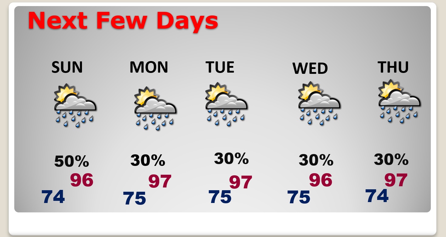
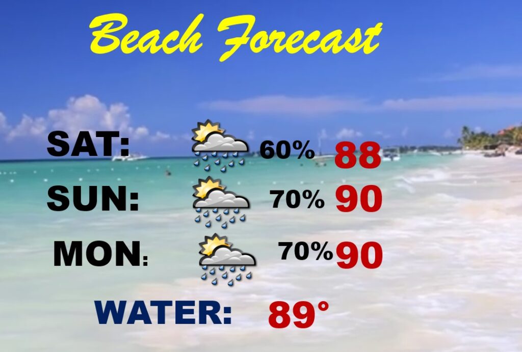
NEXT FEW DAYS: Radar will be quite over the next few days. The storms will be random, but there will be locally heavy downpours. The elevated rain chance will be around through the weekend. Otherwise, it’ll be hot & humid each day. Expect mid 90’s over the weekend and upper 90’s early next week. Expect more dangerous heat indices for the weekend and early next week. In fact I wouldn’t be surprised if we see a Heat Advisory, especially by Sunday.
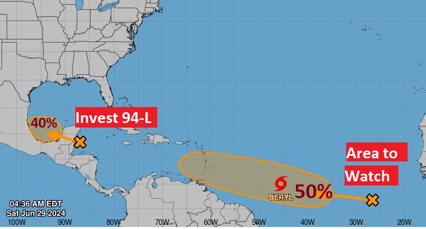
TROPICAL UPDATE: Tropical Storm Beryl, in the Tropical Atlantic could become a Hurricane later today. It could reach the islands of the Lesser Anilities by Monday. Barbados is under a Hurricane watch, but additional watches are likely for many other islands in the Antilles later today. Beryl could be nearly a Cat 3 major hurricane intensity by Monay as it continues westward through the Caribbean. It’s at an unusually low latitude. Beryl’s ultimate destination after it’s Caribbean trek is not known.
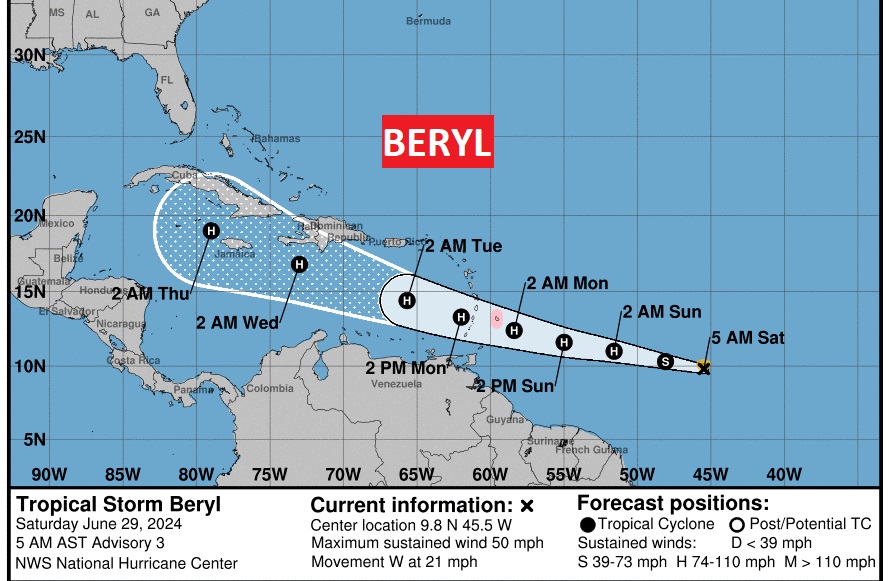
NHC is also tracking Invest 94-L in the SW Gulf, and behind Beryl there is yet another Area to Watch in the Tropical Atlantic off the African coast. The next available name is Chris.
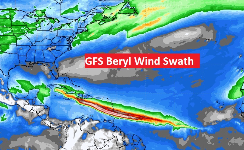
Here’s an interesting map. From the GFS model, this is the expected wind swath of Beryl as it treks westward in the Caribbean over the next six days.
BEACH FORECAST: Expect elevated rain chances through the weekend, Be flexible with your outdoor plans. Watch for dangerous lightning. Moderate rip current risk today and a high risk Sunday and Monday. FIVE people have lost their lives in the last 10 days to Rip Currents.
Thanks for reading the blog. The next complete scheduled blog update and video will be Monday morning, unless updates are needed. Have a nice weekend.
–Rich