
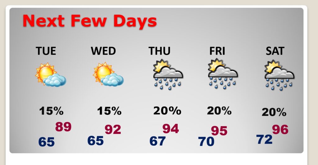
Good Morning! Early this morning, well before Dawn, a front is stretched across central Alabama from Demopolis to Alex City, sliding southward. The front should reach the coast by lunchtime. There’s a risk of scattered showers and a few thunderstorms near and even behind the front. It’s a pretty standard forecaster after today. Rain chance 20% or less each day. Lots of sunshine Tuesday through Friday. Upper 80’s Tuesday. Lower 90’s Wednesday. Mid 90’s Thursday and Friday. Over the weekend, it appears we’ll be watching potential tropical activity in the Gulf. Right now, it appears this activity will be confined to the western Gulf. Here’s my brief forecast Discussion.
TODAY: Sun/cloud mix. Scattered random PM storms, mostly afternoon. High near 91. Partly cloudy tonight.. Low 66. Light wind.
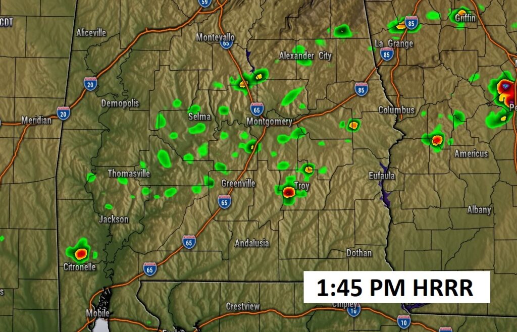
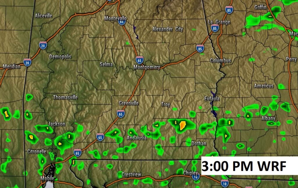
FUTURE RADAR:
NEXT FEW DAYS: It’s a pretty standard forecaster after today. Rain chance 20% or less each day. Lots of sunshine Tuesday through Friday. Upper 80’s Tuesday. Lower 90’s Wednesday. Mid 90’s Thursday and Friday.
TROPICAL: NHC says no tropical development in the next 7 days. HOWEVER…
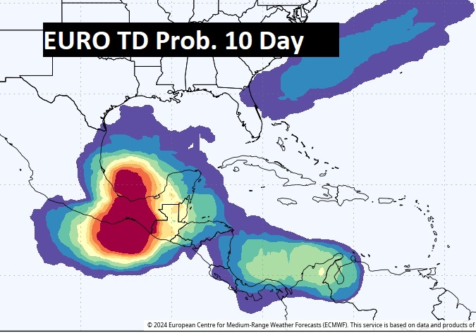
Over the weekend, it appears we’ll be watching potential tropical activity in the Gulf. Right now, it appears this activity will be confined to the western Gulf. Here’s the EURO model Tropical Depression Probability days through 10.
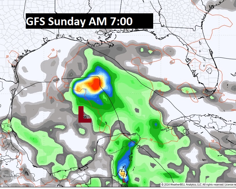
Even the GFS is showing what could be a sub-tropical or tropical Low in the western the Gulf over the weekend
Thanks for reading the blog. There will be another complete Blog update and video forecast discussion tomorrow morning. This morning, everything is normal including LIVE on the Radio from 6 to 9AM on NewsTalk 93.1 – WACV. Have a nice weekend!
–Rich