
Good Morning! We are still officially 3 days away from the Summer Solstice. However, we are deep into the summer pattern. Today’s high in the middle 90’s, with dewpoints in the low to mid 70’s will produce triple digit heat indices. Like yesterday, there will be widely scattered random storms, mostly in the afternoon and evening hour. Tomorrow, Wednesday and Thursday showers will be scarce at beast. Scattered storms will be more numerous Friday and Saturday. The tropics are waking up. It is likely we’ll have a Depression or Tropical Storm Alberto in the southwest Gulf soon.
NEXT FEW DAYS: Tomorrow, Wednesday and Thursday showers will be scarce at best. Scattered storms will be more numerous Friday and Saturday. Highs will be in the low to mid 90’s. Dewpoints in the 70’s. Triple digit heat indices. Lows at night in the middle 70’s.
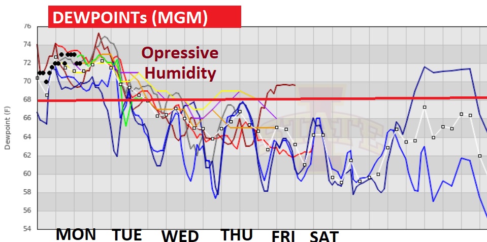
It’s going to be very uncomfortable this week. Very humid. Look at the Dewpoints.
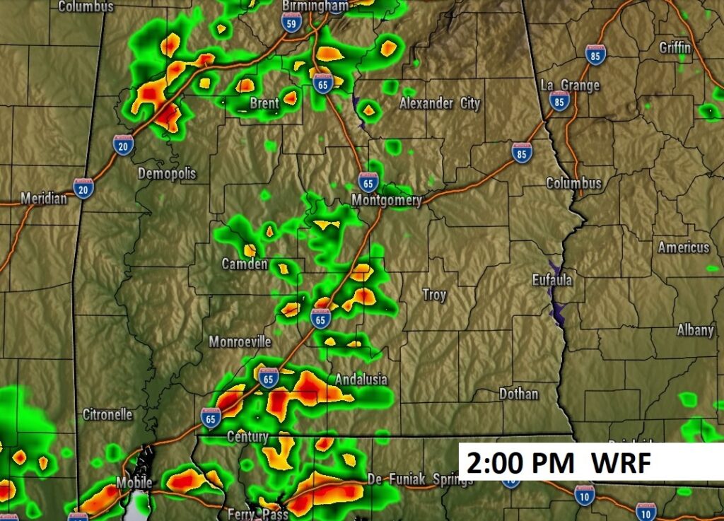
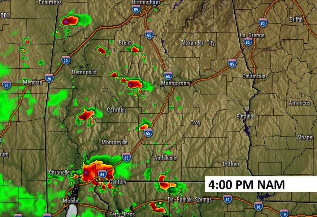
Future Radar examples later today. Routine random spotty PM storms.
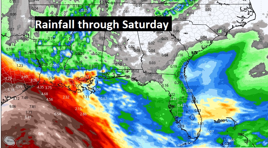
Don’t expect mushc in the way of rainfall this week, but look at the SW Gulf.
TROPICAL: The tropics are waking up. It is likely we’ll have a Depression or Tropical Storm Alberto in the southwest Gulf soon. Plus, there’s a Bahamas disturbance being monitored as it drifts toward the SE coastline.
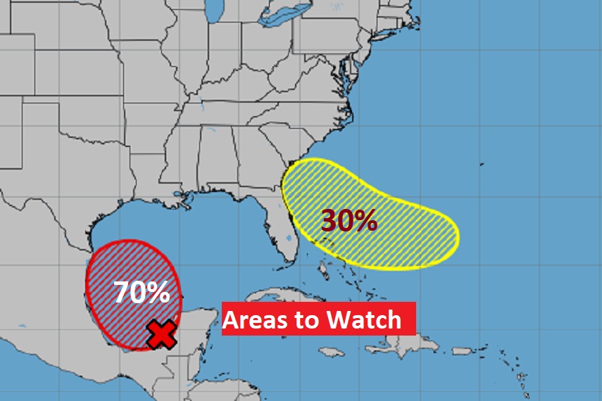
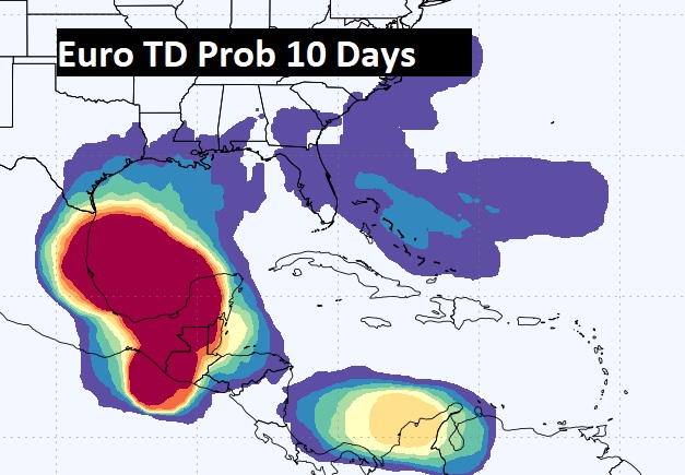
Check out the EURO Tropical Depression probabilities through Day 10. You can see there are many areas to monitor.
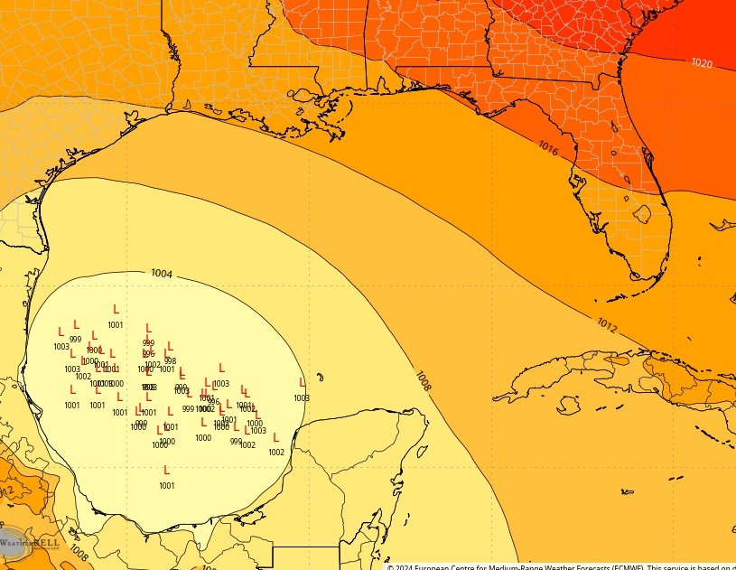
Here’s the EURO Ensembles member Low positions on that SW Gulf system.
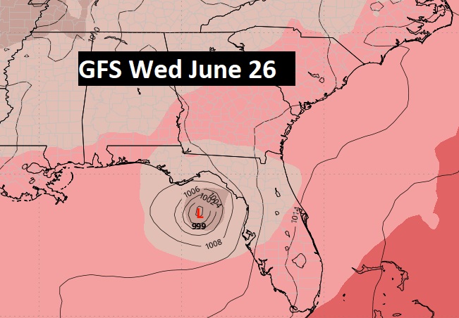
The GFS hints at another tropical system which needs to be monitored in the middle of next week.
Thanks for reading the blog. There will be another complete Blog update and video forecast discussion tomorrow morning. This morning, everything is normal including LIVE on the Radio from 6 to 9AM on NewsTalk 93.1 – WACV. Have a nice day!!
–Rich