
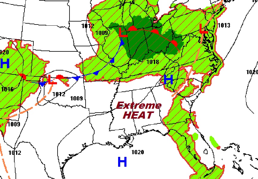
Good Morning! HEAT ADVISORY at least through Thursday. Dangerous Heat indices through Thursday at least 105 or higher. Meanwhile, PM storms will be few and far between. Not much change in the extreme heat through Monday. Here’s my brief forecast discussion.
TODAY: HEAT ADVISORY. Mostly sunny. Random storms will be few and far between. High today 97. Heat index 105 to 110. Light win. Very muddy and warm tonight. Low 77
.
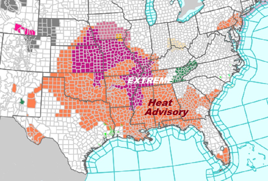
Heat Advisories and Excessive Heat Warnings cover a multi-state area.
NEXT FEW DAYS: HEAT ADVISORY at least through Thursday. Dangerous Heat indices through Thursday at least 105 or higher. Meanwhile, PM storms will be few and far between. Not much change in the extreme heat through Monday.

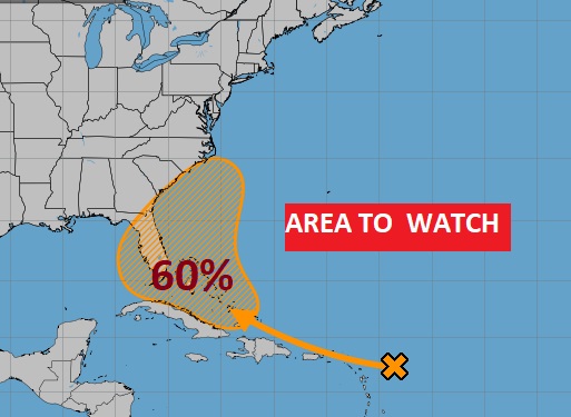
TROPICAL: NHC is still monitoring that Area to watch moving toward the general area of the Bahamas and the SE US.
Thanks for reading the blog. There will be another Blog update in the tomorrow morning. Due to health issues, I’m on the sidelines through the end of the week. COVID, Fever and pneumonia,. Have a nice day!
–Rich