
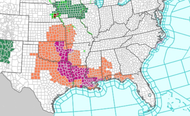
Good Morning! Today will be another extremely hot summer day with heat indices in the triple digit range. Yesterday’s high reacted 98 with a heat index of 108, Today, much of west Alabama is under another Heat Advisory, mainly west of I-65. Spotty random storms will be around Today through Saturday. It looks like a rather routine 4th of July week forecast. Powerful Cat 5 Hurricane Beryl continues to re-write June hurricane history. Where will Beryl ultimately end up this weekend? Invest 96-L is right behind Beryl. NO VIDEO THIS MORNING. SOME UNKNOWN PROBLEM. NO AUDIO. No time to fix. VIDEO TOMORROW . SORRY.
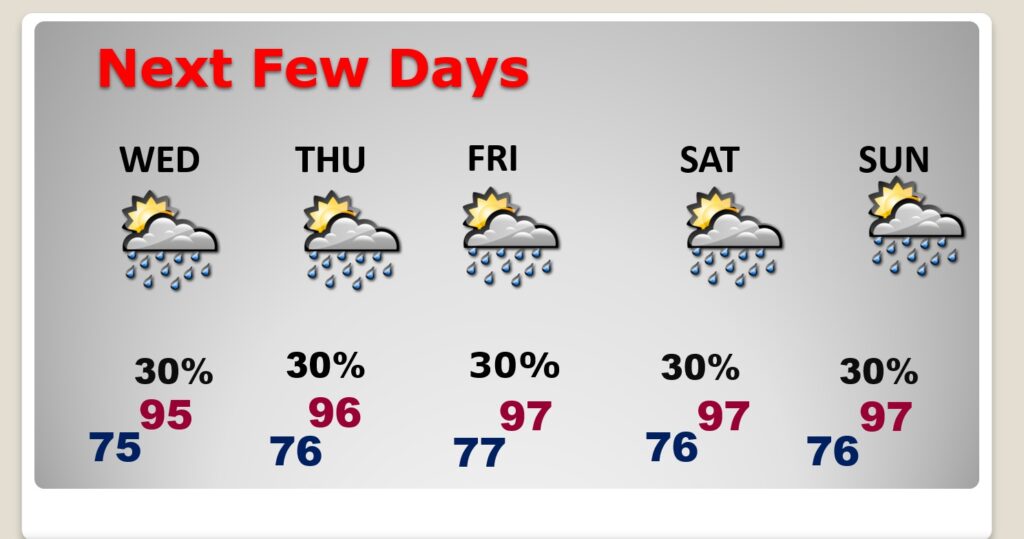
TODAY: A Sun/cloud mix. Hot and humid again. High 95 Heat index 102 to 106. Spotty random storms. Rain chances today 30%. Best chance in South Alabama. Closer to the coast. Low tonight 75.
Extreme heat continues. Triple digit heat Index.

FUTURE RADAR: Storms will be few and far between today in central Alabama. Best chance in South Alabama. Best chance in South Alabama. Closer to the coast.

NEXT FEW DAYS: Looks like a fairly routine 4th of July Week Forecast. Hot and humid. Highs most days in the mid 90’s. Expect triple digit heat indices each day. Spotty random storms will return Tuesday through Saturday. Lows at night in the 70’s. Watch out for lightning. This is statistically the biggest week for lightning deaths in the year.
TROPICAL UPDATE: Hurricane Beryl is beyond all words. It continues to re-write the hurricane record books. Max with reached Cat 5 status at 165 mph yesterday evening. STILL 165 this morning. 370 miles ESE of Jamaica. From NHC:
https://www.nhc.noaa.gov/text/refresh/MIATCPAT2+shtml/010857.shtml?
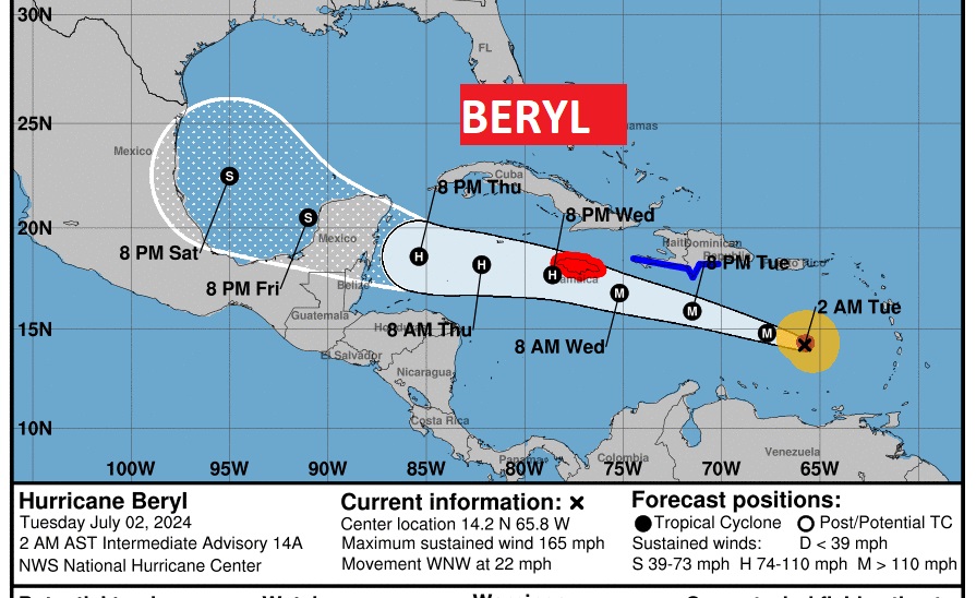
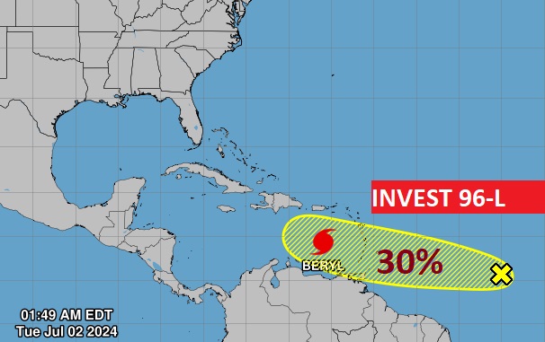
Invest 96-L is behind Beryl in the Tropical Atlantic. However, atmospheric conditions have lowered the probability of development somewhat. Next available name is Debby.
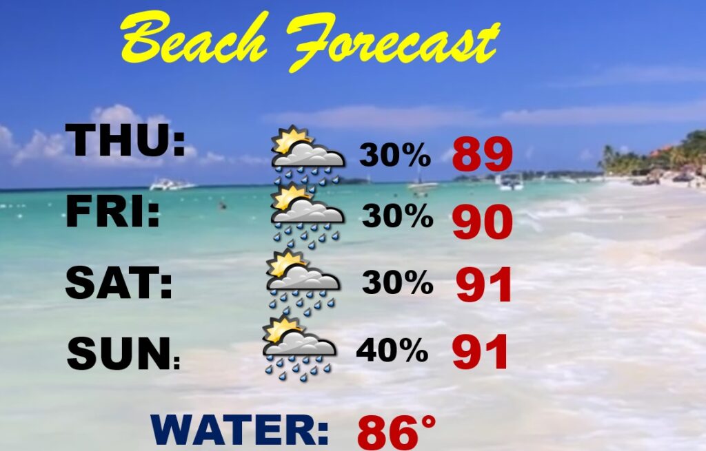
BEACH OUTLOOK: Looks to be like a very routine 4th of July holiday weekend on the coast with spotty random storms. Highs near 90. Watch out for lightning. This is statistically the biggest week for lightning deaths in the year. Watch the flags on the Beach for the Rip Current risk. Too many have died in the last 2 weeks on the coast due to Rip Currents.
Thanks for reading the blog. There will be another complete Blog update and video forecast discussion tomorrow morning. This morning, everything is normal including LIVE on the Radio from 6 to 9AM on NewsTalk 93.1 – WACV. Have a nice day!!
–Rich