
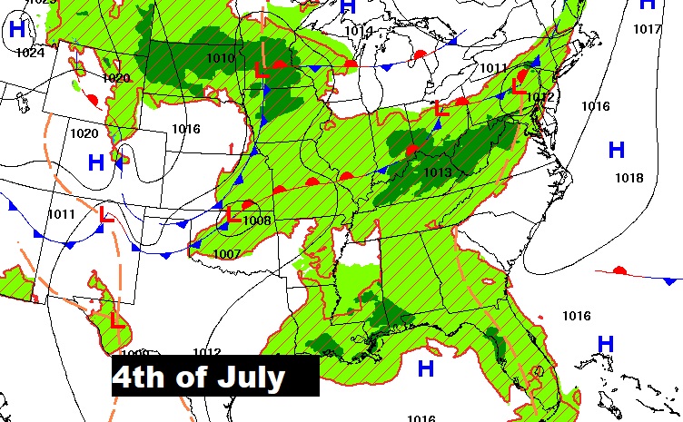
Happy Independence Day! Today’s biggest concerns will be extreme heat and lightning on this 4th of July. Heat Advisory in effect, again. Heat index as high as 110+ in parts of the state. Widespread Heat Advisories and Excessive Heat Warnings cover a multi-state area. There will be will be spotty random storms will be around Today through Sunday. Storms could be a little more numerus, perhaps, on Friday. Otherwise, it looks like a rather routine 4th of July weekend forecast. Powerful Hurricane Beryl now has it sights on the Yucatan and then into the Gulf. Where will it make landfall?
TODAY: Heat Advisory in Effect, again. Sun/cloud mix. Dangerous Heat. High 95. Heat index 103 to 107. Spotty random storms. Remember, statistically there are more lightning fatalities on the 4th than any other day of the year, If you are close enough to hear thunder, you are close enough to be struck. Hopefully, most of the storms will be fading by Fireworks time tonight Low tonight 75.
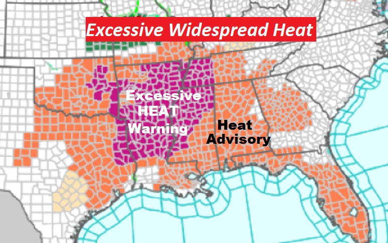
Extreme heat continues. Look at these maps! Dangerous heat covers a multi-state area. Stay hydrated.
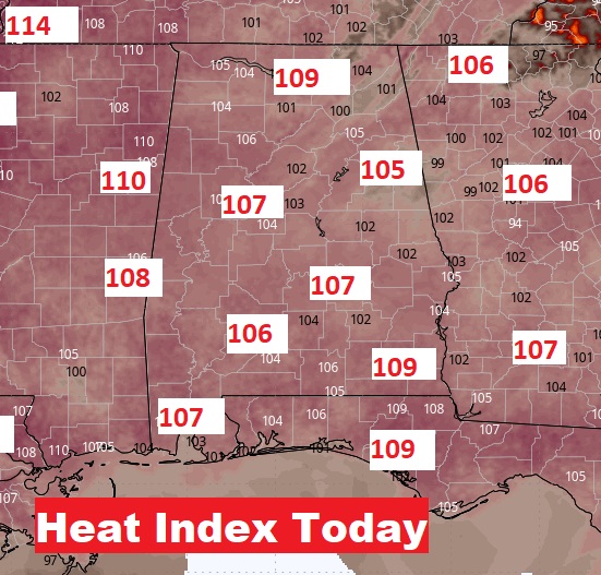
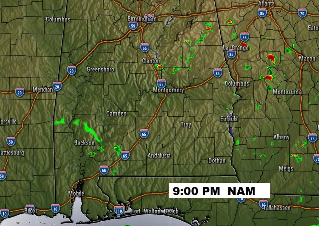
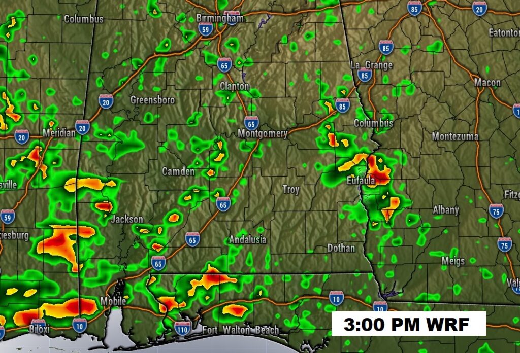
FUTURE RADAR: Excessive Heat continues. There will be will be spotty random storms will be around Today through Sunday. Storms could be a little more numerus, perhaps, on Friday. Maybe even a couple of stronger storms Otherwise, it looks like a rather routine 4th of July weekend forecast. Daytime highs mid 90s. Triple digit heat indices. Lows at night in the muggy mid 70’s.
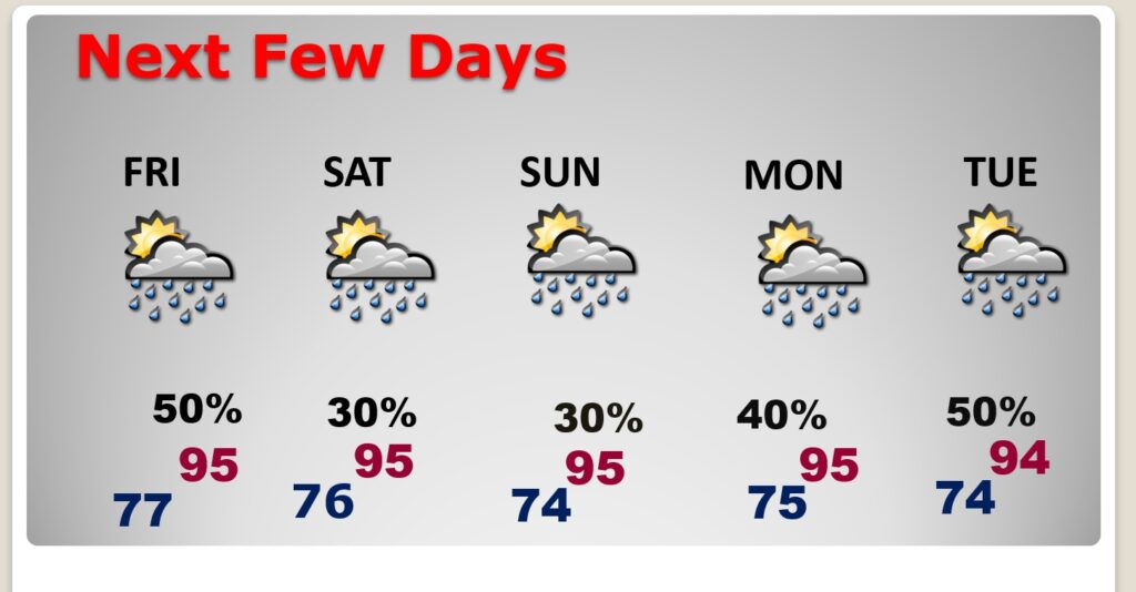
NEXT FEW DAYS: Looks like a fairly routine 4th of July Week Forecast. Hot and humid. Highs most days in the mid 90’s. Expect triple digit heat indices each day. Spotty random storms will return Tuesday through Sunday. Lows at night in the 70’s. Watch out for lightning. This is statistically the biggest week for lightning deaths in the year.
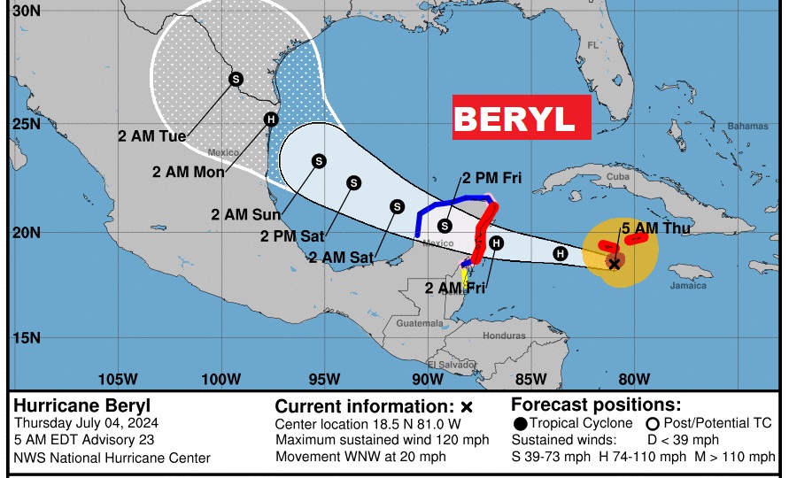
TROPICAL UPDATE: Powerful Major Hurricane Beryl is still having a major impact on the Cayman Islands this morning. Tomorrow the Hurricane the will be headed for the Yucatan. Then, after briefly loosing a little strength over land, Beryl could become a Hurricane again in the SW Gulf before making landfall in NE Mexico or extreme south Texas Sunday night/Monday morning.
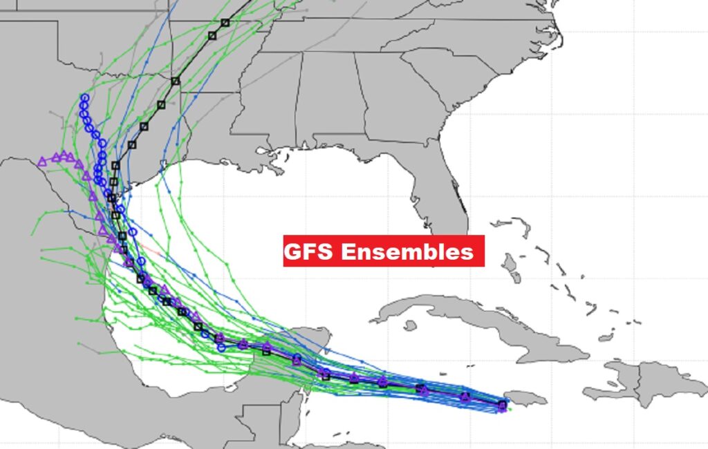
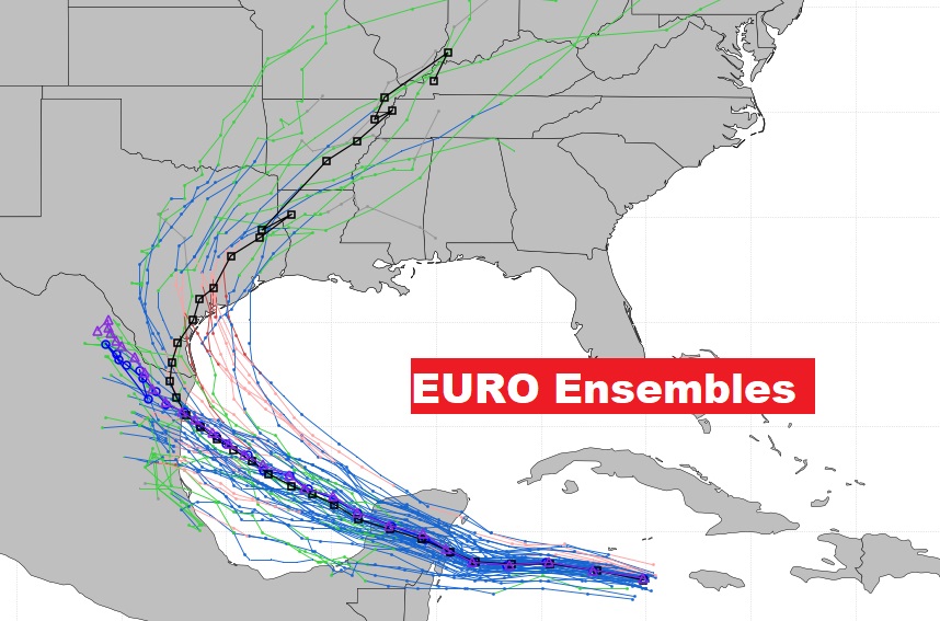
What are the models saying about possible tracks? Here’s the spread in the Ensemble model members on the GFS and EURO.
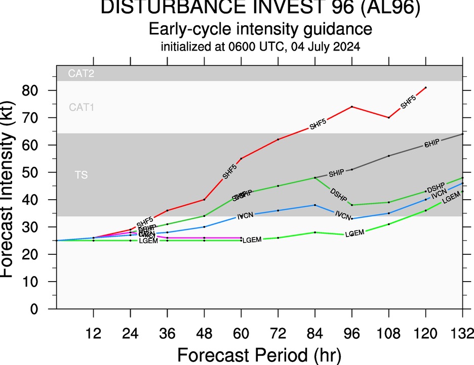
Invest 96-L is behind Beryl in the Tropical Atlantic. However, atmospheric conditions have lowered the probability of considerably.
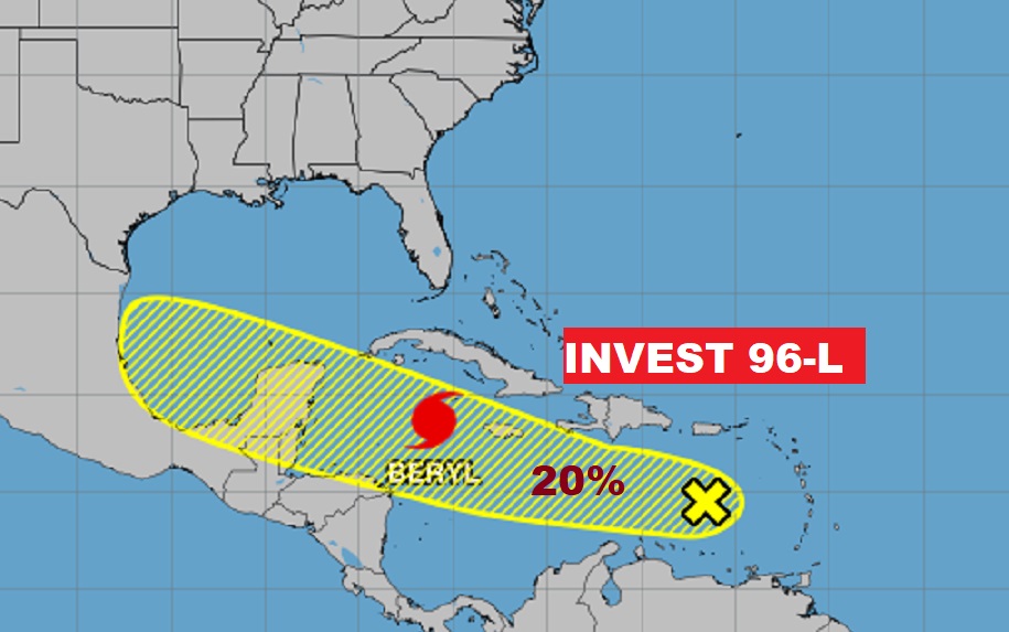
It is interesting to note, that some models take this system to Tropical storm strength in the Gulf. Next available name is Debby.
BEACH OUTLOOK: Looks to be like a fairly routine 4th of July holiday weekend on the coast with spotty random storms. Storms will be a little more numerous than here in central Alabama. Be flexible with your plans. Highs near 90. Watch out for lightning. Watch the flags on the Beach for the Rip Current risk. Too many have died in the last 2 weeks on the coast due to Rip Currents. Swells from Hurricane Beryl are likely to increase the Rip Current Risk to the high range over the weekend, unfortunately.

Thanks for reading the blog. There will be another complete Blog update tomorrow morning. Happy Fourth of July!