
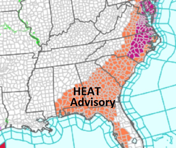
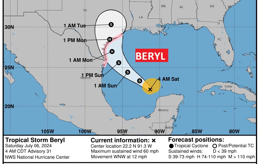
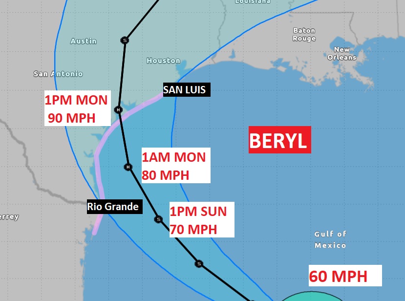
Good Morning! Heat Advisory in effect, again today and tomorrow. Day five today. Dangerous Heat index 105+ today and tomorrow. Radar was quite active yesterday, with drenching rainfall in spots, and radar will be active again today. Big heat can produce big storms. Our weather App will keep you on top of the action. Watch out for frequent intense lightning and gusty winds in some of the stronger storms. Expect more scattered random storms tomorrow through Thursday, most numerous in the afternoon and evening hours. Texas is poised for Beryl. Hurricane watch as far north as just shy of Galveston. San Luis, It’s a tropical storm now, but expected to reach hurricane strength Sunday. Could be just shy of Cat 2 status at Texas landfall Monday.
CLIMATE DATA: Friday’s high in Montgomery was 97 with a Heat Index 108. (Normal 93/72) Then, the late afternoon storms drenched the area. Airport: East Montgomery: 2.00”
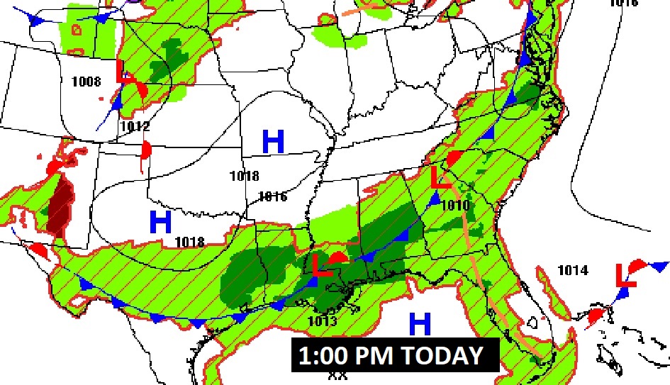
TODAY: Heat Advisory in Effect, again. Sun/cloud mix. Dangerous Heat indices. High 96. Heat index 104 to 108. Big heat can produce big storms, Like yesterday, radar will be more active again today, Watch out for frequent intense lightning in some of the stronger storms. Low tonight 75.
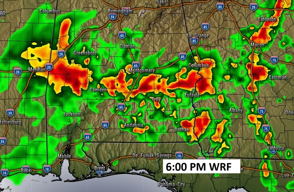
FUTURE RADAR: Snapshot of just one hi-res model at 6:00PM. Looks like yesterday. Very active. I had 2” at my house in East Montgomery yesterday. Local flooding is spots.
Dangerous heat continues. Stay hydrated.

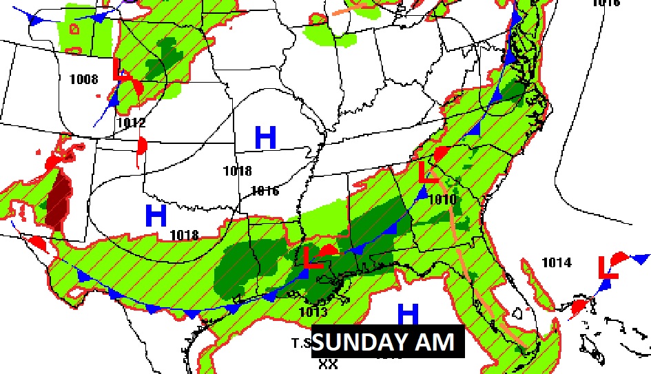
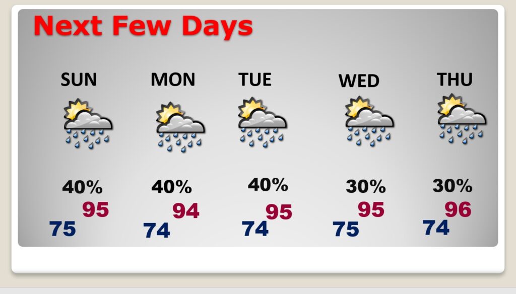
NEXT FEW DAYS: Hot and humid. Highs most days in the mid 90’s. Expect triple digit heat indices each day. Scattered random hit or miss storms each day through Wednesday. The random storms will be most numerous In the afternoon and evening hours. Lows at night in the muggy mid 70’s. Watch out for frequent intense lightning.
TROPICAL UPDATE: Texas is poised for Beryl. Hurricane watch as far north as just shy of Galveston. San Luis, It’s a tropical storm now, but expected to reach hurricane strength Sunday. Could be just shy of Cat 2 status at Texas landfall Monday.
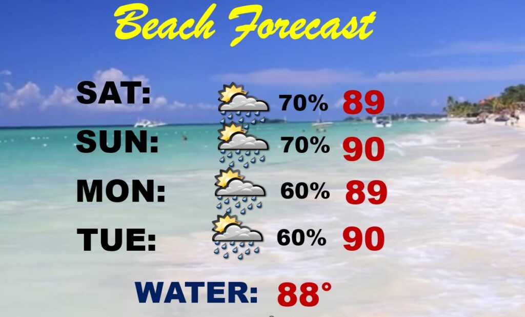
BEACH OUTLOOK: Be Flexible with your plans. Random storms will be a little more numerous. A generous supple each day but not a washout. Highs near 90. Watch out for lightning. Rising swells from Beryl will cause dangerous Rip Currents. Watch the flags on the Beach.
Thanks for reading the blog. I’m sure there will be some sort of update tomorrow. The next complete blog and video will be Monday morning. Have a great holiday weekend!
–Rich