
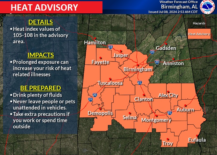
Good Morning! The relentless heat continues. Heat Advisory in effect, again today Dangerous Heat index 105+ again today. Once again, expect the daytime heat to fire-up scattered random storms, most likely in the afternoon and evening. I fact that will be the case each day through Saturday. Little daily change with highs in the middle 90’s and triple digit heat indices each day. Lows at night in the muggy mid 70’s. Meanwhile Beryl has now made landfall on the Texas coast. It has slowed down and that is going to cause multiple extreme problems for many hours along the Texas Gulf coast. Here’s my brief forecast discussion.
TODAY: Heat Advisory. Sun/cloud mix. Heat Advisory continues. High 96. Dangerous Heat index 104 to 108. Scattered random storms most numerous in the afternoon and evening hours. Low tonight 75.
FUTURE RADAR: Spotty random hit or miss storms, especially late afternoon and into the evening.
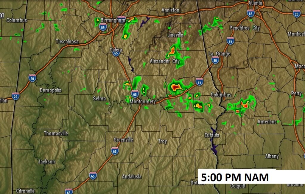
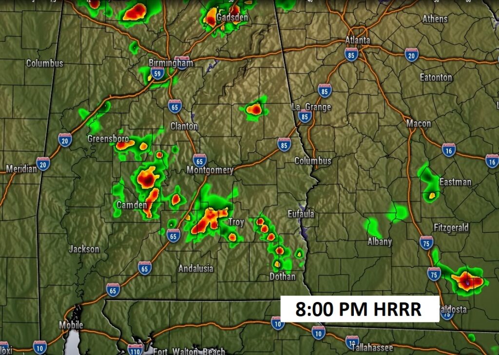
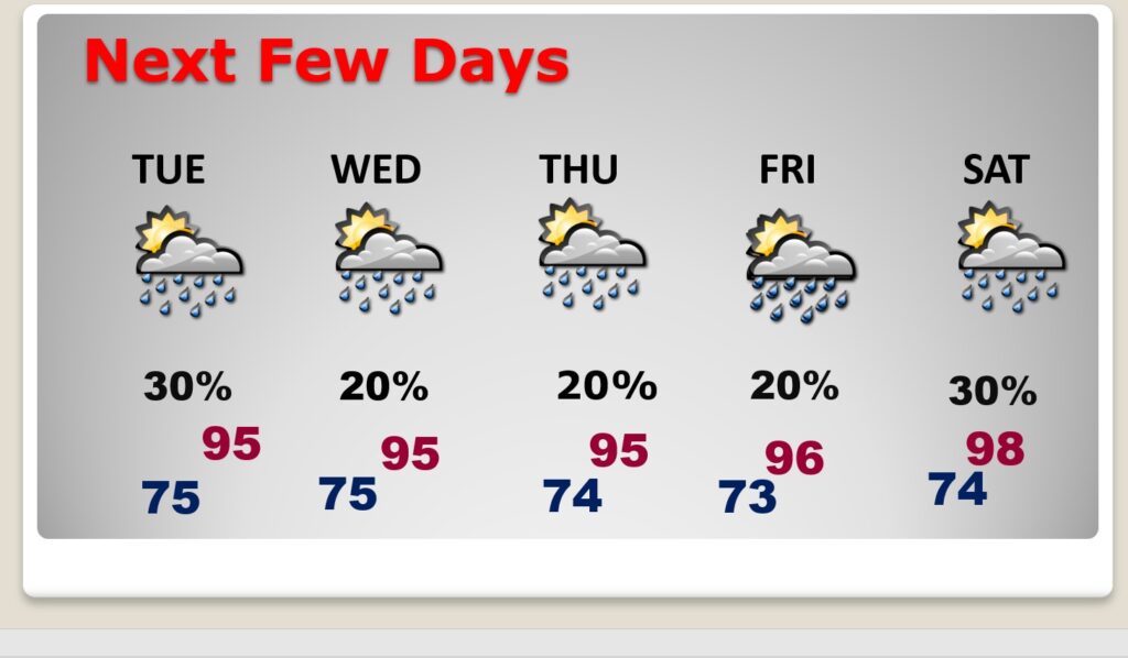
NEXT FEW DAYS: The intense heat will continue. There is no relief in sight. Highs will average in the mid 90’s for much of the week ahead. Scattered random “hit or miss storms” will populate the radar each day, especially in the afternoon and evening hours. Lows at night will be in the muggy mid 70’s.
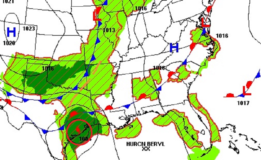
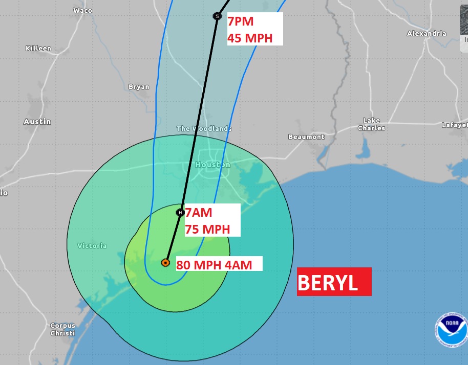
TROPICAL UPDATE: As of 4AM CDT,Hurricane Beryl has made landfall as a category 1 hurricane near Matagorda Bay, TX with 80 mph winds and higher gusts. For much of the Texas Gulf coast there will be multiple extreme hazards including significant storm surge, tornado threat, and prolific extremely heavy rainfall totals that could total over a foot, causing widespread flooding, well inland. The storm is moving slowly.
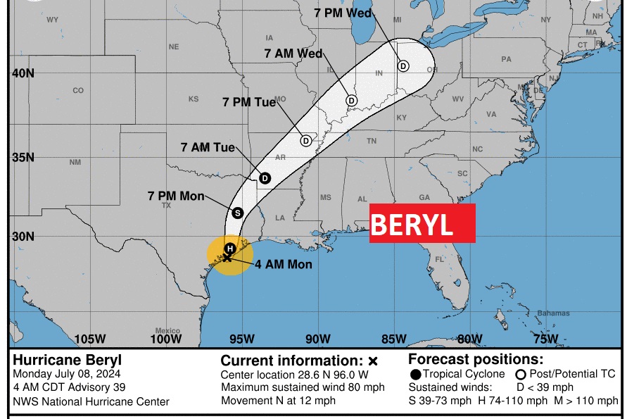
My gosh. Look at the future track of this system into Ohio!
Thanks for reading the blog. I’m sure there will be some sort of update tomorrow. The next complete blog and video will be Monday morning. Have a great holiday weekend!
–Rich