
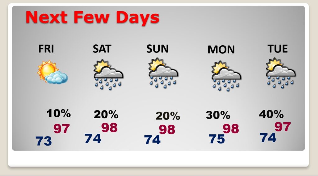
Good Morning! We’ve been enjoying some slightly more bearable humidity. Yesterday the Heat Inde4x stayed below 100 for the first time in many days. That will be the case again today. Radar continues quiet again today. The BEST rain chance will be along a stalled front on the coast. Expect Highs in the middle 90s Today. Get ready for a hotter weekend which may persist for several days. Expect Upper 90’s Friday through Wednesday. Triple digit heat indices will return. There will be widely scattered random storms, but they will be few and far between. Overnight lows in the low to mid 70’s. The Tropics are quiet right now, except for an Area to Watch off the SE coast. Here’s my brief forecast discussion.
TODAY: Mostly Sunny. Still hot, but again today, relatively tolerable humidity. High 95. Heat index should stay below 100. Rain chance just about zero. As close as we get this time of the year. Amy storms will be closer to the coast. Low tonight 73.
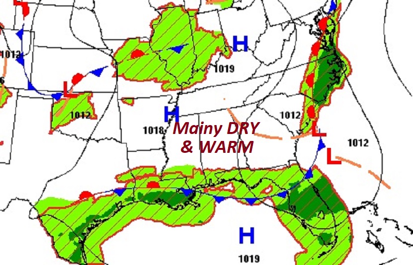
Today the BEST chance of rain will be along a stalled front close to the coast.
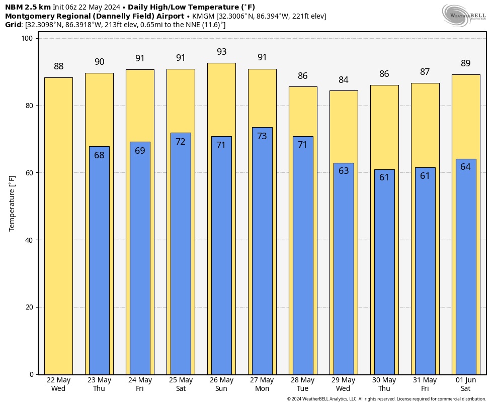
NEXT FEW DAYS: Get ready for a hotter weekend which may persist for several days. Expect Upper 90’s Friday through Wednesday. Triple digit heat indices will return. There will be widely scattered random storms, but they will be few and far between. Overnight lows in the low to mid 70’s.
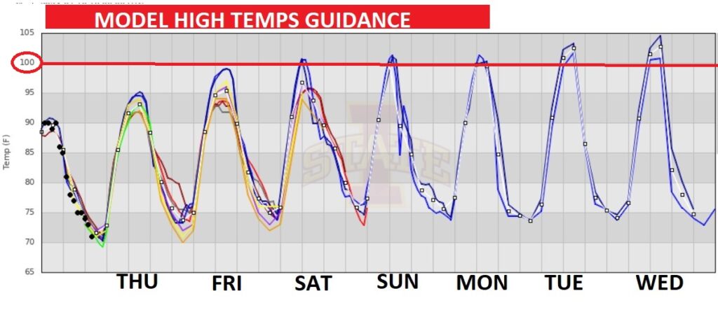
The model trends hint at the highest temperatures of the summer so far Friday through Wednesday. I’ve got us in the upper 90’s, however, as you can see, some models are hinting at 100 or higher this weekend and early next week. Two graphics below. One shows the blending of all models. Below that notice that some models take us to 100 or above, not just this weekend, but especially early and mid next week.
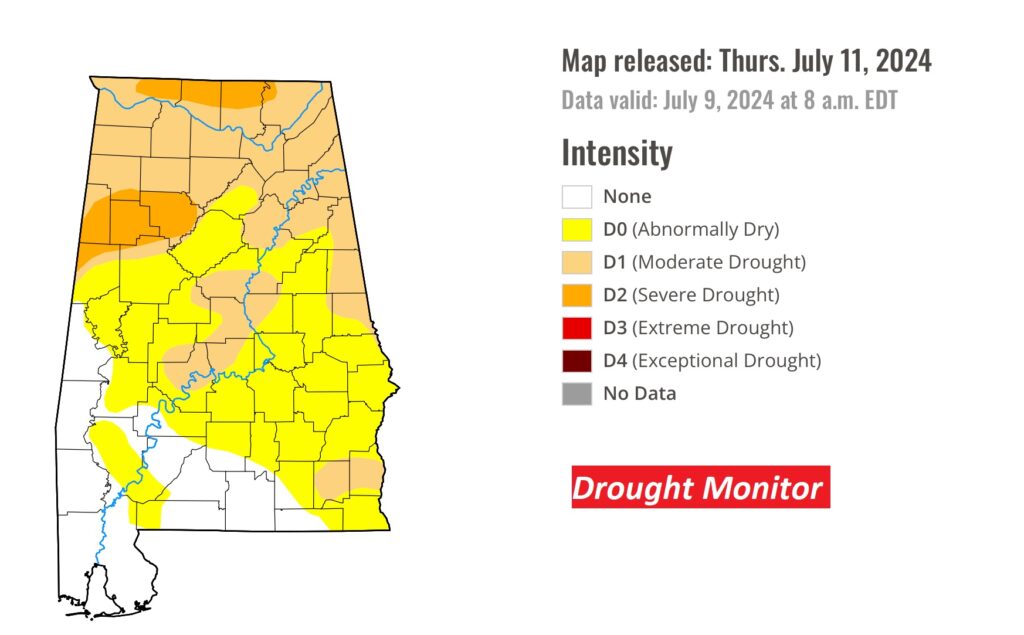
Recent showers & storms had little or no improvement in the latest Drought Monitor map. In fact, this week at least 78% of the state is Abnormally Dry, with 38% of the state now in the Moderate Drought or higher category.
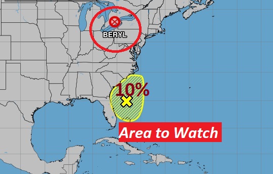
TROPICAL UPDATE: Off the SE US coast is a small disturbed area being watched by NHC. This Area to Watch has a small 10% chance of tropical development before bring absorbed by a frontal system. The rest of the tropics are quiet FOR NOW. A brief but welcome pause.
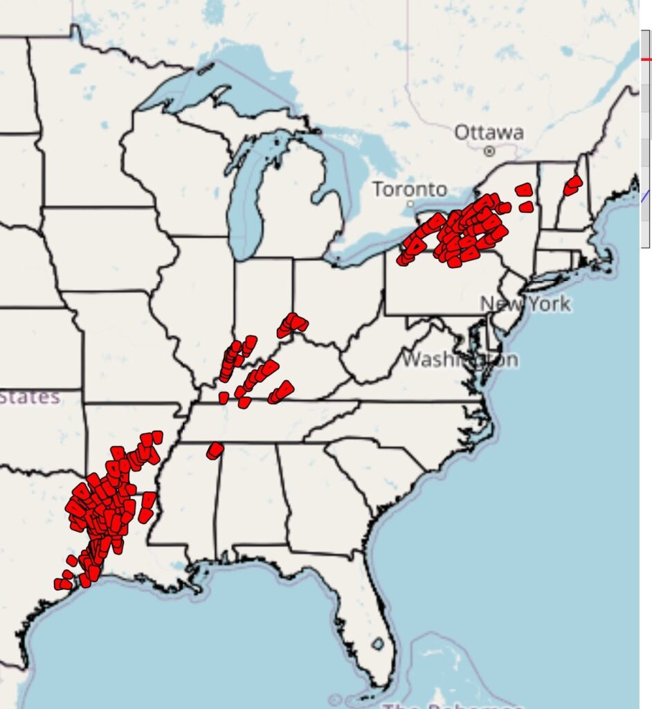
The remarkable remnants of Beryl, which caused dozens of tornadoes in the Northeast yesterday, is located not too far from Buffalo. There will be more severe storms associated with Beryl over the northeast again today, 16 days after the Beryl saga began in the Tropical Atlantic. AMAZING.
Here’s an astounding BERYL factoid. From landfall near Houston as a Category 1 hurricane through its post-tropical transition in the northeast, BERYL resulted in the issuance of 201 tornado warnings.
By the way, 110 tornado warnings on Monday 7/8/24 was the most tornado warnings ever issued on any July day in US History.
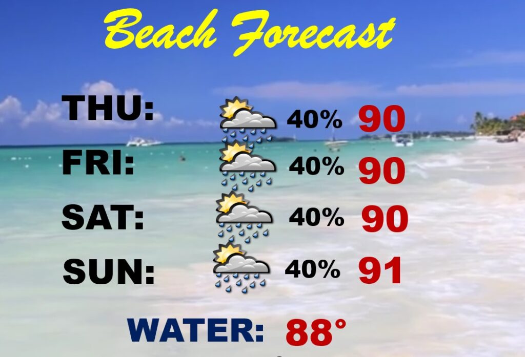
BEACH OUTLOOK: Next few days, the better rain chances will be near the coast along a stalled front. Spoty random PM storms are possible. Highs mainly near 90. Nighttime lows near 80. Gulf water temp. 88.
Thanks for reading the blog. I’m sure there will be some sort of update tomorrow. The next complete blog and video will be Monday morning. Have a great holiday weekend!
–Rich