
Good Morning! We are in a very different weather pattern now. High temperatures are down a notch. Not as extreme. Rain chances are much better. Radar will be very Much higher rainfall probabilities through Monday. Showers and storms will be random but quite numerous, especially in the afternoon and evening. In general, the atmosphere is very conducive for storms. Some of the storms will put on quite a show with gusty winds, intense lightning and very heavy downpours. Here’s my brief forecast discussion.
TODAY: Limited sunshine. High near 89. Random but scattered to numerus hit or miss storms, especially in the afternoon and evening. Low tonight 71.
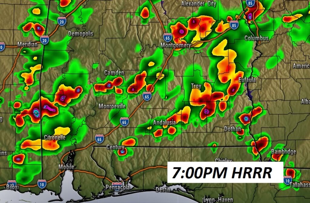
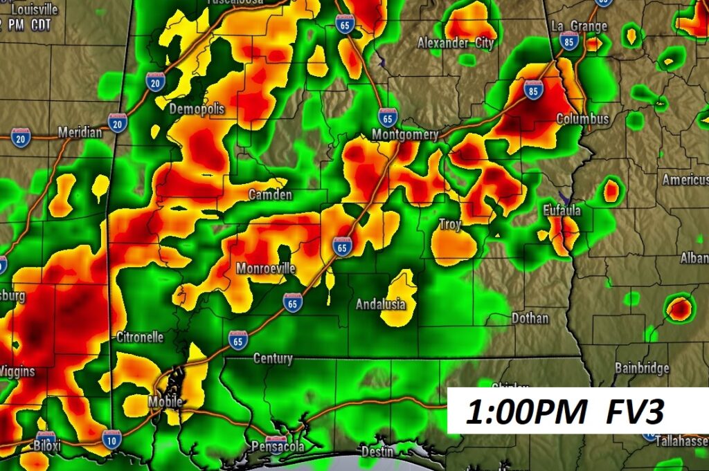
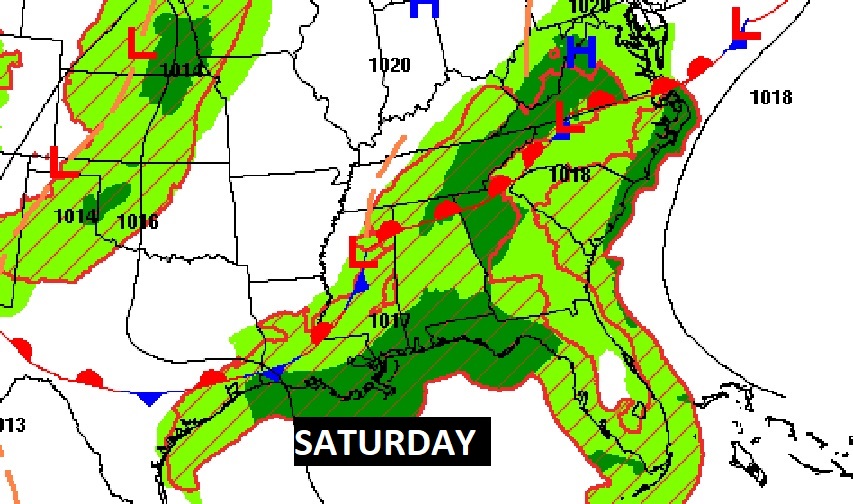
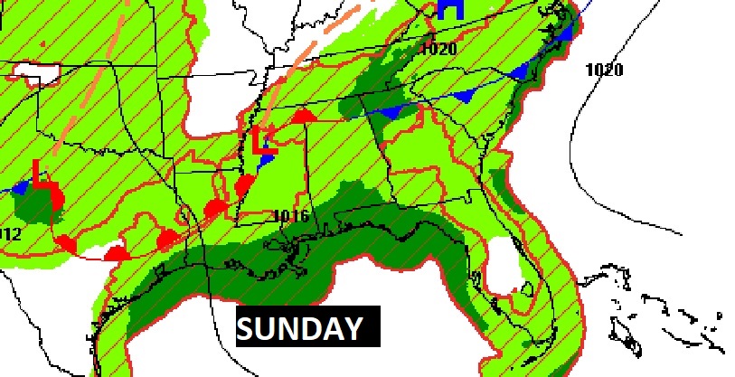
FUTURE RADAR: Again today, there a generous Spotty Random PM storms, across the Deep South. It will be feat or famine. Some storms could see heavy rainfall totals. Other towns little or none. Here’s some Future Radar snapshots from some of the hi-res models.
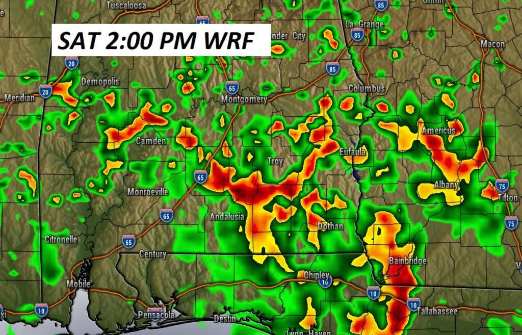
And, how about a snapshot of early Saturday afternoon.
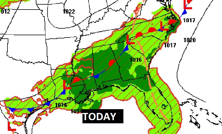
FRONTAL RELIEF. Fronts will act as a focus for increased daily storms. But, that’s really only part the story. The airmass above is cooler, and that’s conducive to better rain chances.
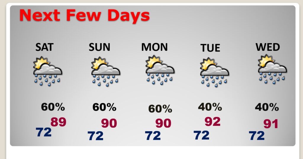
NEXT FEW DAYS: Expect scattered to numerous random, pop-up,“hit or miss” each of the next several days through Monday. The increase of showers and storms will help lower highs a notch. Highs will range from the upper 80’s to lower 90’s.
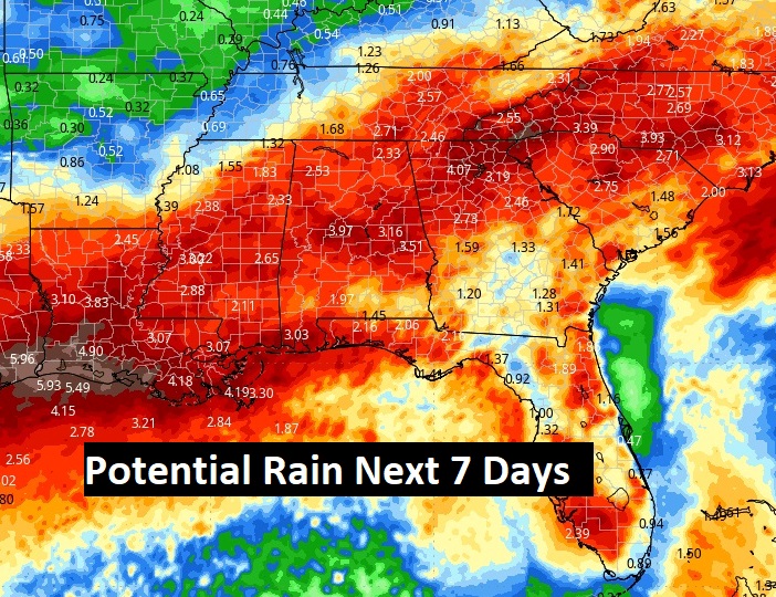
Here’s a profile of “average” rainfall potential in the next 7 days. The point is, numerous showers and storms will drench a multi-state area across the South for several days. It’s a very different pattern we will be in for the next several days.
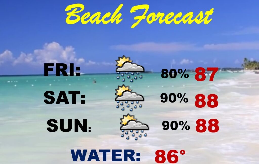
BEACH OUTLOOK: It’s not the forecast you want to see if you’re Beachbound. Storms will be random, but in generous supply each day. Scattered to numerous. Be flexible with your plans, Highs will be in the upper 80’s. Gulf water 86. Moderate Rip current risk –yellow flags—through the weekend.
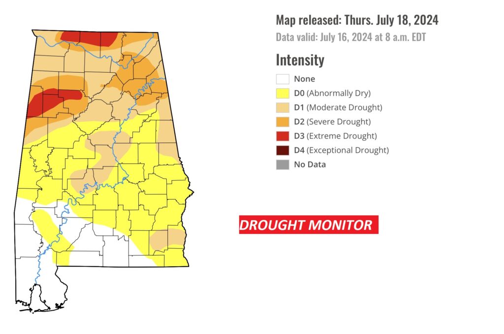
DROUGHT MONITOR:
New Drought Monitor map showing 81% of the state in some level of Drought, 41%+ in Moderate Drought or greater, and 16% in a Severe our Extreme drought in north Alabama. Increased rain chance over the next seven days will hopefully make a big difference next Thursday.
Thanks for reading the blog. There will be another complete Blog update and video forecast discussion tomorrow morning. This morning, everything is normal including LIVE on the Radio from 6 to 9AM on NewsTalk 93.1 – WACV. Have a nice weekend!
–Rich