
Good Morning! Our Temperatures continue very reasonable, at least for the next few days. Highs continue the upper 80’s to near 90 are likely for the through much of the week ahead. Our much wetter than normal pattern also continues, Showers and storms will be random, but quite numerous, especially in the afternoon and evening at least through the work week, possibly beyond. Some of the storms will be strong. Gusty winds, intense lightning, and very heavy downpours. Here’s my brief forecast discussion.
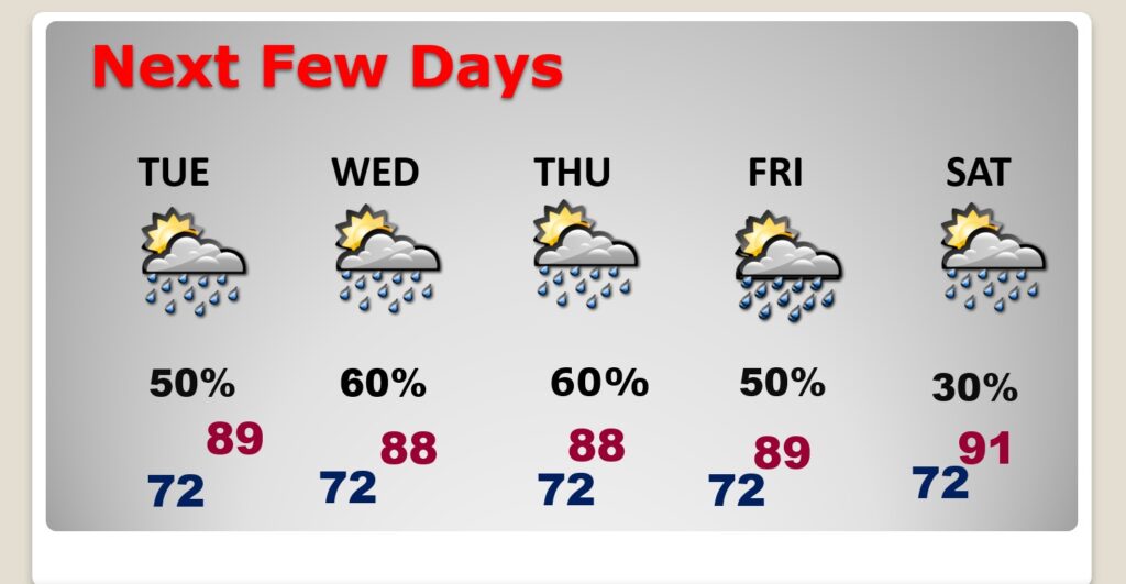
TODAY: Limited sunshine. High near 88. Random but scattered to numerous “hit or miss” storms, any hour of the day or night, but especially in the afternoon and evening. Low tonight 71.
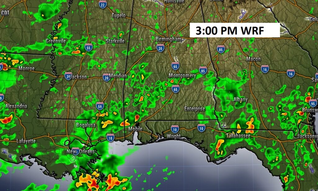
FUTURE RADAR: Again today, there a generous Spotty Random PM storms, across the South. It will be feat or famine. Some storms could see heavy rainfall totals. Other towns little or none. Here’s a Future radar snapshot late this afternoon.
NEXT FEW DAYS: Expect scattered to numerous random, pop-up,“hit or miss” each of the next several days. . Highs will mostly be in the upper 80’s to near 90. Lows at night in the lower 70’s.
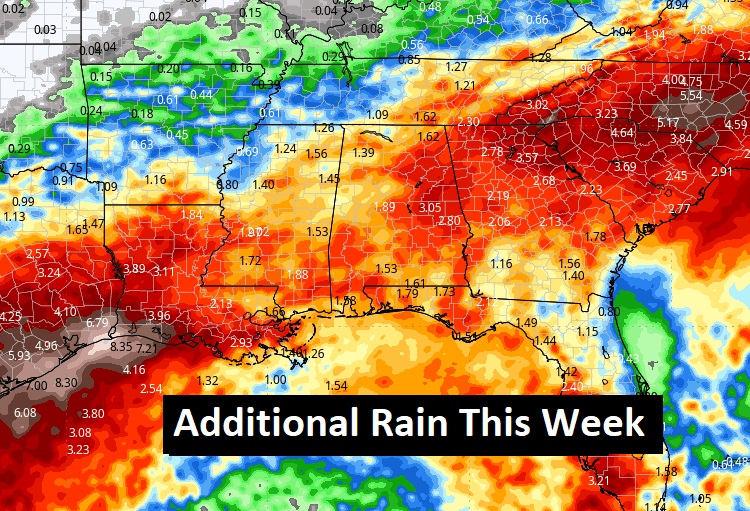
Here’s a profile of “average” rainfall potential this week. Wet times across the South continues.
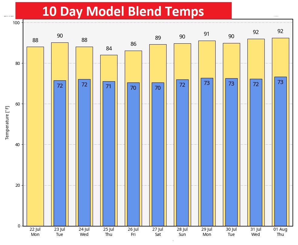
Fortunately, no intense heat is in our future. Here’s the 10 day model blend temperature trend.
The Full Buck Moon Continues. Moonset at 6:59 AM.

Thanks for reading the blog. There will be another complete Blog update and video forecast discussion tomorrow morning. This morning, everything is normal including LIVE on the Radio from 6 to 9AM on NewsTalk 93.1 – WACV. Have a nice day!!
–Rich