
Good Morning! We are locked into this current pattern. Temperatures continue very reasonable, through the end of the week. Our wetter than normal pattern also continues, Showers and storms will be random, but quite numerous, especially in the afternoon and evening at least through the work week, and into the weekend. Some of the storms will be strong. Gusty winds, intense lightning, and very heavy downpours. Here’s my brief forecast discussion.
TODAY: Limited sunshine. High near 89. Random but scattered to numerous “hit or miss” storms, any hour of the day or night, but especially in the afternoon and evening. Low tonight 73.
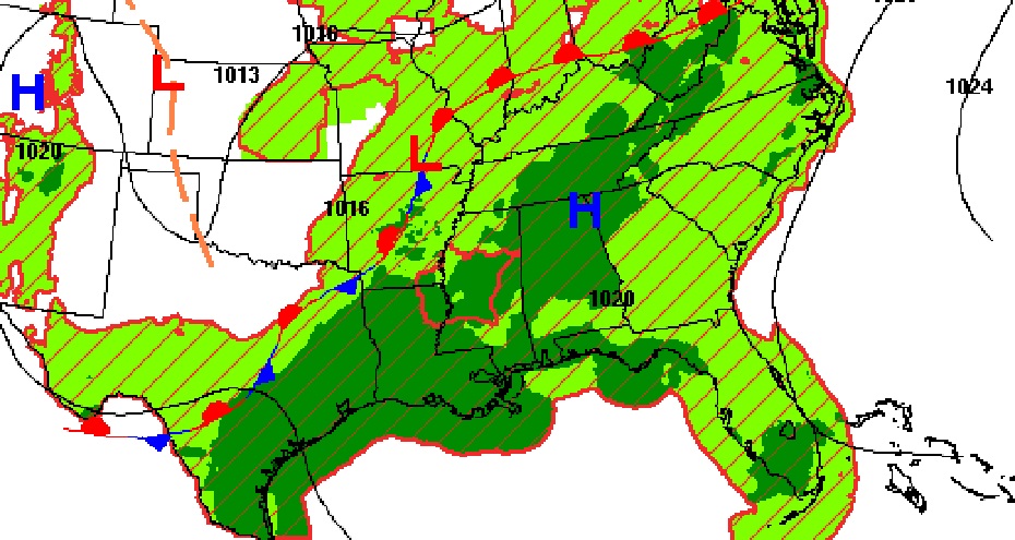
Another very wet day across the Deep South.
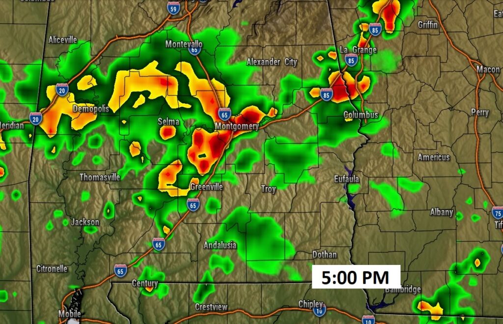
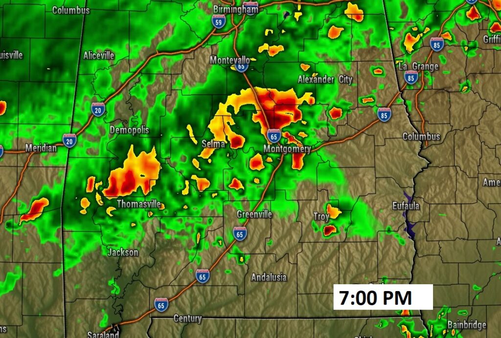
FUTURE RADAR: Again today, expect a a generous Spotty Random PM storms. It will be feast or famine. Some storms could see heavy rainfall totals. Other towns will get very little. Here’s a couple Future radar snapshots.
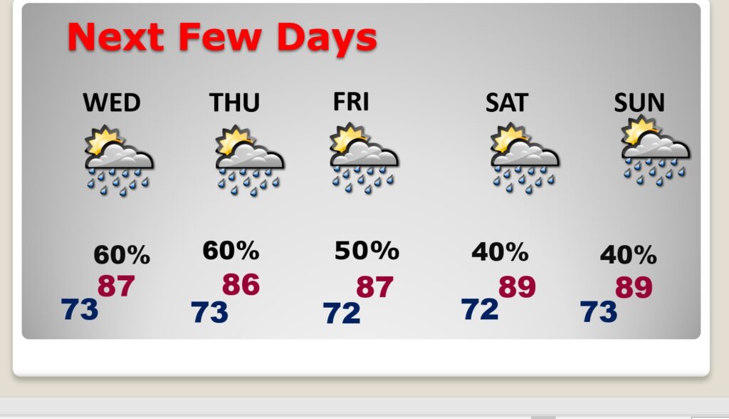
NEXT FEW DAYS: Expect scattered to numerous random, “hit or miss” each of the next several days, through the rest of the week and this weekend, Highs will mostly be in the upper 80’s to near 90. Lows at night in the lower 70’s.
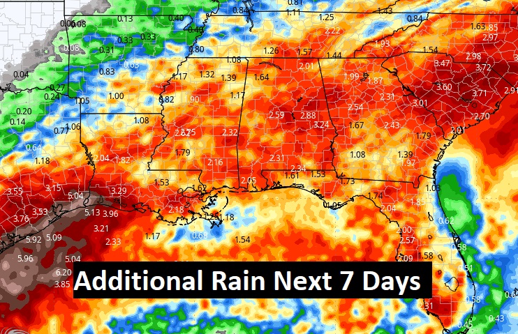
Here’s a profile of additional “average” rainfall potential for next 7 days.
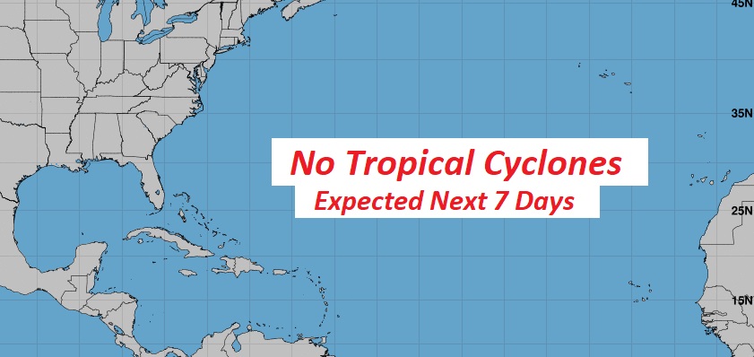
TROPICAL: The Atlantic Basin remains quiet for the next seven days.
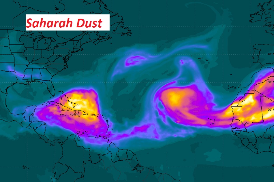
At the moment – a layer of Sharan Dust in the Main Development Region is helping to limit any development.
.
Thanks for reading the blog. There will be another complete Blog update and video forecast discussion tomorrow morning. This morning, everything is normal including LIVE on the Radio from 6 to 9AM on NewsTalk 93.1 – WACV. Have a nice day!!
–Rich