
Good Morning! The atmosphere is primed for more action today and over the next few days. Showers and storms will continue random, but quite numerous, especially in the afternoon and evening at least through the upcoming weekend. (Mostly light rain is widespread around the state even early this morning, pre-dawn.) Some of the storms will be strong. Gusty winds, intense lightning, and very heavy downpours. Localized urban flooding is possible. Here’s my brief forecast discussion.
TODAY: Limited sunshine. High near 89. Random but scattered to numerous “hit or miss” storms, any hour of the day or night, but especially in the afternoon and evening. Low tonight 73.
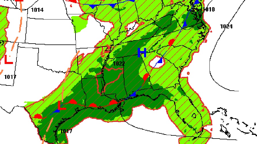
The better than normal rain chances continue as a quasi-stationary front haunts the South.
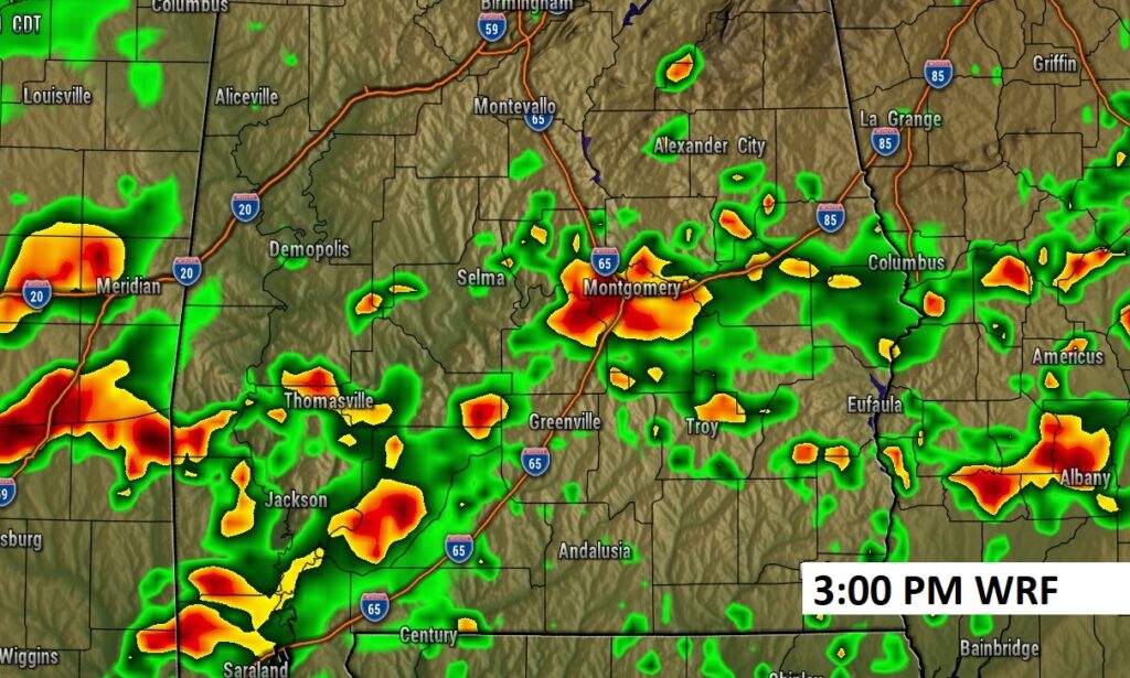
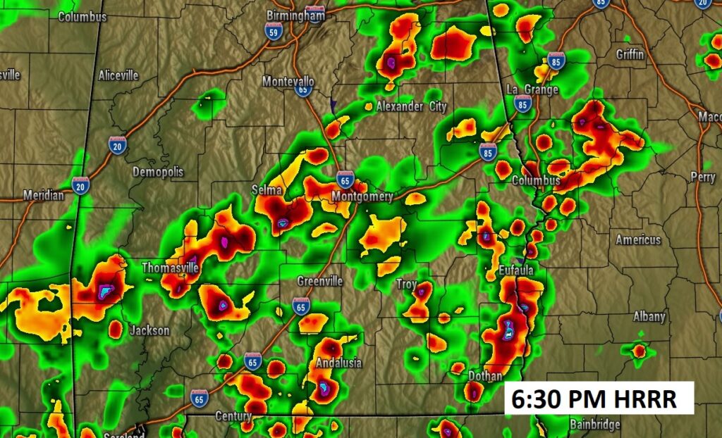
FUTURE RADAR: Here’s two examples from 2 models of Radar later this afternoon and this evening. Busy again. Our Weather App will keep you on top of the action. Yesterday, I had 1.08” in East Montgomery. You could have had a lot more.
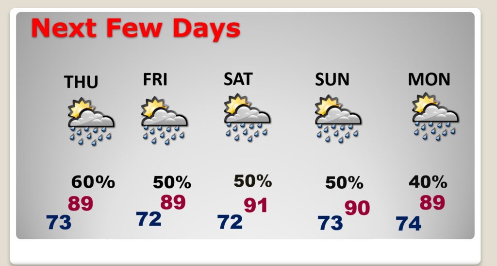
NEXT FEW DAYS: Showers and storms will continue random, but quite numerous, especially in the afternoon and evening at least through the upcoming weekend. , Highs will mostly be in the upper 80’s to near 90. Lows at night in the lower 70’s.
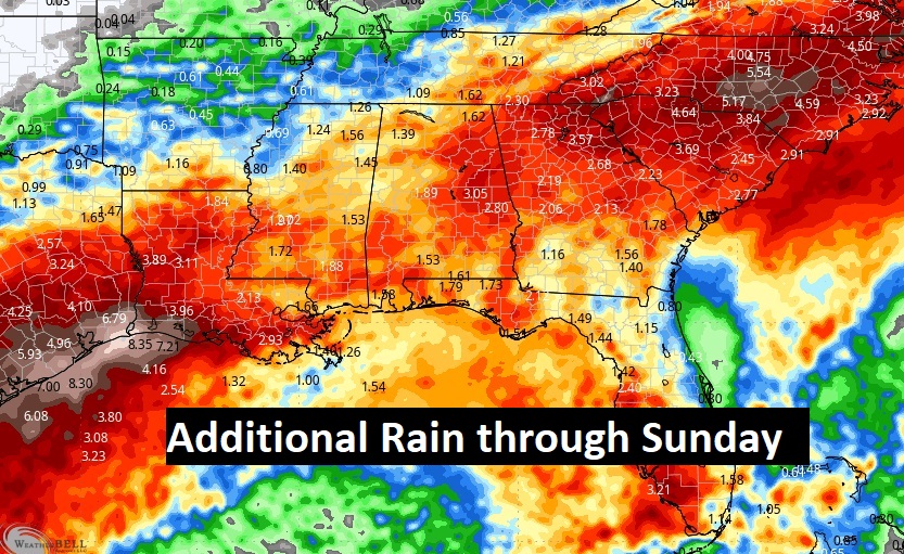
Here’s a profile of additional “average” rainfall potential through Sunday.
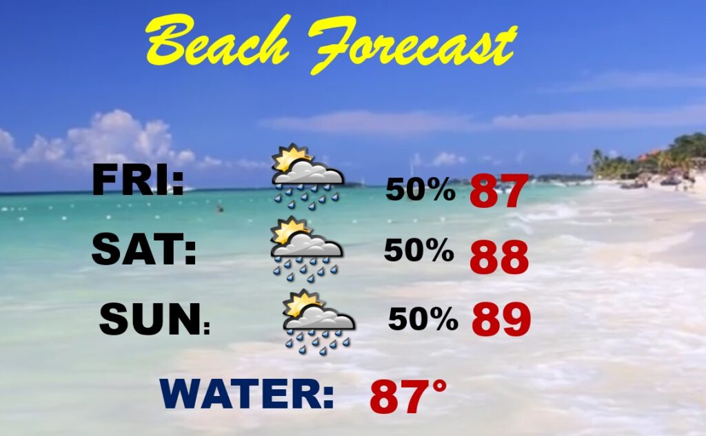
BEACH OUTLOOK: Not a washout, but expect better than normal rain coverage through the weekend. Highs in the upper 80’s. Gulf water temperature is 87.
.
Thanks for reading the blog. There will be another complete Blog update and video forecast discussion tomorrow morning. This morning, everything is normal including LIVE on the Radio from 6 to 9AM on NewsTalk 93.1 – WACV. Have a nice day!!
–Rich