4:00PM CDT Update
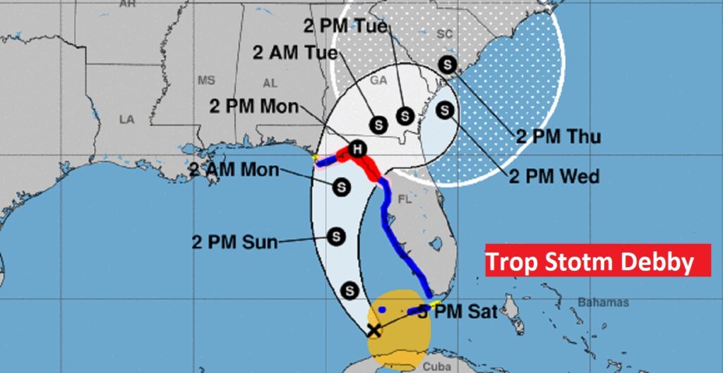
Les than 36 hours ago we were talking about Invest 97-L. Then, it became PTC 4. Then. TD 4. Now, her name is Debby. She’s a tropical storm, currently entering the warm “bath waters” of the Gulf of Mexico. It’s 100miles WSW of Key West moving west at 10 mph. Top winds now 40 mph. There is a short time window before Debby’s potential landfall in the Florida Big Bend early Monday morning, perhaps close to Cat 1 Hurricane status. Then, after landfall, Debby has a very complicated and unknown future near or along the SE US coastline Monday through Thursday. It could re-intensify, especially if it gets over the warm Gulf stream waters.
10AM UPDATE:\
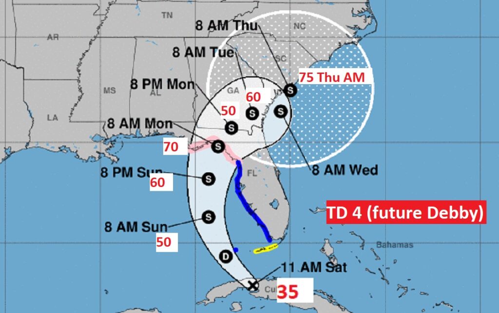
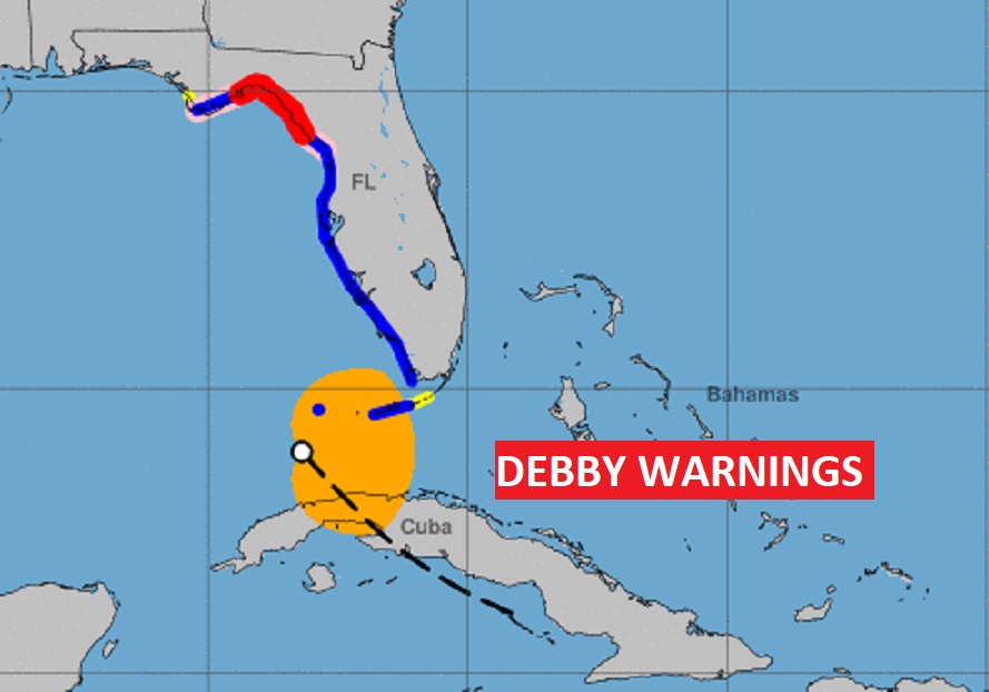
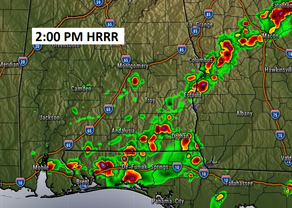
Good Morning! Overnight the Front that brought evening thunderstorms ti the state has reached near the River Region. The best chance of showers/storms will be along and south of the front today and Sunday. As we get into next week, we’re headed for an extended period of drier weather and hotter temps. But, the dewpont will be lower, and with a little breeze, it’ll be a little more bearable. Today, however, one more day of a HEAT ADVISORY. Heat index 105+. The BIG story in our region is Tropical Depression 4 near Cuba heading for the Gulf. It will become Tropical Storm Debby. Potential landfall over the big Bend area late Sunday night. A hurricane Watch is now in effect for the Big Bend. Tropical storm warning for the western Florida Gulf coast.
TODAY: Heat Advisory.
Mostly sunny. Random storms will be few and far between. Isolated. High today 95. Heat index 105+. Light wind. Low 75
Overnight the Front that brought evening thunderstorms ti the state has reached near the River Region. The best chance of showers/storms will be along and south of the front today and Sunday.
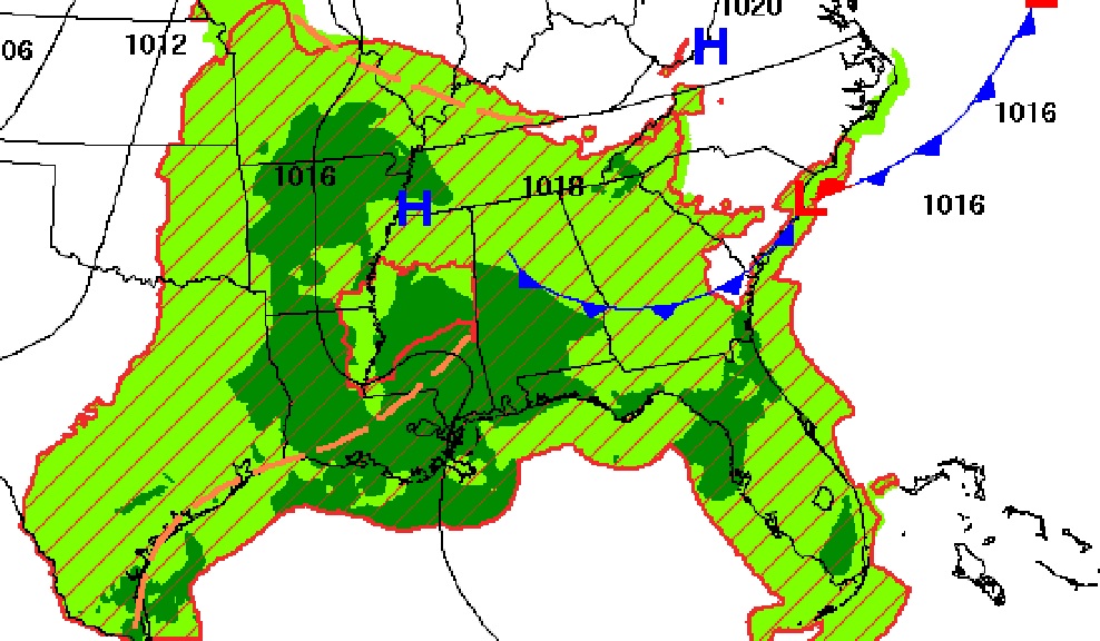
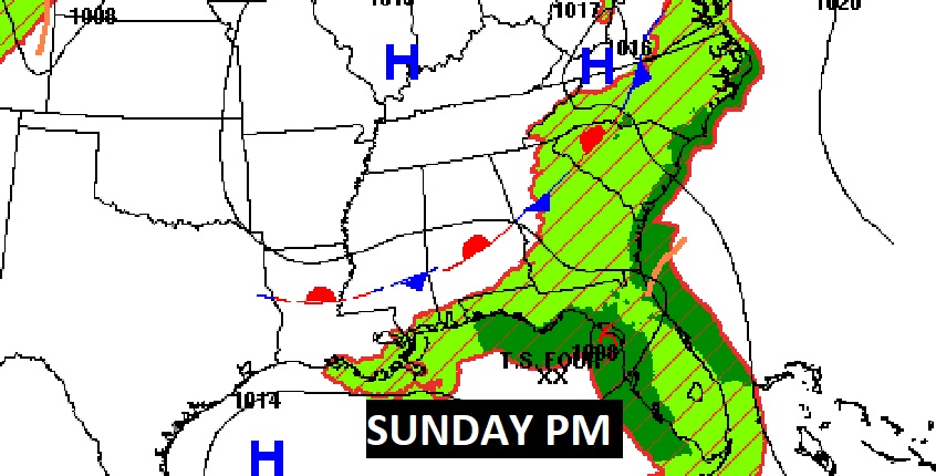
The best chance of showers/storms will be along and south of the front today and Sunday.
.
. TROPICAL: The BIG story in our region is Tropical Depression 4 near Cuba heading for the Gulf. It will become Tropical Storm Debby. Potential landfall over the big Bend area late Sunday night.
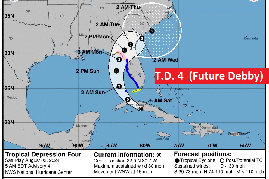
. A Hurricane Warch is now in effect for the Big Bend. Tropical storm warning for the western Florida Gulf coast.
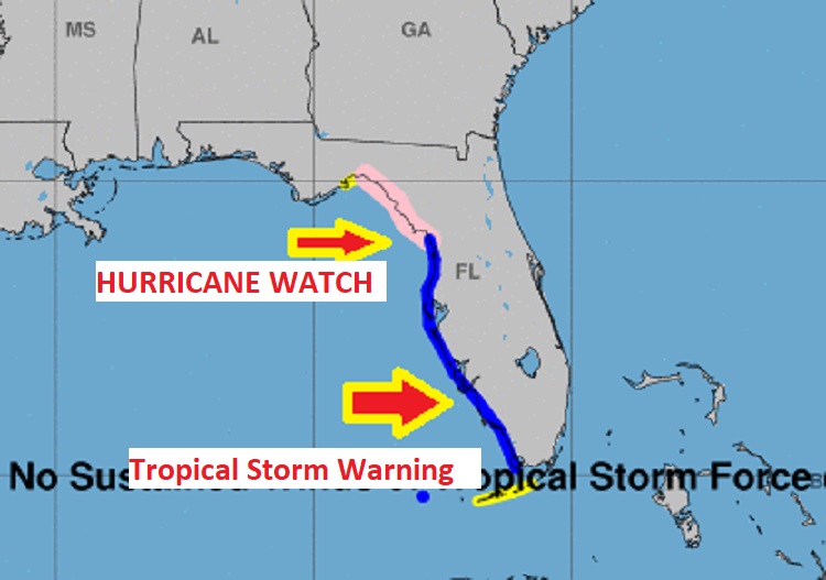
Then, after Florida landfall, it’s a brand new ball game for folks along the SE US coastline. Lots of headaches. Many question marks. We’ll be talking about Debby for a long time.
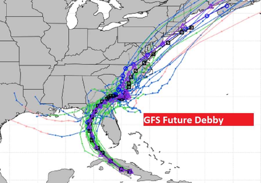
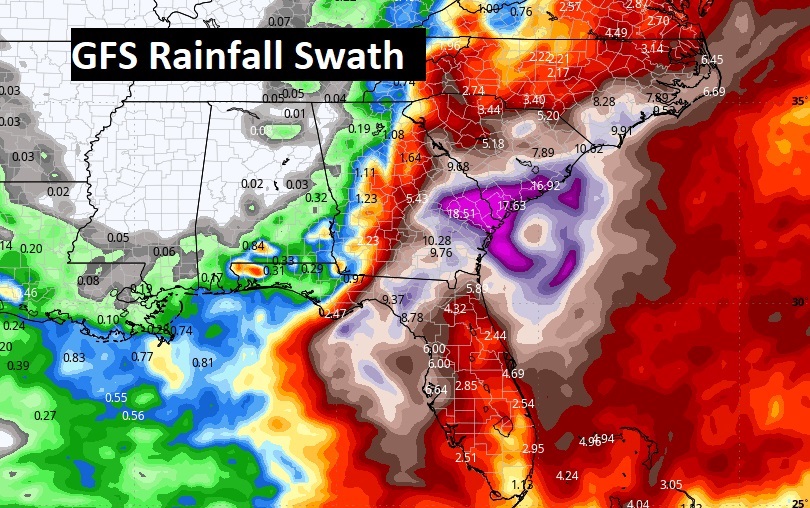
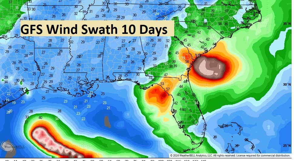
The GFS wind swath map is very interesting. Future Debby will be close to Cat 1 Hurricane Status at landfall near the Big Bend late Sunday night. Then, look at the wind increase off the SE US coastline early next week. And, oh yeah, Does the GFS see another system in the Gulf, later in the 10 day period? Don’t take that to the bank. We’re talking about the GFS here.
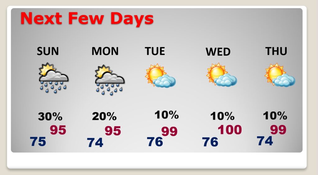
NEXT FEW DAYS: As we get into next week, we’re headed for an extended period of drier weather and hotter temps. But, the dewpont will be lower, and with a little breeze, it’ll be a little more bearable. Highs will average in the upper 90’s to near 100.
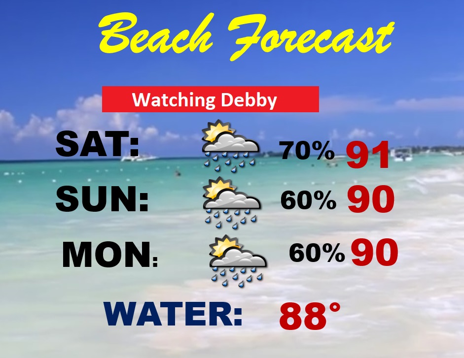
BEACH OUTLOOK: Spotty scattered storms, south of that frontal system. Highs 90-92. Lows at night near 80. On it’s current course Debby, will have not much impact for the beaches from Guf Shores to Destin. But, Panama City eastward should be very watchful.
Thanks for reading the blog. There will be another Blog update in the tomorrow morning. Have a good Weekend.
–Rich
