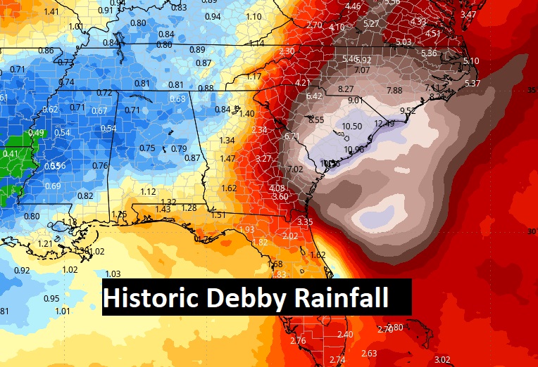
Good Morning! Debby continues to dump prolific rainfall amounts on our neighbors in Georgia and the Carolinas. Weak steering currents will keep Debby in place for the next few days, dropping historic flooding rainfall. Meanwhile, the “sinking air”or subsistence around Debby will keep us Hot & Dry for several days. This dry, very warm pattern will be in the place through the weekend. We’ll be near 100 on Wednesday. Here’s my brief forecast discussion. .
TODAY: Lots of sunshine. Hot & dry .High today upper 90’s. Heat index 100+ NW wind 6 to 12 mph. Low 75
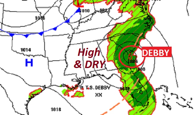
Here’s the Map Set-up at 1PM. Debby is spinning round near the SE coast.

Subsistence around Debby will essentially keep most of us dry today.
.
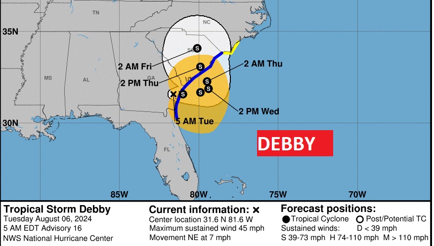
. TROPICAL: Debby is a 45 mph tropical storm stuck in Georgia th is morning. It will hang around GA and the Carolinas through at least Thursday before getting dislodged and moving northeast along the Atlantic coast.

. Subsistence around Debby will essentially keep most of us dry today. Subsistence is sinking air. MENWHILE, historic prolific rain along the SE coastal states will be measured in feet.

.
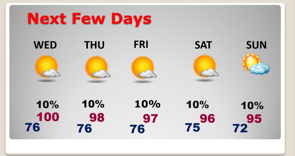
NEXT FEW DAYS: For us here in Alabama, the subsistence, or sinking air around Debby will tend to keep us dry most of this week and weekend. High temperatures will range to near 100 by Wednesday. We’ll be well into the 90’s over the weekend. Lows at night in the mid 70’s.

Thanks for reading the blog. There will be another complete Blog update and video forecast discussion tomorrow morning. This morning, everything is normal including LIVE on the Radio from 6 to 9AM on NewsTalk 93.1 – WACV. Have a nice day!
–Rich
