Good Morning! Debby continues to dump prolific rainfall amounts along the Southeast US coast. While Debby produces historic rainfall, the “sinking air”or subsistence around Debby will keep us Hot & Dry for several days. We close to a record high yesterday, and today’s record high of 101 is in jeopardy. This dry, very warm pattern will be in the place through the weekend. Here’s my brief forecast discussion. .
TODAY: Lots of sunshine. Hot & dry .High near 100. Heat Index near 105. (Record 101 from 2007) NW wind 6 to 12 mph. Low 75.
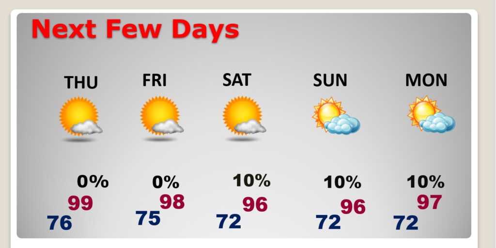
NEXT FEW DAYS: HEAT ADVISORY TODAY. Our extremely hot and bone dry pattern will continue for several days. We’ll be well into the 90’s over the weekend. Lows at night in the mid 70’s.
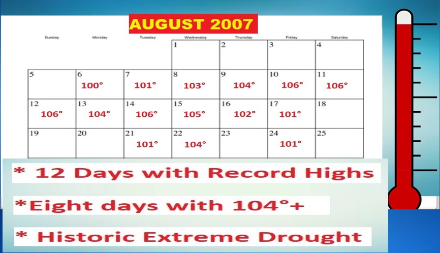
AUGUST HEATWAVE OF 2007: Yesterday we were close to the Aug. 2007 record of 100. Today’s record will tease 101 in 2007. Do you remember that August? We re-wrote the record book at MGM with 12 record highs and 8 days of 104+, in the midst of an extreme drought.
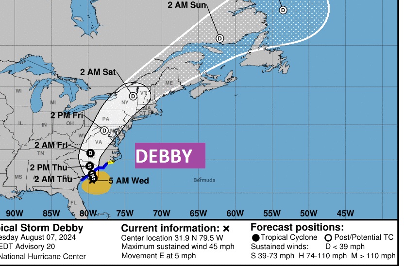
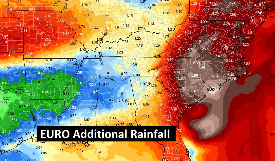
TROPICAL: Slow moving Debby, along the Carolinas coast, continues to re-write the record books with prolific rainfall. By late week it will finally breakaway and move northeast causing, flooding rains along the I-95 corridor across the east and northeast.
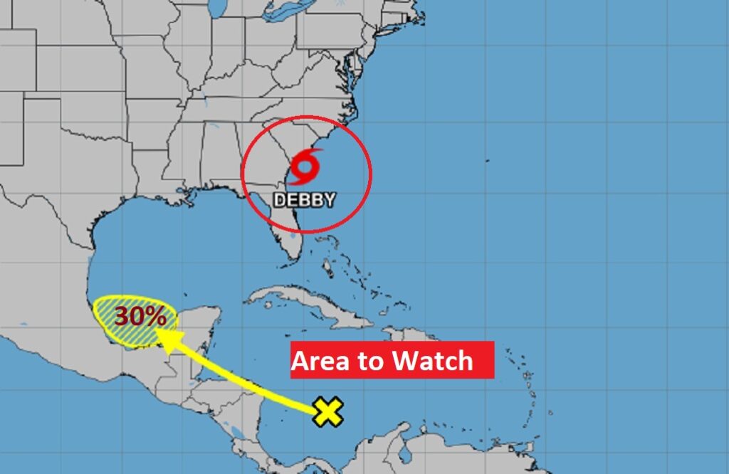
Meanwhile, There is an Area to Watch in the Caribbean headed in the general direction of the southern Gulf.
Debby is not done breaking rainfall records. Look at Future Rainfall potentials from the Carolinas to the middle Atlantic states.
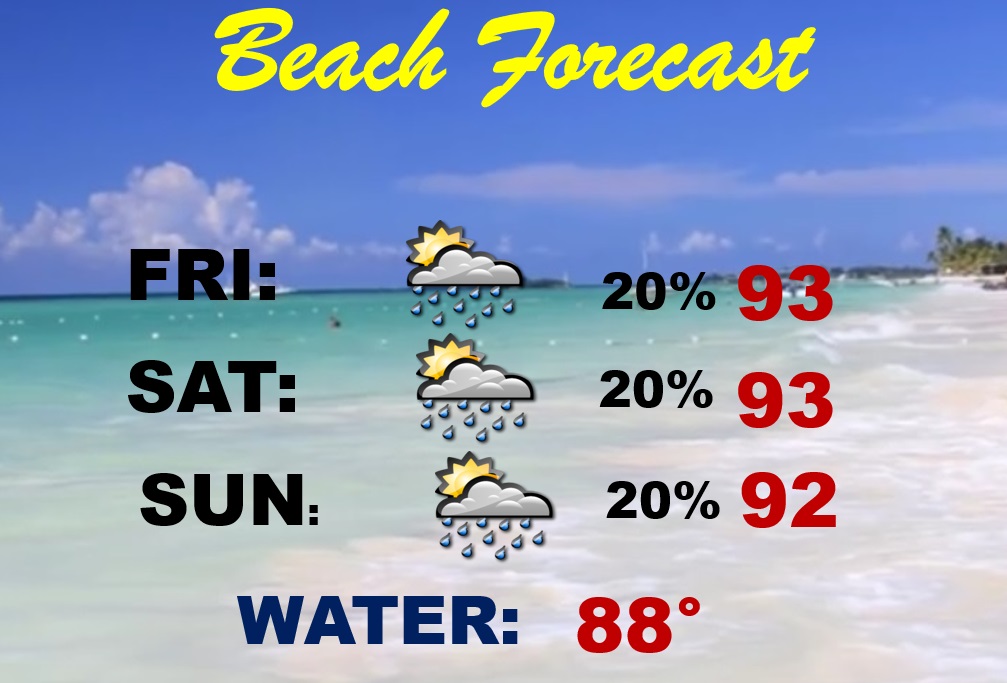
BEACH: Beachgoers have a treat this weekend. Rain chances will be very low. Isolated storms. Highs in the low 90’s. Gulf water 88. Medium Rip Current Risk.
Thanks for reading the blog. There will be another complete Blog update and video forecast discussion tomorrow morning. This morning, everything is normal including LIVE on the Radio from 6 to 9AM on NewsTalk 93.1 – WACV. Have a nice day!
–Rich
