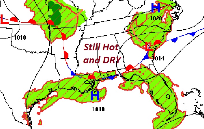
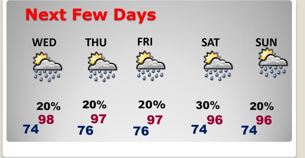
Good Morning! Our Hot and Dry August pattern continues. Highs will be in the upper 90’s through Friday at least. Still mainly dry for now. We’ll mention a small chance of widely scattered storms Wednesday through Sunday. Meanwhile, Large Tropical Ernesto is growing stronger as it heads for the Virgin Islands and Puerto Rico. Eventually, as it turns into the open Atlantic, it could become a major hurricane, and maybe threaten Bermuda. Here’s my brief forecast discussion
TODAY: Lots of sunshine. Still Hot & dry. High near 98. I expect that the Heat Index 100 to 105. Light wind.. Low 74.
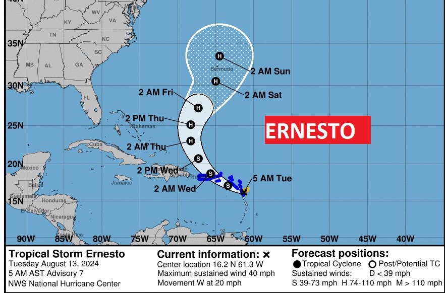
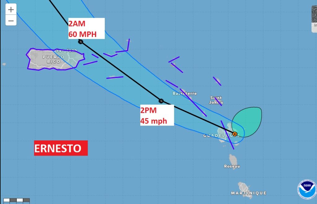
. TROPICAL: Large Tropical Ernesto is growing stronger as it heads for the Virgin Islands and Puerto Rico. Eventually, as it turns into the open Atlantic, it could become a major hurricane, and maybe threaten Bermuda. Ernesto is the only feature NHC is tracking at the moment, however, several Tropical waves are emerging off the African coast.
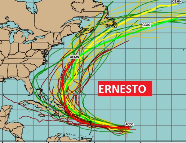
Here’s the tropical storm Ensemble tracks on Ernesto. While most tracks are well out in the Atlantic, Maritime Canada needs to be watchful. Ernesto could become a major hurricane.
NEXT FEW DAYS: Our extremely hot and bone dry pattern will continue. Expect upper 90’s most days this week. Lows at night in the low to mid 70’s. We’ll mention a very small chance of random storms starting Wednesday. Widely scattered storms.
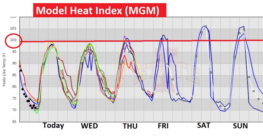
Lower Dewpoints over the last few days has kept the Heat Index in the more tolerable 90’s. That luxury is apparently ending. Triple digits are making a come back.
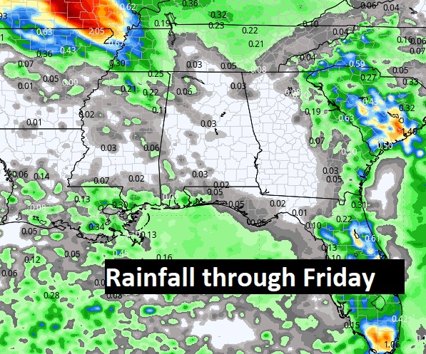
Take a look at the potential rain through Friday., Mostly dry. Showers few and far between.
Thanks for reading the blog. There will be another complete Blog update and video forecast discussion tomorrow morning. This morning, everything is normal including LIVE on the Radio from 6 to 9AM on NewsTalk 93.1 – WACV. Have a nice day!
–Rich
