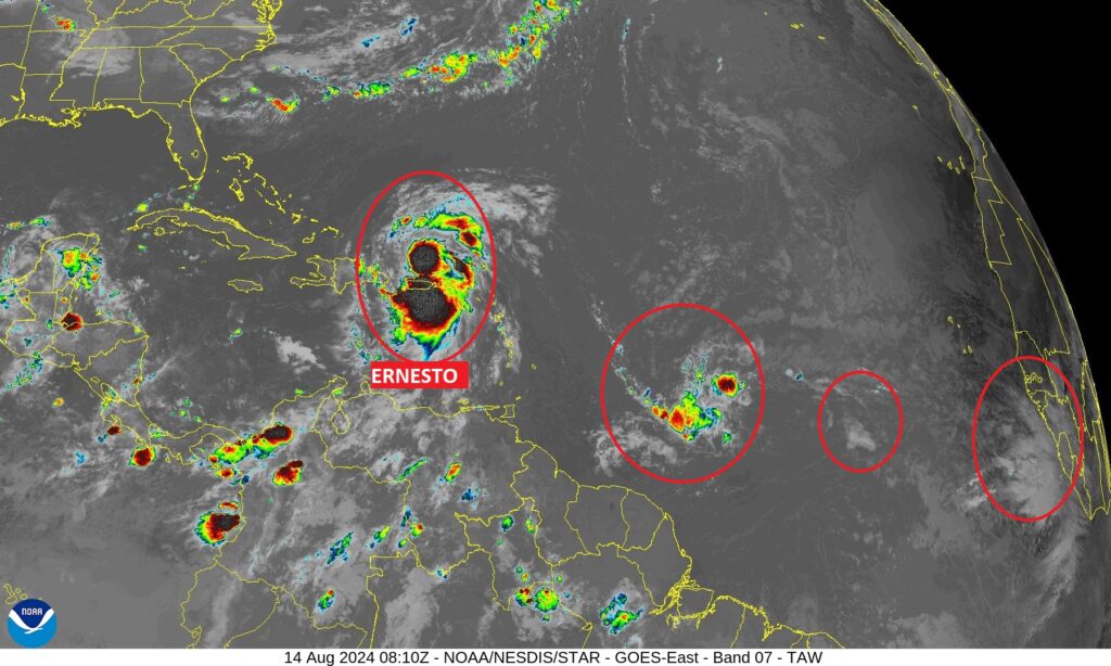
10AM CDT: He’s officially a Hurricane. #Ernesto with minimal Cat 1 winds of 75 mph, located 176 NW of San Juan, is moving NW at 10 mph. Expected to reach major Cat 3 – 115 MPH status in 48 hrs. as it moves in the general direction of Bermuda,
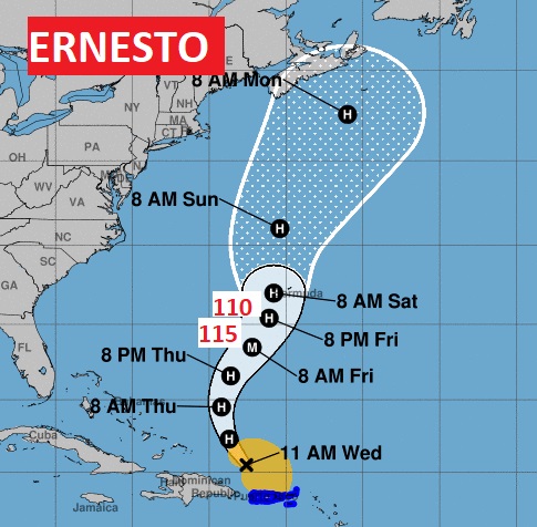
Good Morning! We have been hot and dry for several days. Today, we’re headed for the upper 90’s again, with triple digit heat indices. Also today, it’s possible a few isolated random storms will start to populate the radar, but not many. We’ll mention widely scattered storms, mostly in the afternoon and evening hours each day through Monday. Meanwhile. Ernesto is assaulting Puerto Rico this morning. Ernesto will make a northward turn into the Atlantic and could become a major hurricane as it approaches Bermuda in a few days. Here’s my brief forecast discussion
TODAY: Sunshine dominates. Still Hot. High near 98. I expect a Heat Index 100 to 104. Isolated to widely PM scattered showers/storms are possible, but they will be few and far between. Light wind.. Low 74.
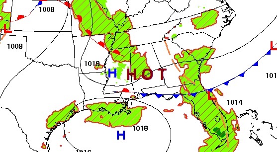
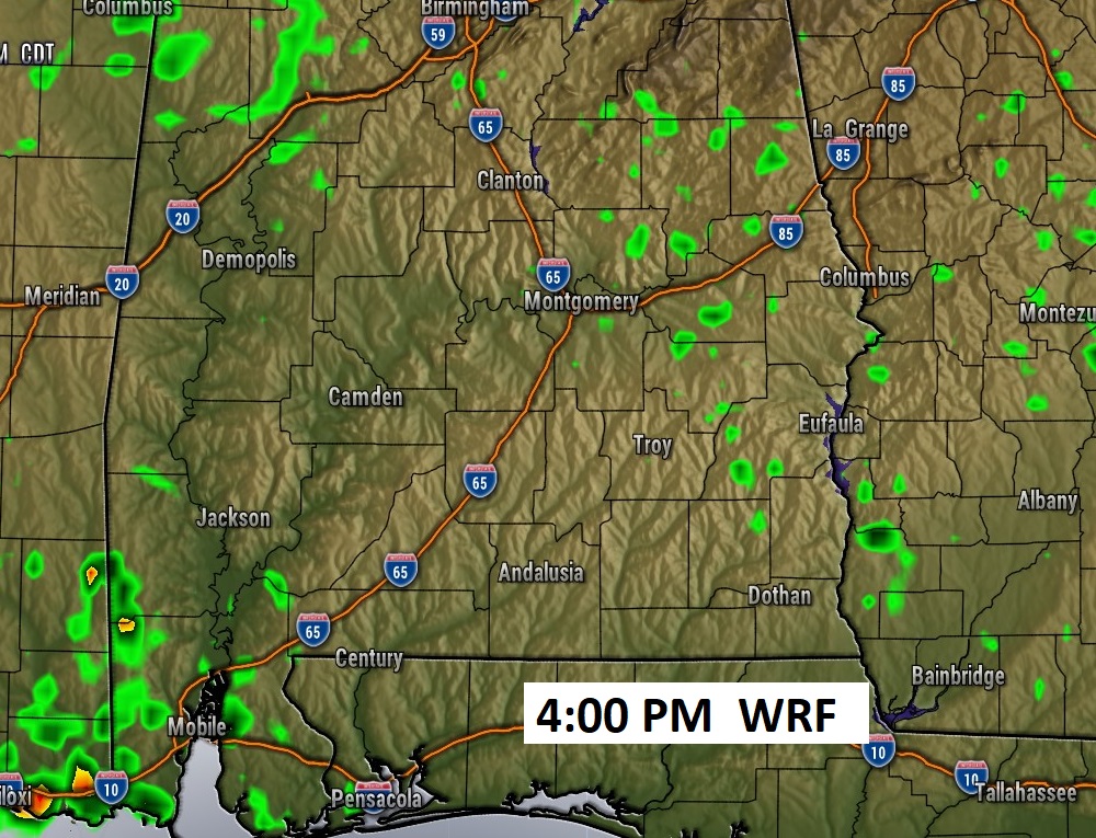
FUTURE radar late this afternoon. Your odds of getting wet are not good.
. TROPICAL: Large Ernesto is assaulting Puerto Rico this morning. It is nearly a hurricane with 70 mph winds. Ernesto made landfall in the British Virgin Islands last night. Ernesto will make a northward turn into the Atlantic and will likely become a major hurricane as it approaches Bermuda by about Friday.
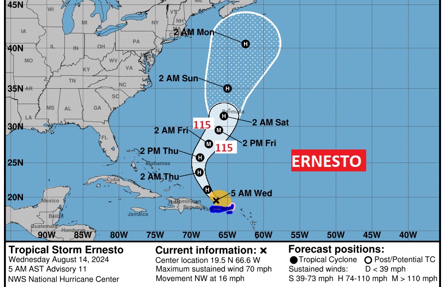
Ernesto is the only feature NHC is tracking at the moment, however, several Tropical waves are emerging off the African coast.
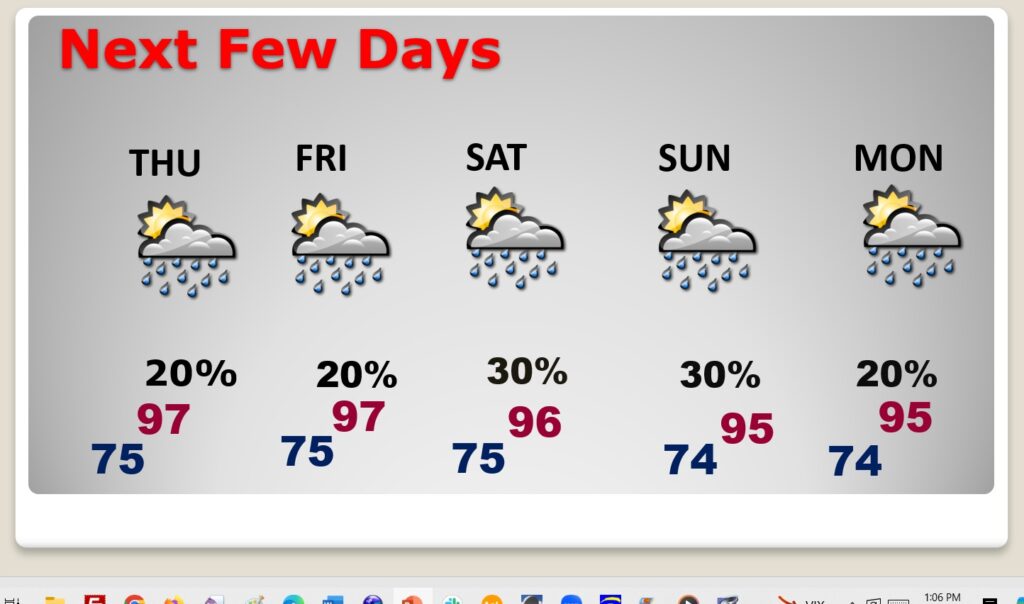
NEXT FEW DAYS: Our extremely hot pattern will continue. Expect upper 90’s most days through the weekend. Lows at night in the low to mid 70’s. We’ll mention a very small chance of random storms starting each day through Monday. Widely scattered storms.
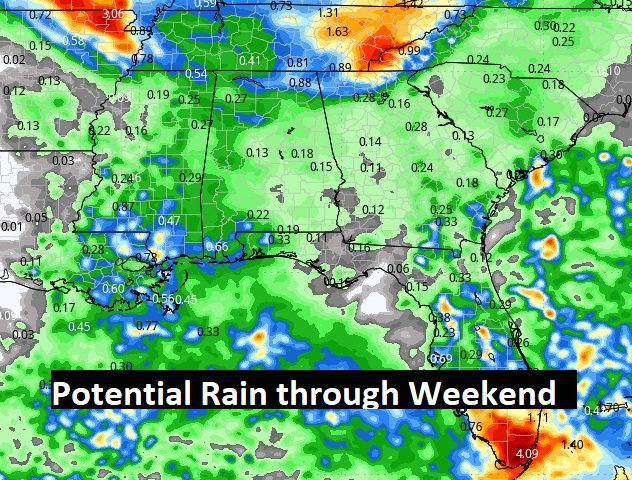
Take a look at the potential rain for the work week ahead, Not much.
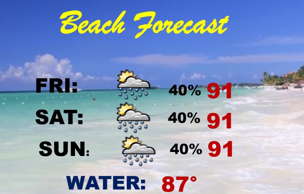
BEACH OUTLOOK: Scattered PM storms are possible each day, but certainly not a washout. Many dry hours. Highs near or above 90. Gulf water 87. Medium risk current risk especially from Destin eastward,
Thanks for reading the blog. There will be another complete Blog update and video forecast discussion tomorrow morning. This morning, everything is normal including LIVE on the Radio from 6 to 9AM on NewsTalk 93.1 – WACV. Have a nice day!
–Rich
