
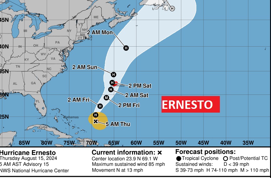
Good Morning! Our forecast is starting to evolve a little bit. High temperatures will not be extreme. Mid to Upper 90;s are likely today, and mainly mid 90’s over the weekend. Spotty, widely scattered storms will pop up today. It’s possible some of the storms will be a little stronger and perhaps become a bit more numerous by Saturday and Sunday, especially across the northern 2/3 of our state. Hurricane Ernesto is getting stronger after it’s encounter with Puerto Rico yesterday. Bermuda could have a very close encounter with Ernesto by Saturday AM, perhaps as a major hurricane. Here’s my brief forecast discussion
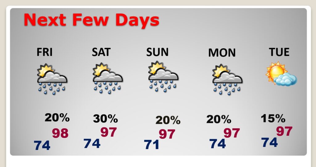
TODAY: Lots of sunshine. Still Hot. High in the mid to upper 90’s. Heat Index 100+. Widely scattered random storms. Mostly in the afternoon and evening. . Light wind.. Low 74.
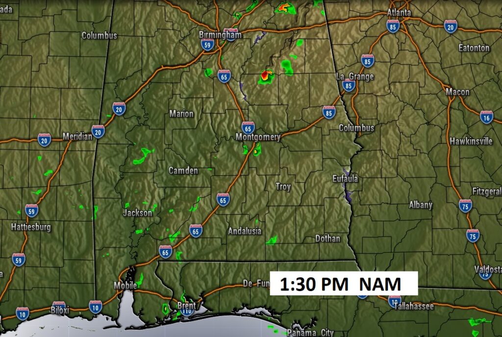
FUTURE radar Not many storms, but there will a few “pop up,” hit or miss storms, this afternoon & this evening.
. TROPICAL: Ernesto is moving northward in the Atlantic and growing stronger. It will have a close encounter with Bermuda in the next by Friday night into Saturday morning especially.
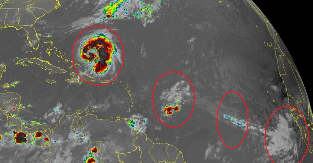
There are a number of Tropical Waves in the tropical Atlantic coming off the coast of Africa.
NEXT FEW DAYS: Expect widely scattered pop up storms each day. It’s possible some of the storms will be a little stronger and perhaps become a bit more numerous by Saturday and Sunday, especially across the northern 2/3 of our state. Highs will be mostly in the mid 90’s each day through early next week. Lows at night in the 70’s.
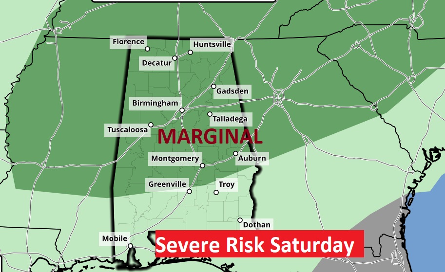
Interesting new wrinkle. By Saturday, a southward moving MCS (complex of storms) may spark a few stronger storms for the northern 2/3 of the state. Damaging wind gusts will be the main risk.
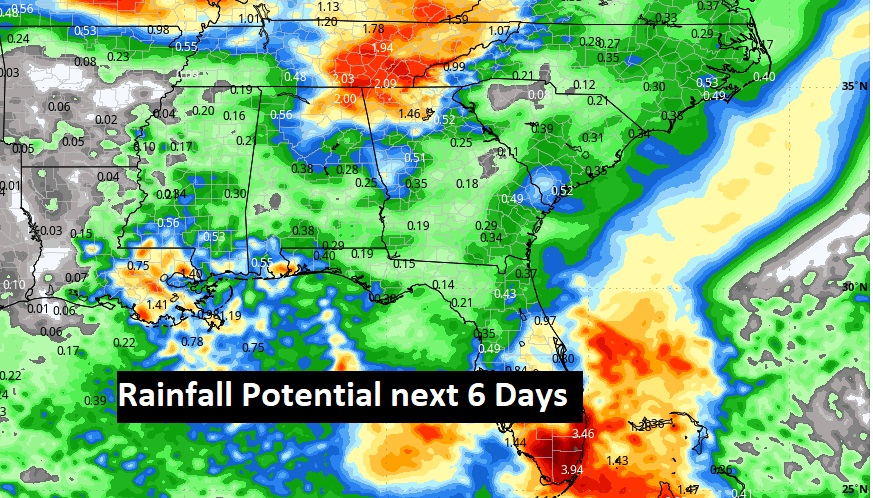
Here’s the potential rainfall through the weekend into early next week. Moisture is increasing. We need the rain.
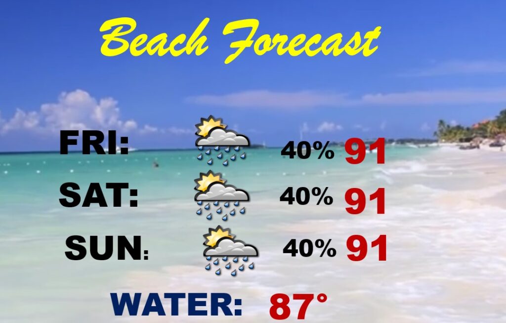
BEACH OUTLOOK: Scattered PM storms are possible each day, but certainly not a washout. Highs near or above 90. Gulf water 87. Medium rip current risk especially from Destin eastward,
Thanks for reading the blog. There will be another complete Blog update and video forecast discussion tomorrow morning. Have a nice day!
–Rich