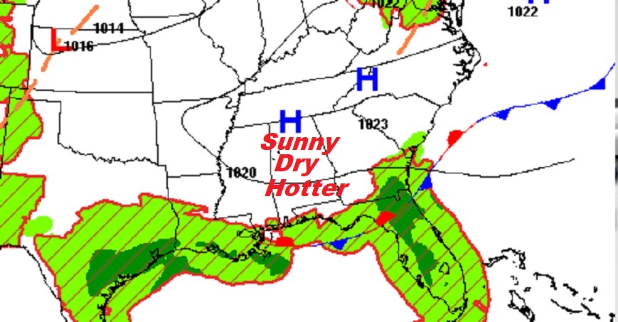
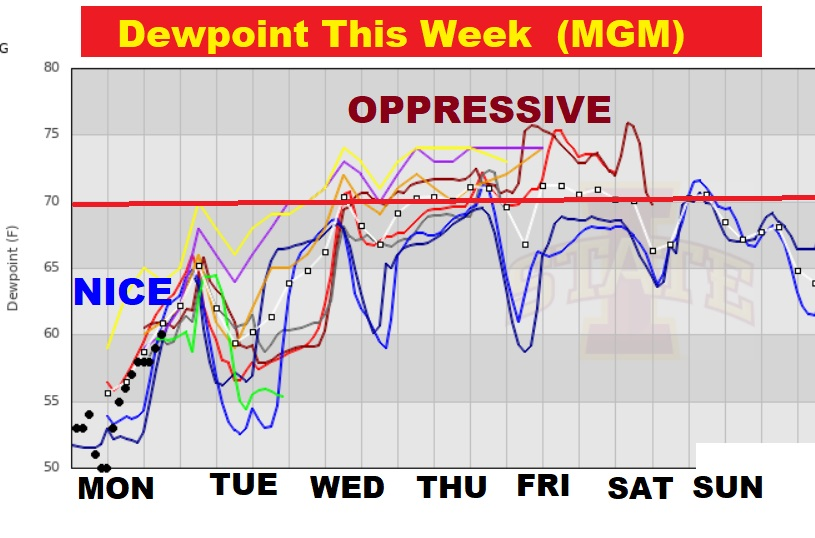
Good Morning! Our persistent comfortable pattern will start to fade..slowly. That nice easterly breeze will go away. Temperatures will get hotter. The humidity will slowly increase. By about Thursday, we’ll be near the 105 danger range by about Thursday. Also, spotty, widely scattered, random, PM showers will return to the forecast, especially by Thursday through Saturday. Scattered showers and thunderstorms will be more numerous on Sunday as a front approaches. Meanwhile, the tropics in the Atlantic basin continues very quiet for now.
TODAY: Sunshine. Hotter. Still not too humid. High in the mid to upper 90’s. East wind 6 to 12 mph. Mostly clear. Low tonight 72.
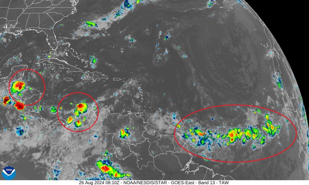
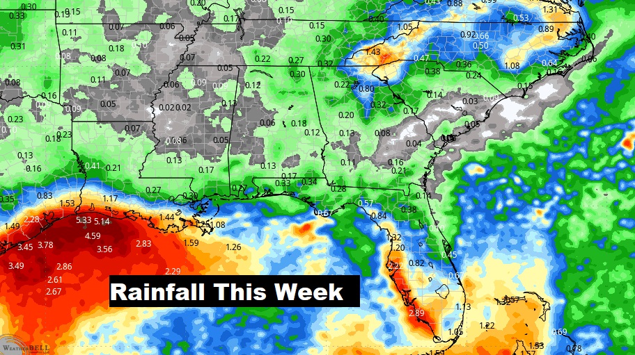
. TROPICAL: The tropical Atlantic, the Caribbean and the Gulf of Mexico is amazingly quiet, for now. There’s a few tropical waves and that’s about it.
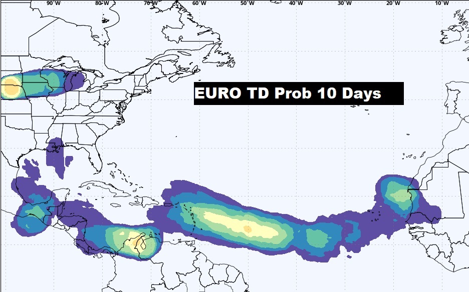
The EURO model suggests the Tropical Atlantic and Caribbean may start to wake up in the next 10 days.
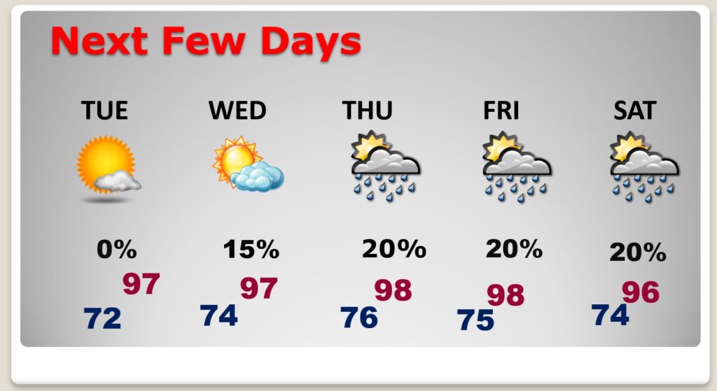
NEXT FEW DAYS: Sunshine will dominate. Highs will be well into the 90’s. We’ll be in the upper 90’s. The Heat index will start nosing upward. We could be near the 105 danger range by Thursday. We’re dry Tuesday. Wednesday rain chance 20% or less. Spotty widely scattered storms Thursday through Saturday. Random Scattered showers and thunderstorms return Sunday as afront approaches.
Uh oh. Our string of comfortably low humidity days is about to be a thing of the past. Those awful dewpoints in the 70’s will be back by mid week. Summer isn’t over yet.
Spotty random storms will return late this week.
Thanks for reading the blog. There will be another complete Blog update and video forecast discussion tomorrow morning. This morning, everything is normal including LIVE on the Radio from 6 to 9AM on NewsTalk 93.1 – WACV. Have a nice day!
–Rich
