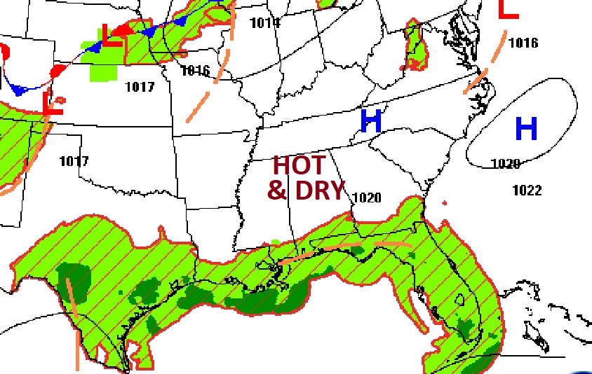
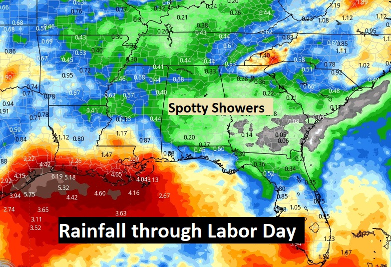
Good Morning! Our nice humidity break is ending. Our forecast is getting hotter and more humid. The Heat Index returns to triple digit levels for the rest of the week. We still have a dry forecast today. But, gradually, starting tomorrow, widely scattered random PM showers will return to our forecast. Over the Labor Day weekend, while the number of hit or miss” showers & storms will increase, it should be a rather routine holiday weekend forecast. The best chance of rain will be Labor Day Monday. Here’s my brief forecast discussion.
TODAY: Abundant Sunshine. Hotter. High near 97. Heat index 100+. Light wind. Mostly clear. Low tonight 74.
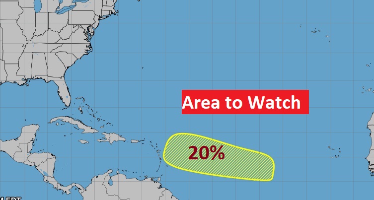
. TROPICAL: There is now an Area to Watch in the tropical Atlantic heading toward the Caribbean. Low end risk at the moment.
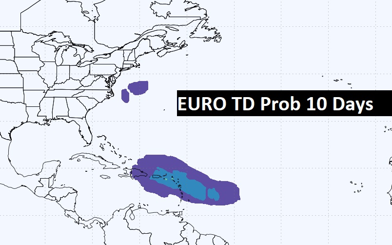
Here’s the Eruo Probabilities through Day 10 for Tropical Development.
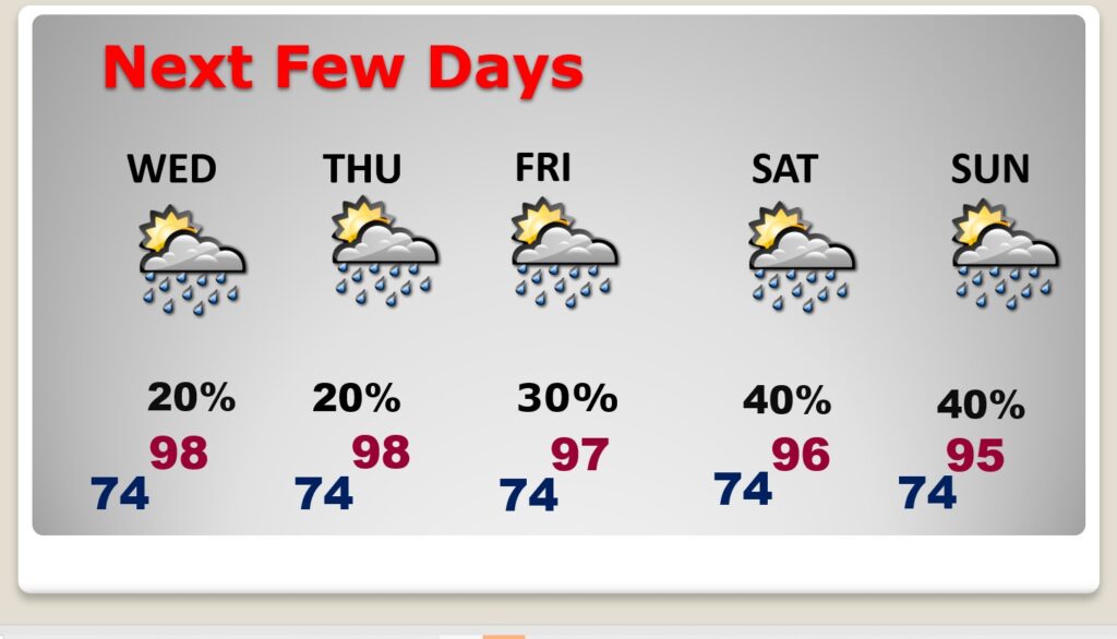
NEXT FEW DAYS: Expect some hotter days ahead. The Heat index will be in the 100 to 105 range for the rest of the week. Spotty widely scattered storms are back in the forecast for Thursday and Friday. Scattered showers and storms return over the weekend. The best chance of random storms will be Labor Day Monday.
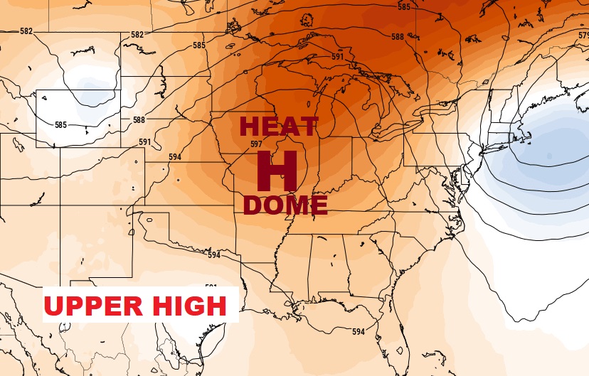
Much of the nation will bake again today. The big upper Heat Dome is still in control.
Spotty random storms will return.
Thanks for reading the blog. There will be another complete Blog update and video forecast discussion tomorrow morning. This morning, everything is normal including LIVE on the Radio from 6 to 9AM on NewsTalk 93.1 – WACV. Have a nice day!
–Rich
Thanks for reading the blog. There will be another complete Blog update and video forecast discussion tomorrow morning. This morning, everything is normal including LIVE on the Radio from 6 to 9AM on NewsTalk 93.1 – WACV. Have a nice day!
–Rich
