
Good Morning! Get ready for more late summer heat & humidity through the Labor Day weekend. Random scattered storms will be most numerous in the afternoon & evening hours. Storms will become more numerous by Monday & Tuesday as a frontal system enters the state and moves southward. No video this morning. Technical issues. Sorry
TODAY: Mostly sunny, hot and humid. High near 97. Heat index 102-105. Scattered random pop-up storms in the afternoon & evening. Light wind. Mostly clear. Low tonight 73.
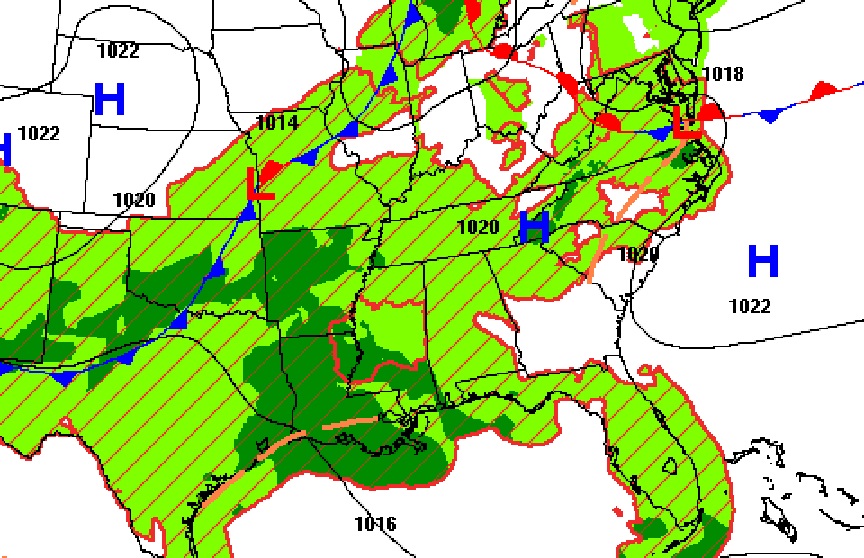
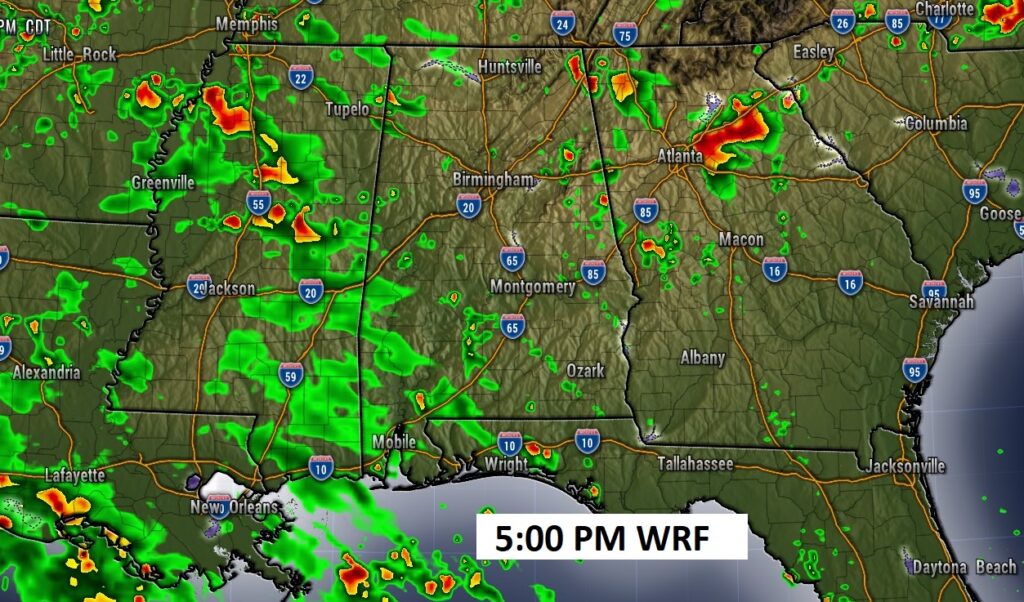
FUTURE RADAR : Routine late summer day across the south.
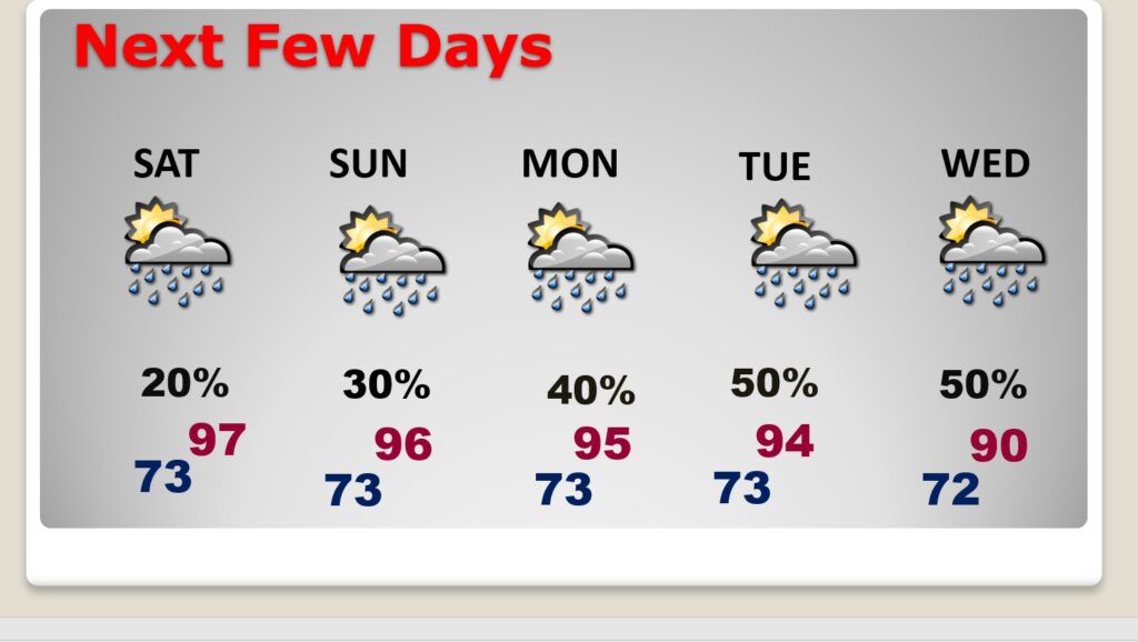
NEXT FEW DAYS: Hot and Humid through the Labor Day weekend. The Heat index will be in the 100 to 105 range for the rest of the week. Spotty random, scattered storms are back in the forecast through the Holiday weekend. Storms will become more numerous by Monday & Tuesday as a frontal system enters the state and moves southward.
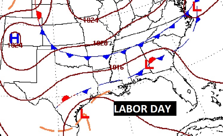
Here’s the Labor Day set-up. A southward moving front will increase the rain chance Monday through Wednesday.
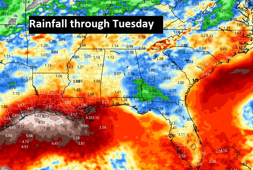
Here’s the expected rainfall across the Southeast US through Tuesday.
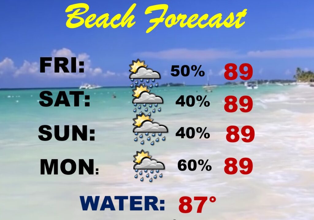
BEACH OUTLOOK: Scattered mostly PM Showers and storms each day. Highs in the upper 80’s to near 90. Gulf water temperature 87. Medium Rip Current risk especially from Destin eastward.
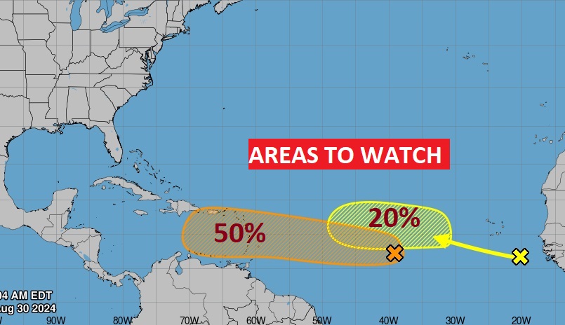
. TROPICAL: NHC is still tracking two Areas to Watch in the tropical Atlantic. The lead system now has a 50% chance of development over the next few days.
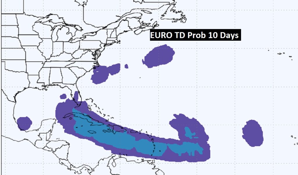
Here’s the EURO Probabilities through Day 10 for Tropical Development.
Thanks for reading the blog. There will be another complete Blog update and video forecast discussion tomorrow morning. This morning, everything is normal including LIVE on the Radio from 6 to 9AM on NewsTalk 93.1 – WACV. Have a nice day!
–Rich