
4:30 PM 9/12/24
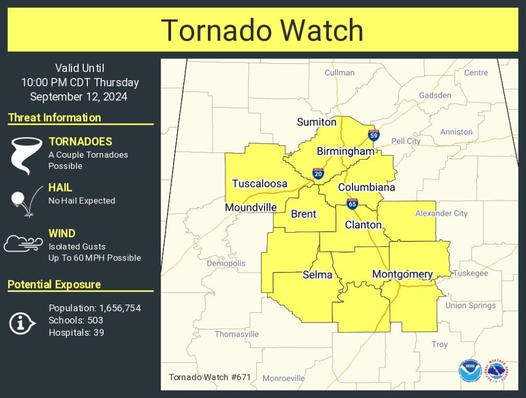
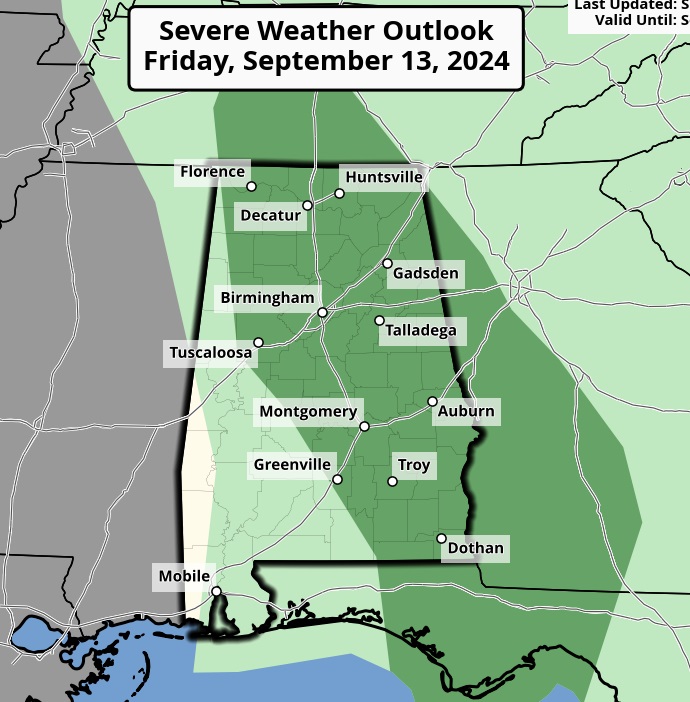
A relatively small in coverage tornado watch has been issued for central Alabama until 10:00 PM. SPC says: A couple of tornadoes are possible. No hail. Damaging wind gusts to 60 mph. possible. Stay weather aware. Our Weather App will keep you on top of the action with instant push notifications.
EARLY MORING UPDATE:
Good morning! Here we go… We will be on the active right side of the Francine track today and tonight. . Expect some torrential downpours, very gusty winds and a level 2 tropical tornado threat. We have a Flood Watch, Wind Advisory, and at least a Level 2 Tornado Threat. There will be tornado Watches and possibly several Warnings. The rain risk continues through Friday. There even could be a few leftover showers over the weekend. Here’s my brief forecast discussion.
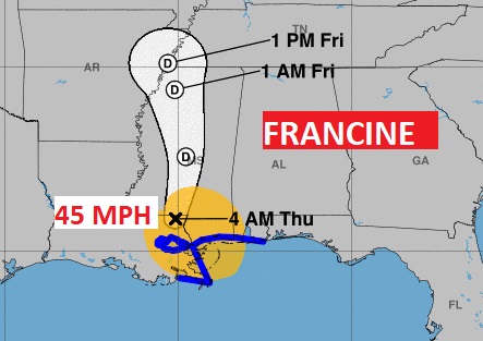
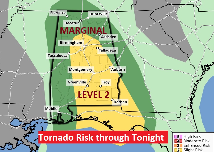
FRANCINE IMPACTS IN ALABAMA: We have a Flood Watch, Wind Advisory, and at least a Level 2 Tornado Threat. There will be tornado Watches and Warnings. Our Weather App will keep you on top of the action with instant push notifications. Download our app by searching Rich Thomas Weather. Make sure you allow notifications,
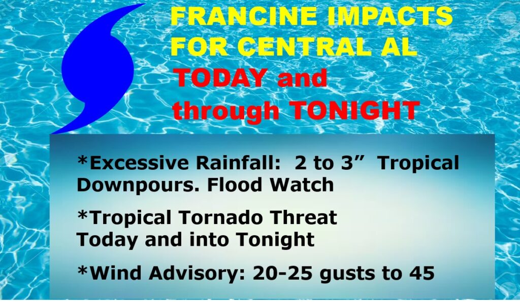
Rainfall of 2-3” will be common. Flood Watch.

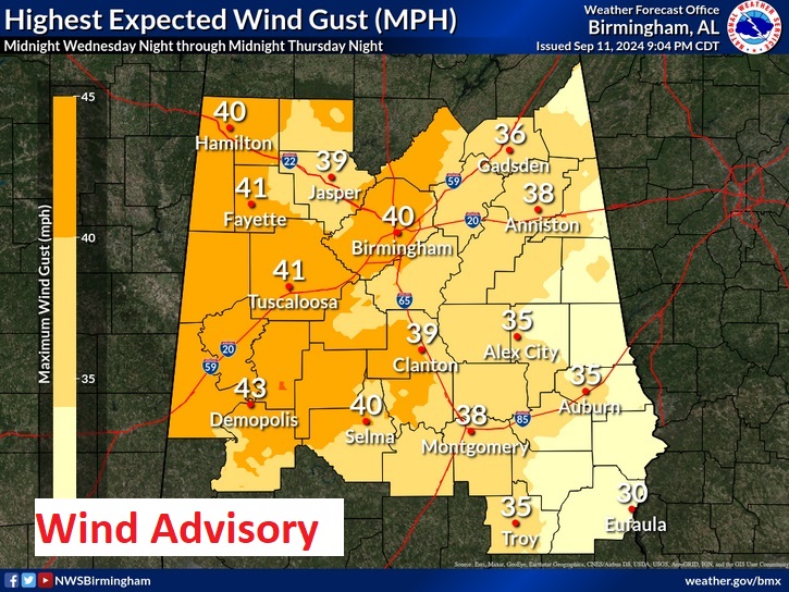
Wind gusts as high as 45 mph is not out of the question. Wind Advisory.
Most concerning to me is the Level 2 Tornado Risk today and int tonight. Tornado Warnings will be common. Quick spin up tornadoes. The weather app will instantly alert yu, because it knows where you are. We will be interrupting for Tornado Warnings on the 8 station Bluewater radio group.
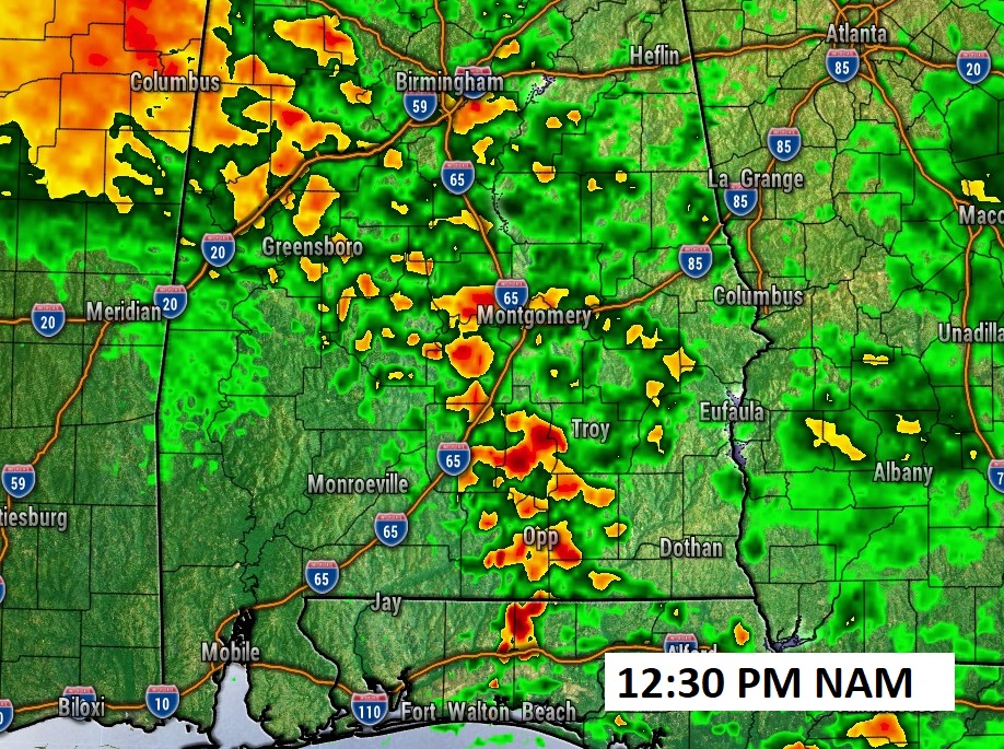
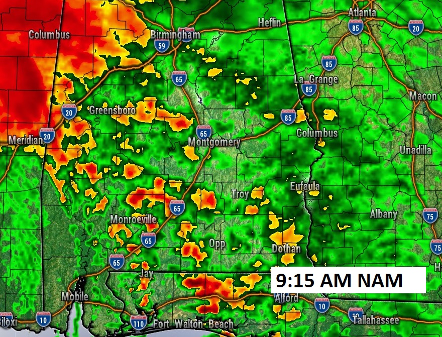
Here’s a flavor of Future Radar which gives you an idea of the cellular nature of the storms later. This is concerning to me. Many of these cells will be rotating and producing tornadoes. The atmosphere is becoming ripe for a number of warnings today. Be ready to act quickly.
NEXT FEW DAYS: The rain risk continues through Friday. There even could be a few leftover showers over the weekend.
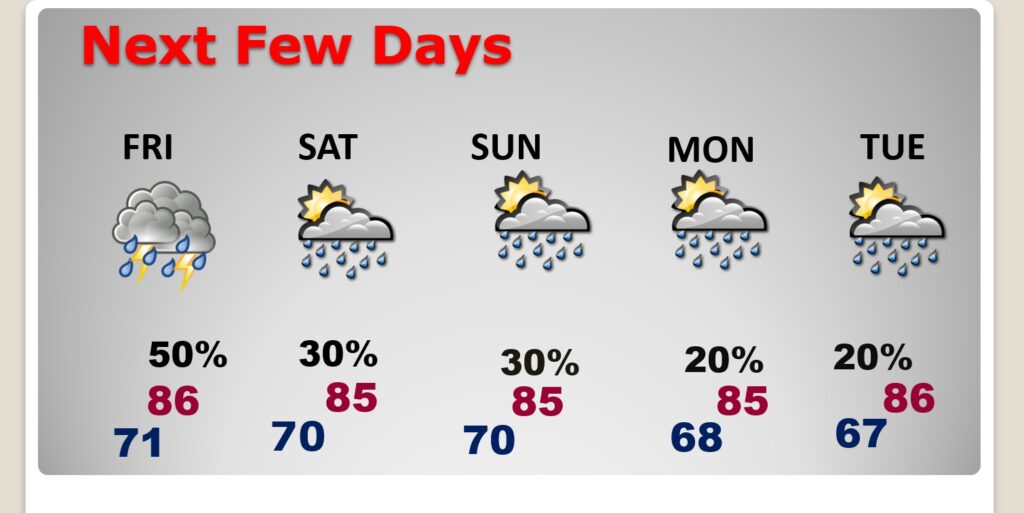
Newly added- Friday Marginal Severe Risk. Brief tornado possible.
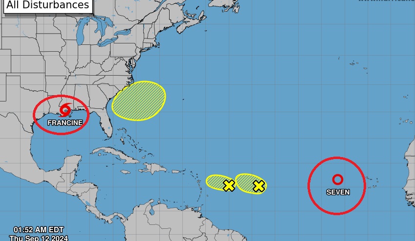
. ELSEWHERE IN THE TROPICS: NHC is tracking several other systems in the Atlantic Basin including Tropical Depression 7 (Future Gordon. .
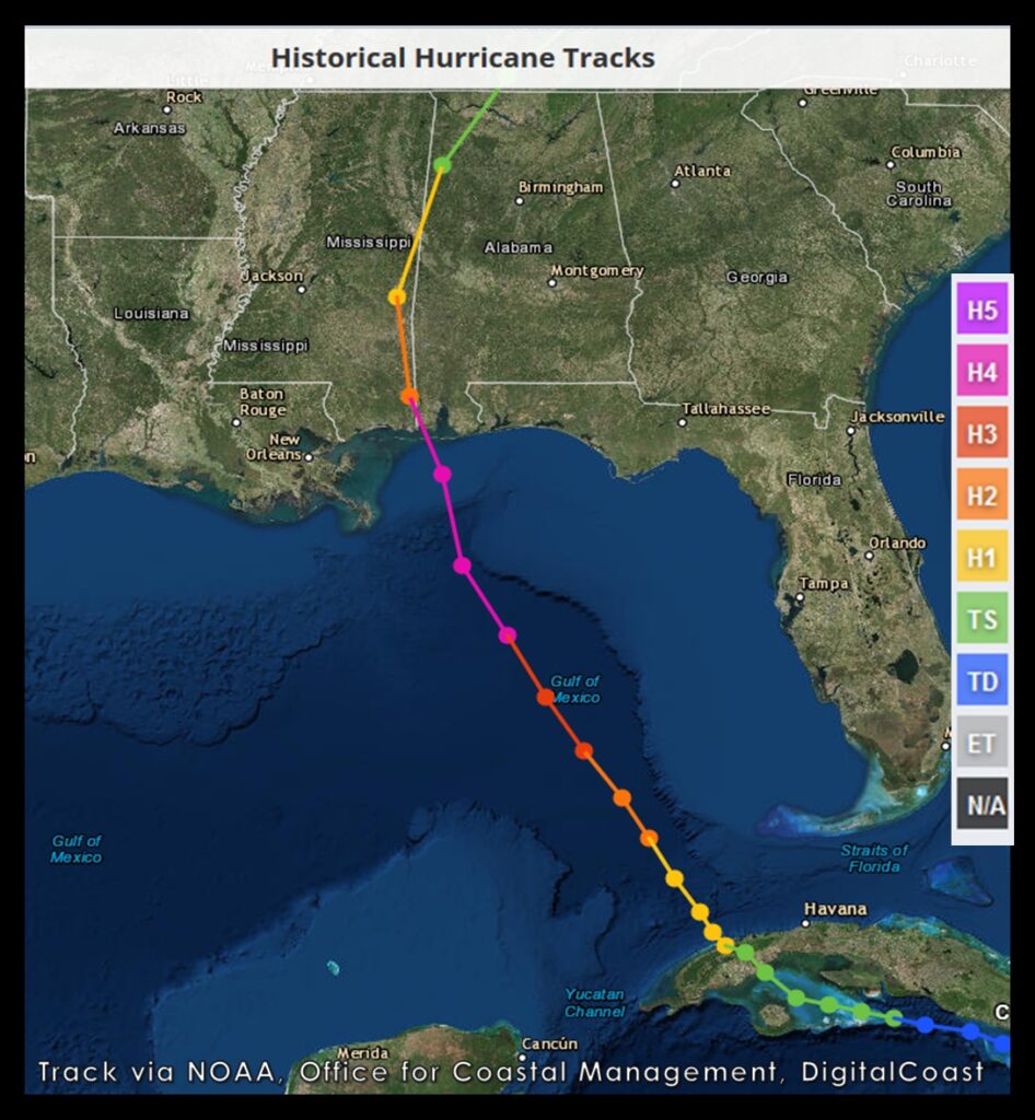
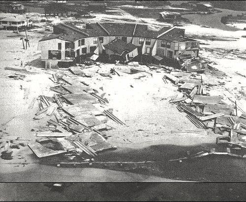
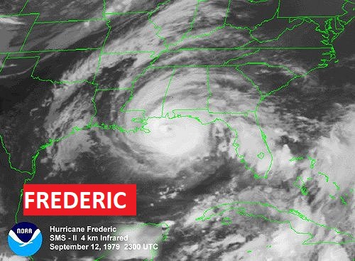
We were dealing with an”F” storm 45 years ago today. Today is the 45 anniversary of historic, devastating Cat 4 Hurricane Frederic from 1979. It came ashore at Dauphin Island with 145 mph winds. First year male names were used in the list.

We will be updating you as much as possible on social Media and interrupting on the air today.
–Rich