
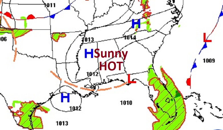
Good morning! It still a quiet, uneventful forecast for the next several days. We continue to be dry and rather hot for September. Thursday’s high was 91. Today we’ll be near 90. In fact, we’ll be near 90 each day through Tuesday. Summer may officially end Saturday, but the heat will continue. We could be in the mid 90’s on the last day of summer. (Normal 89/66). We continue to monitor an Area to Watch in the west Caribbean. All the Global models hint at future trouble in the Gulf, but not right away. There’s actually very little new to tell you this morning. Most of the long range models hold off on developing this system in the Gulf for the next few days. We’ll walk you through the long range Global model possibilities on the Blog below. Here’s my brief forecast discussion.
TODAY: Sunshine. Hot and dry. High 93. Low tonight 70. Light wind.
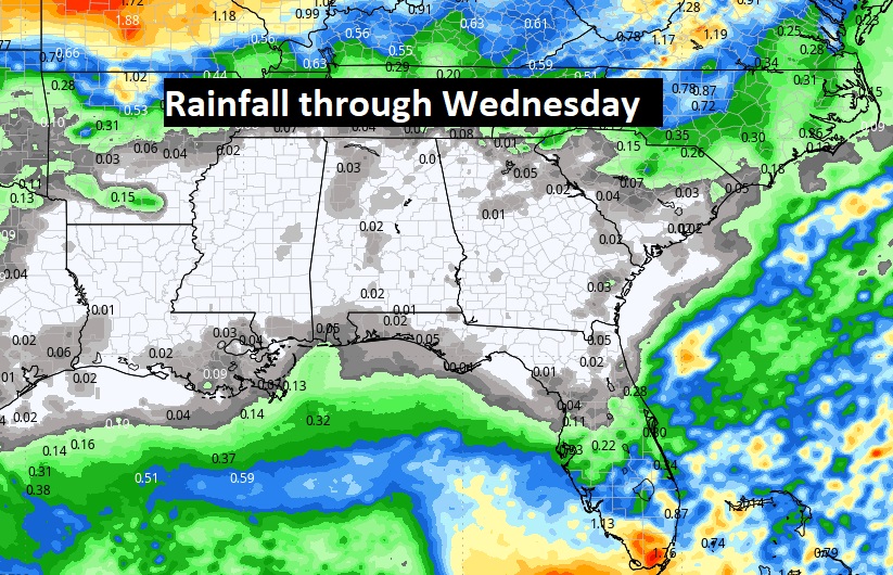
NEXT FEW DAYS: Hot and dry through at least Tuesday. Fall officially begins this Sunday. We’ll be in the low to mid 90’s through Monday. Lows at night near 70. We’ll introduce the chance of widely scattered showers Wednesday.
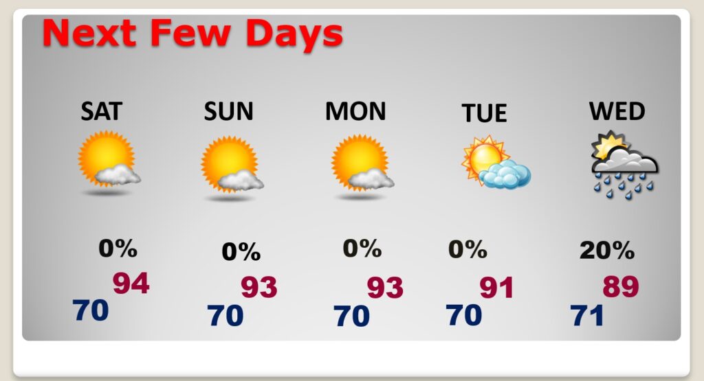
It’s basically a dry forecast through Wednesday. Perhaps isolated showers. Late week is still unknown. Tropical trouble?
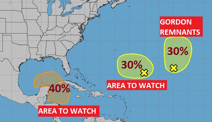
TROPICAL UPDATE: We continue to monitor an Area to Watch in the west Caribbean. All the Global models hint at trouble in the Gulf, but not right away.. Right now NHC is still giving this system it a medium 40% chance.
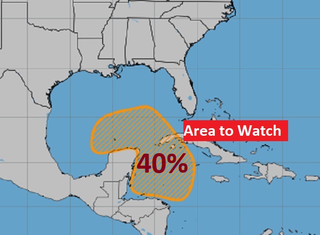
Here’s the EURO Tropical Storm Probability for the next 10 days. Once this system gets in the Gulf, it will have to effect land, but where?
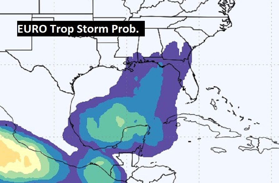
Now the Global models. I selected next Saturday Sept. 28. Notice the EURO still favors the SW Gulf.
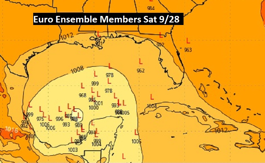
The GFS and the Canadian CMC Ensemble members are all over the place
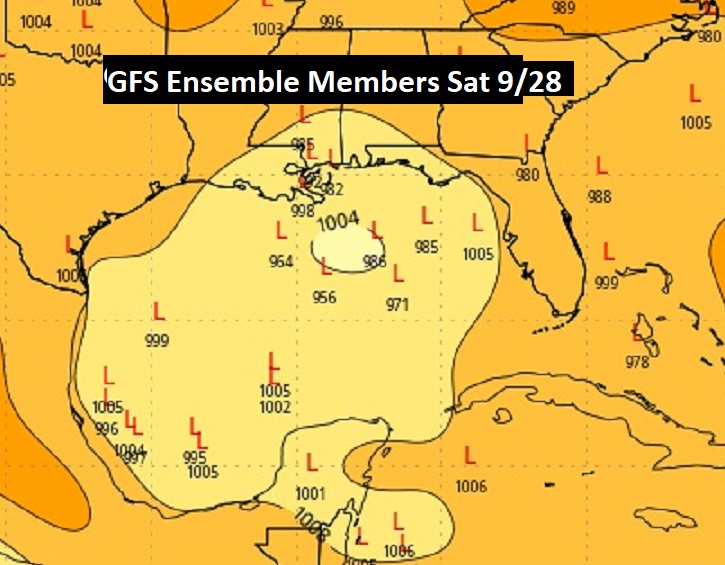
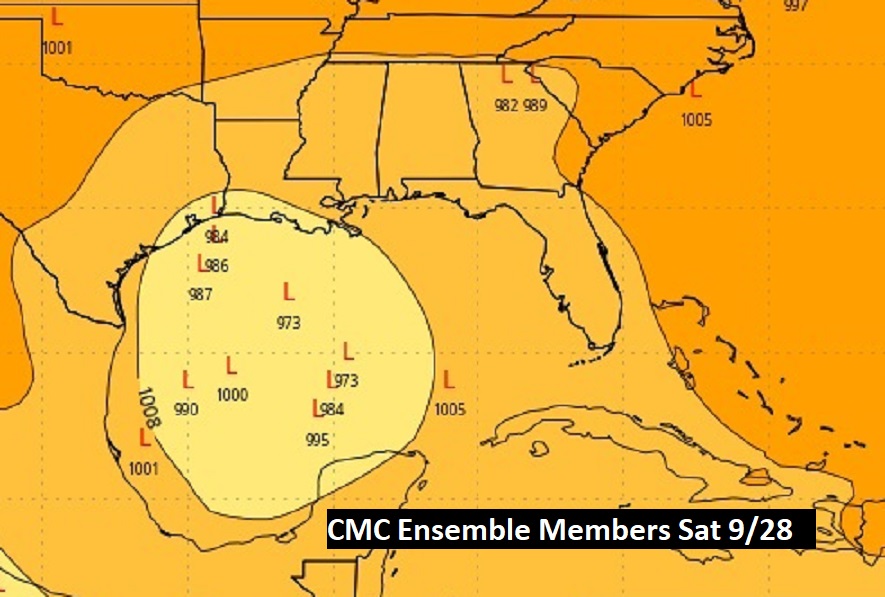
The GFS and CMC operational want to bring this system basically to our shore, But, it all depends on the Jetstream over the US late next week. How far will it dip down, That will be a key player in the future potential movement of this Tropical system. Do not worry about this yet, because It could go antwhere.
Elsewhere in the Tropics, NHC is monitoring an Area to Watch in the Atlantic and the Remnants of Gordon.
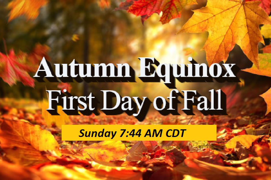
FALL BEGINS SUNDAY: Saturday is the last official day of Sumner. Sunday is the Autumnal Equinox. Fall officially begins at 7:44 AM CDT.
Thanks for reading the blog. There will be another complete Blog update and video forecast discussion tomorrow morning. This morning, everything is normal including LIVE on the Radio from 6 to 9AM on NewsTalk 93.1 – WACV. Have a nice day!
–Rich