
Good morning! The month of October will end tonight as one of the 3 driest months ever in Montgomery, in 152 years of records with .02”. On this Halloween, expect a hot, dry day with a high of 86. It’ll be mainly in the 70’s this evening for the Trick and Treaters. Expect more dry and very warm weather through the weekend and into early next week. And, there’s still no rain drops in our future until perhaps Tuesday Night. Rain chances will start to improve later next week. Here’s my brief forecast discussion video.
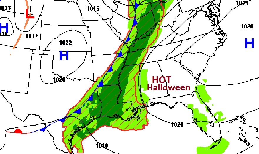
TODAY: Sun and cloud mix. Hot Halloween. High 86. SW wind 10 to 15 mph. It’ll be in the comfortable 70’s for the Trick or Treat Hours. Mostly cloudy tonight . Low 63.
There may be some showers and maybe thunderstorms in our state by this evening and tonight, but mainly in west and NW Alabama, The rest of us should stay dry.
FIRE DANGER expands to all Alabama counties. counties
New Drought monitor map comes out later this morning,
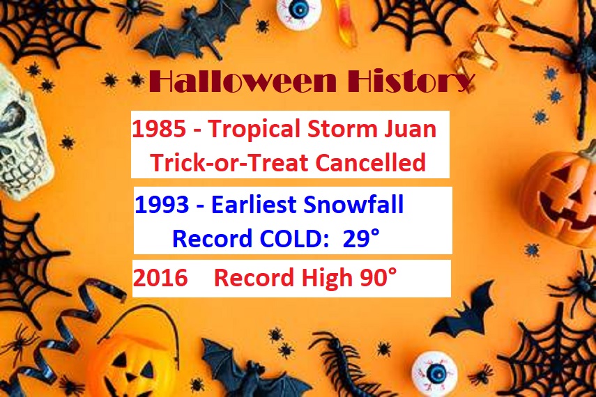
HALLOWEEN HISTORY: There have been some pretty wild weather extremes on Halloween in Montgomery over the years. I have now covered 46 for you, including the coldest, the hottest, a Tropical Storm and even the first and earliest snowflakes in MGM weather history.
.
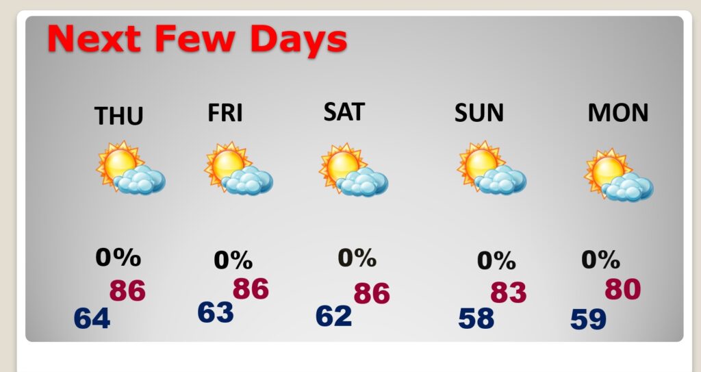
NEXT FEW DAYS: Expect more dry and very warm weather through the weekend and into early next week. And, there’s still no rain drops in our future until perhaps Tuesday Night. Rain chances will start to improve later next week.
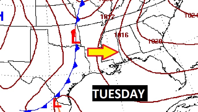
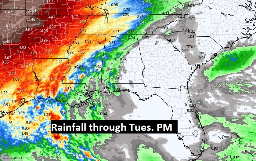
An approaching frontal system will bring a risk of showers and storms for most of us by Tuesday night.
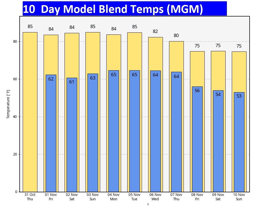
The 10 Day Model Blend Temperature Trend. There’s no chilly air expected. It’s an above normal forecast until somewhat cooler air filters in late next week.
.
.
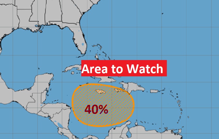
TROPICAL UPDATE: NHC is still tracking that Area to Watch in the West and SW Caribbean. There still could be some organized low pressure development by the weekend.
FALL BACK THIS WEEKEND: This is the weekend we switch from CDT to CST.

Thanks for reading the blog. There will be another complete Blog update and video forecast discussion tomorrow morning. This morning, everything is normal including LIVE on the Radio from 6 to 9AM on NewsTalk 93.1 – WACV. Have a nice day!
–Rich