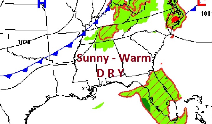
Good morning! Welcome to October. Our quiet, dry, comfortable pattern continues for now, with mostly sunny, tolerable humidity days and comfortably cool nights. An approaching front will bring a small rain chance Thursday night and Friday. Meanwhile, we’re still monitoring the Gulf for possible Tropical Development late in the week or over the weekend. Here’s my brief forecast discussion.
TODAY: Patchy morning fog. Mostly Sunny and very warm for the first day of October. High 87. North wind at 5 to 10 mph. Clear and comfortable tonight. Low tonight 67. .
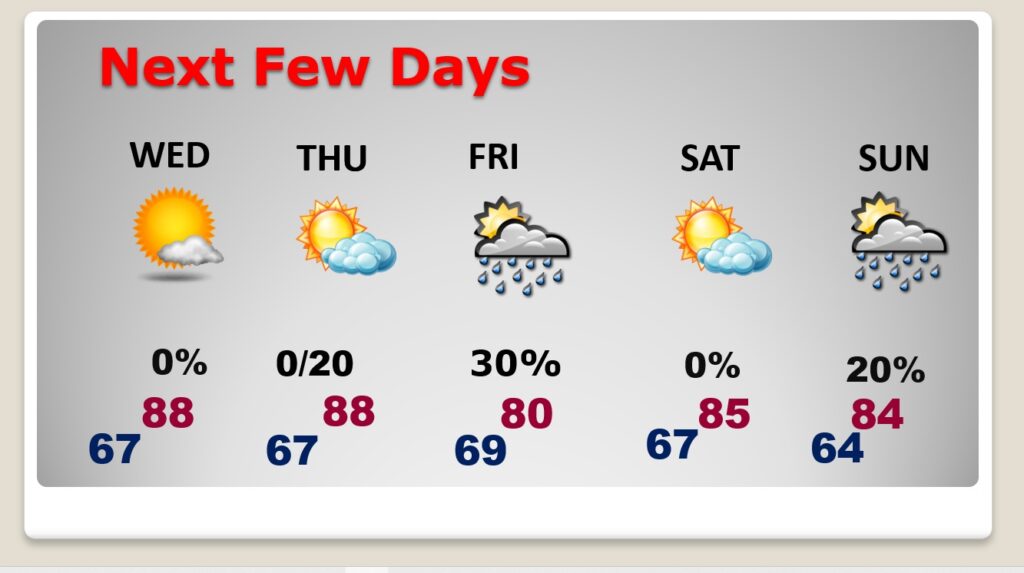
NEXT FEW DAYS: . Expect sunny, warm days with tolerable humidity, and clear, pleasantly cool nights through Thursday. Spotty showers are back in the forecast by Thursday night and Friday. Saturday looks dry. Widely scattered showers Sunday. Highs in the 80’s. Lows in the 60’s.
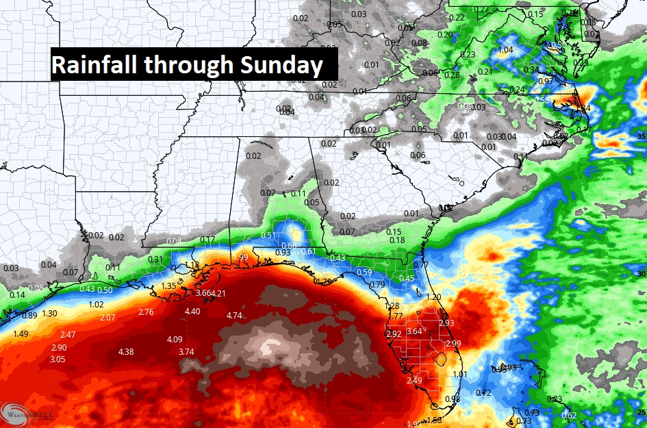
Here’s the expected rainfall through Sunday. Not much rain in our neighborhood. WOW. Look at the Gulf!
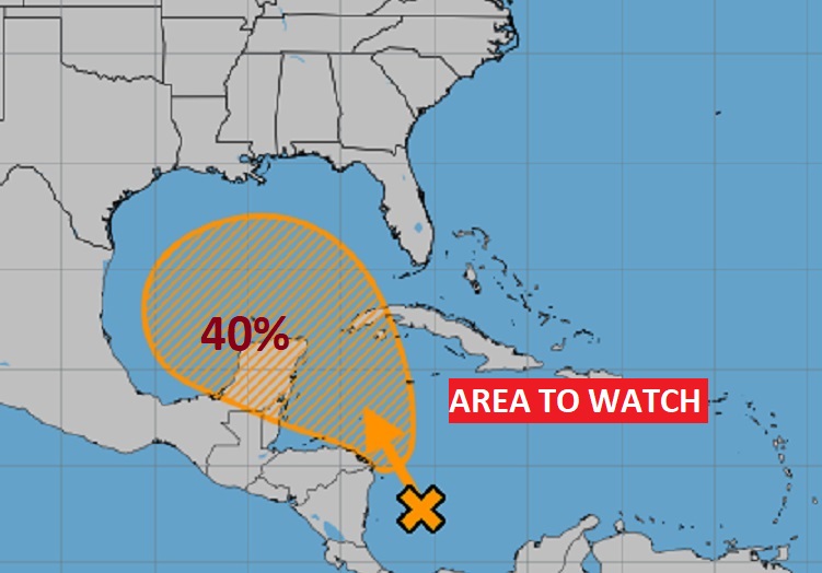
TROPICAL UPDATE: NHC is monitoring several systems including Joyce and newly formed Kirk. Plus, there’s Invest 91-L in the far eastern Tropical Atlantic.
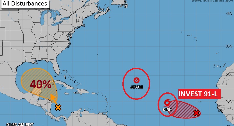
. We’re still monitoring that Area to Watch that extends from the west Caribbean into the Gulf. The tropical wave in the Caribbean could become a Depression, somewhere in the Gulf. The models do not agree on development of this system. But, there are still many question marks on a future track and potential strength. The next available name is Leslie.
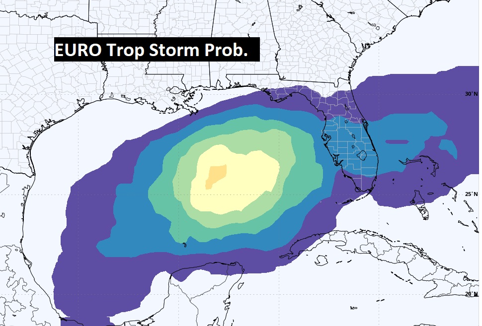
Here’s the EURO’s Probability of a Tropical Storm. The EURO is still bullish on the idea of eventual tropical development.
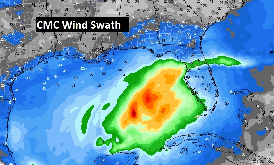
The Canadian CMC model is also bullish on the idea of development in the eastern Gulf.
Thanks for reading the blog. There will be another complete Blog update and video forecast discussion tomorrow morning. This morning, everything is normal including LIVE on the Radio from 6 to 9AM on NewsTalk 93.1 – WACV. Have a nice day!
–Rich
