Good morning! Rain is back on the radar today. A brief shot of tropical moisture, ahead on approaching trough, will bring showers and thunderstorms back to our forecast, mainly daytime today. If you have plans for the Alabama National Fair this evening, most of the rain should move out by tonight. The weekend for the Fair and Football tailgating looks nice. Lots of sun. Highs in the 80’s. Tolerable humidity and comfortable nights. The nice weather pattern continues through the middle of next week at least. Still watching a disturbed Gulf of Mexico, but no worries for us, it appears. Here’s my brief forecast discussion.
TODAY: Occasional showers and thunderstorms mainly daytime today. If you have plans for the Alabama National Fair this evening, most of the rain should move out by tonight. Cooler today. High 78. East wind 6 to 12 mph. Mostly cloudy tonight. Low 66.
. A brief shot of tropical moisture, ahead on approaching trough, will bring showers and thunderstorms back to our forecast, mainly daytime today.
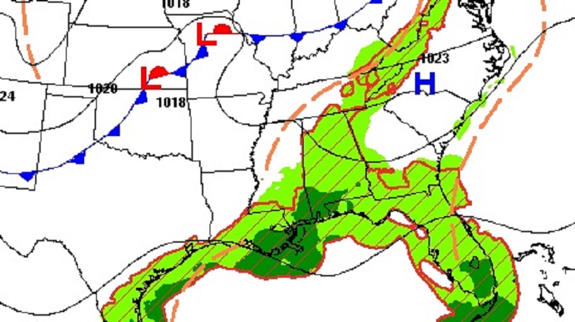
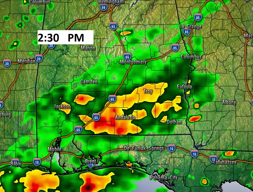
NEXT FEW DAYS: The weekend for the Fair and Football tailgating looks great. Lots of sunshine. Highs in the 80’s. Tolerable humidity and comfortable nights. Lows in the 60’s The nice weather pattern continues through the middle of next week at least. A little cooler by mid-week.
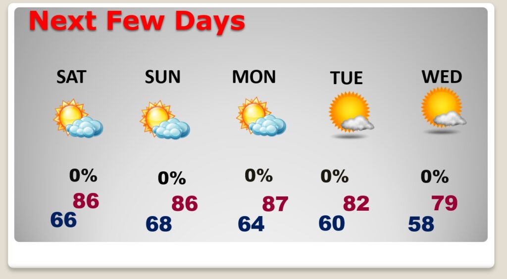
. Monday and Tuesday look dry. Mostly sunny and comfortable. Highs in the 80’s and lows in the 60’s.
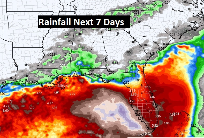
Here’s the expected rainfall through the next 7 days. Deep tropical moisture continues across the Gulf of Mexico for several more days.
TROPICAL UPDATE: NHC is still monitoring Hurricane Kirk. Plus, tropical storm Leslie eastern Tropical Atlantic. Neither of these systems should impact land areas
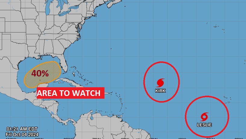
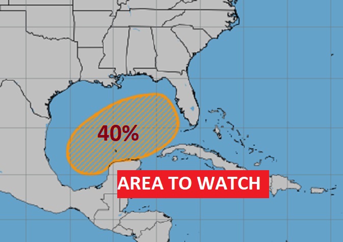
. We’re still monitoring that Area to Watch that extends from the west Caribbean into the Gulf. The future of this system remains unknow. There area still many question marks on a future track and potential strength. NHC has raised the possible future tropical development down a notch to 40% over the next 7 days.
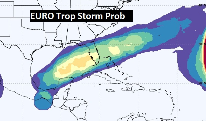
Here’s the EURO’s Probability of a Tropical Storm. It still indicates a decent chance of a possible tropical storm over the next several days.
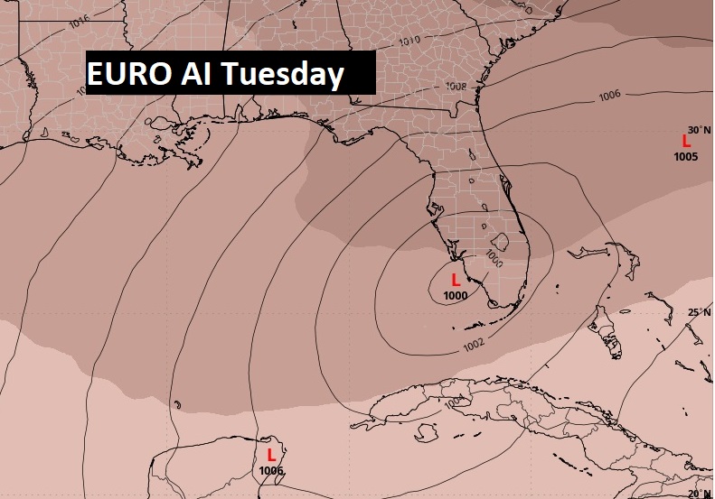
The new EURO artificial intelligence model continue to show possible Tropical Depression development over the next few days in the eastern Gulf moving in the direction of the Florida Gulf coast.
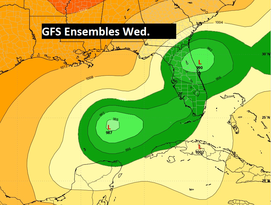
The GFS Ensemble Member Lows are still spread out from the central to eastern Gulf next week.
HURRICANE OPAL ANNIVERSARY:
THIS IS A BIG BIG DAY IN MONTGOMERY WEATHER HISTORY..
On this date in 1995…Cat 3 Hurricane Opal came shore on the Gulf coast around Destin, 115 mph winds around 4pm. It was a Wednesday.. Opal moved straight north into Alabama. It was still a Full Fledge Hurricane when it came straight up through and over Montgomery. NHC listed to top sustained winds at 75, but wind gusts to over 90 mph recorded at Dannely field and Maxwell. 29 years ago today.
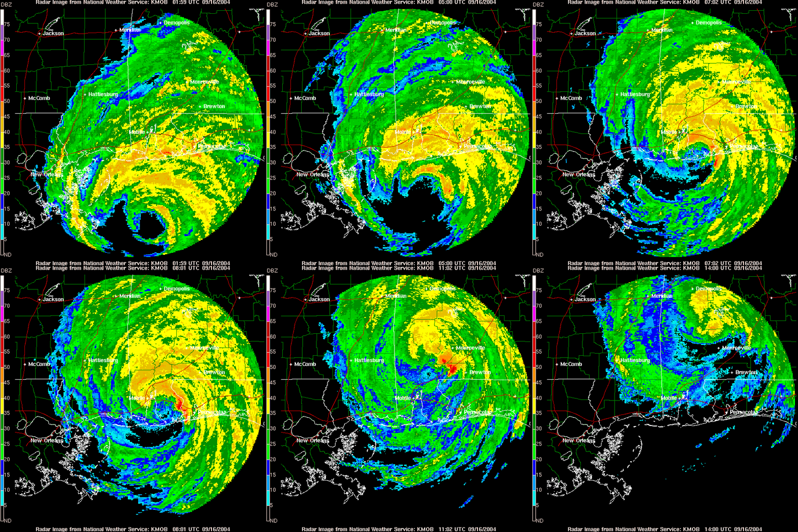

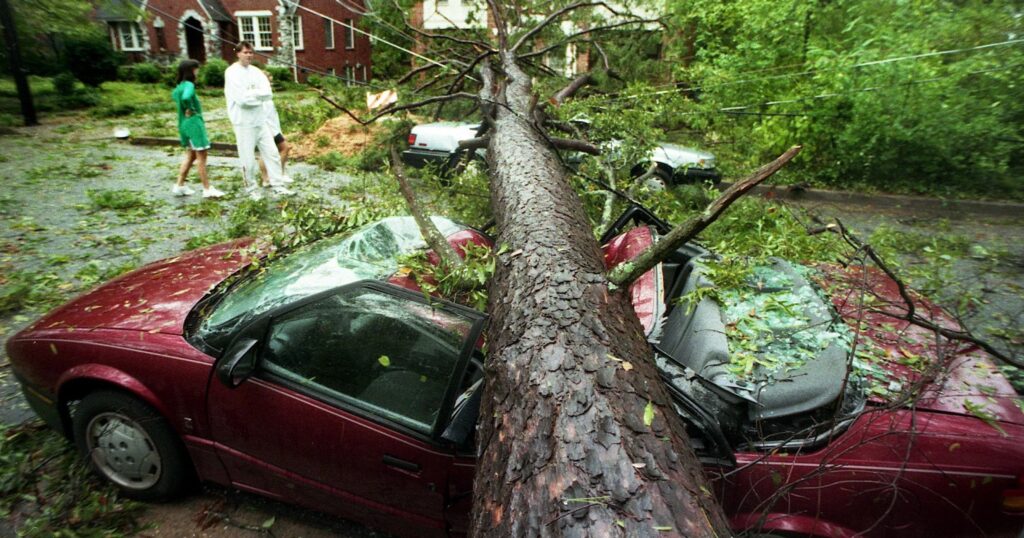
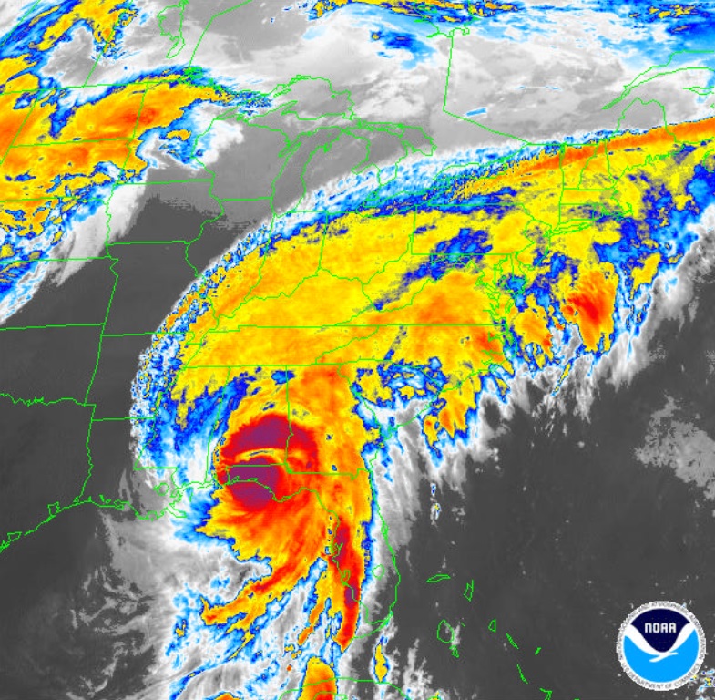

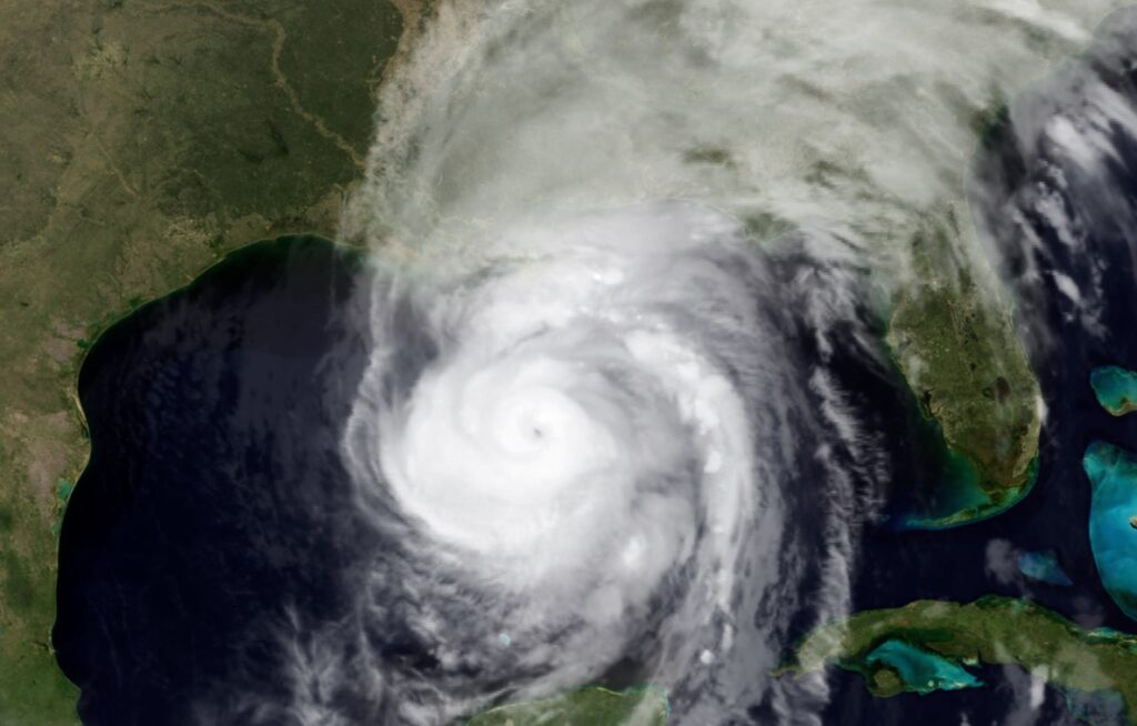
Here’s an Opal Feature I produced on the 25th Anniversary.
Thanks for reading the blog. There will be another complete Blog update and video forecast discussion tomorrow morning. This morning, everything is normal including LIVE on the Radio from 6 to 9AM on NewsTalk 93.1 – WACV. Have a nice day!
–Rich
