12:30 PM BULLETIN:
THAT was quick. Invest 92-L, which became TD 14, has been promoted to Tropical Storm Milton. Milton will continue to develop. Could become a hurricane SUN. and has the potential to be near major Hurricane Strength along the western Florida Gulf coast on Wednesday. “an intense hurricane with =multiple life-threatening hazards.” Almost Cat 3 at Landfall.
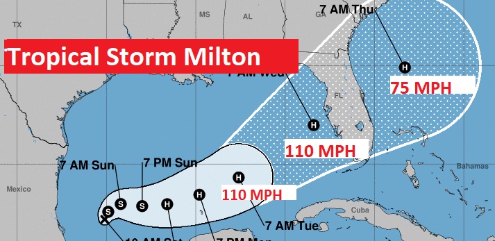
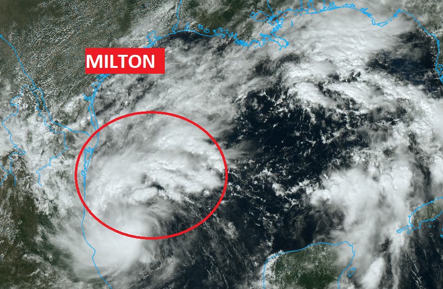

Breaking news: TD14 forms – Growing major Hurricane Threat for Central Florida Coast
‘(10:30 AM 10/6/2024)
All right, here we go gang. Another potential disaster. Tropical depression 14 has formed in the southwestern Gulf of Mexico. Expected to be close to major hurricane status when it arrives on the Florida West Coast by midweek week. The name will be Milton. More later!
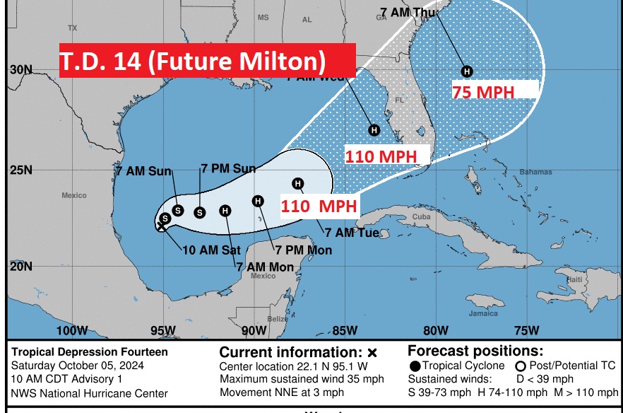
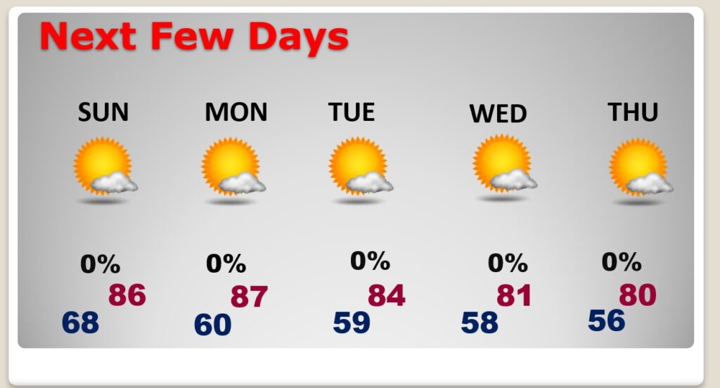
Good morning! Looks like a pretty nice weekend forecast, with tolerable humidity and comfortable nights. Great weather for the Fair and tailgating. Highs in the 80’s. Lows in the 60’s. The nice weather pattern will continue through the middle of next week at least. Expect some cooler nights by mid week. We could be in the 50’s Tuesday and Wednesday nights. Meanwhile, all eyes on Invest 92-L in the Gulf of Mexico. NHC now gives this system an 80% chance of development in the next few days. And, finally the models are coming into better agreement in the future of this system.
TODAY: Partial sunshine. Tolerable humidity. High 86. East wind at 5-10 mph. Cloudy at times tonight. Low 68.
All The active weather is in the Gulf.
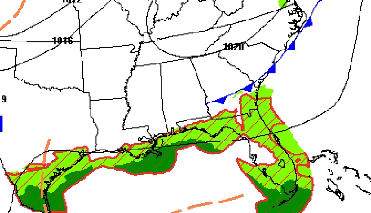
NEXT FEW DAYS: The weekend for the Fair and Football tailgating looks great. sun/cloud mix today. Mostly sunny Sunday. Highs in the 80’s. Tolerable humidity and comfortable nights. Lows in the 60’s The nice weather pattern will continue through the middle of next week at least. Expect some cooler nights by mid week. We could be in the 50’s Tuesday and Wednesday nights.
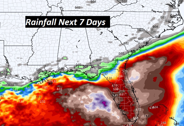
Here’s the expected rainfall through the next 7 days. Deep tropical moisture continues across the Gulf of Mexico for several more days.
TROPICAL UPDATE: NHC is still monitoring Hurricane Kirk and Hurricane Leslie, and an Area to Watch in the Tropical Atlantic. Neither of these systems should impact land areas
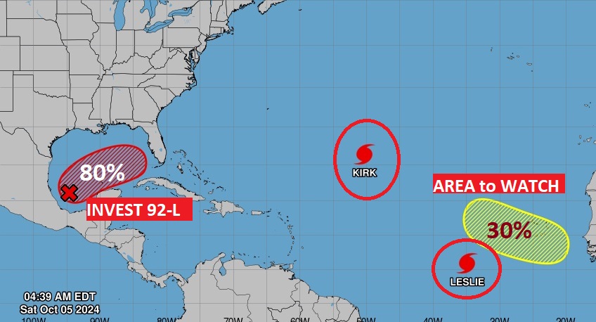
. But, All eyes on INVEST 92-L in the Gulf of Mexico. NHC now gives this system an 80% chance of development in the next few days. And, finally the models are coming into better agreement in the future of this system.
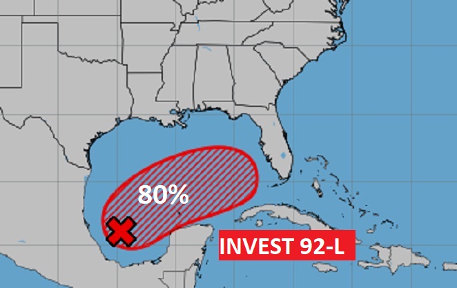
And, now FINALLY the models are coming into much more agreement that this system could develop, either into a Tropical Storm or possibly a hurricane and threaten Florida this week.
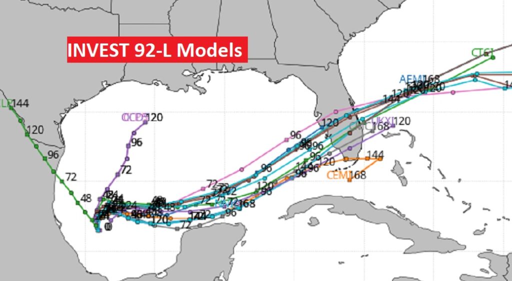
What about timing? Here’s a few of the model operational runs showing various solutions over the week ahead. Potential trouble for central and south Florida.
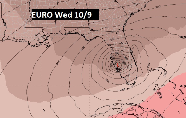
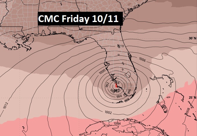
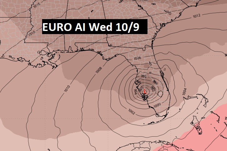
LATE BREAKING:
Concern is growing for a potentially highly impactful hurricane for the west Florida Gulf coast by hi-res -week. The name would be MILTON. The newer hi-res Hurricane models frankly paint a very serious potential threat for the central Florida west coast.
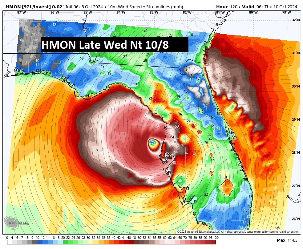
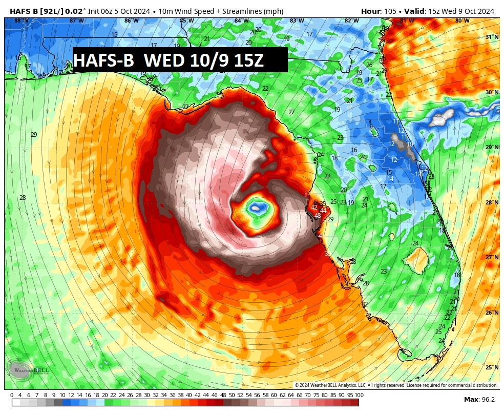
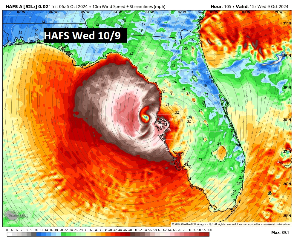
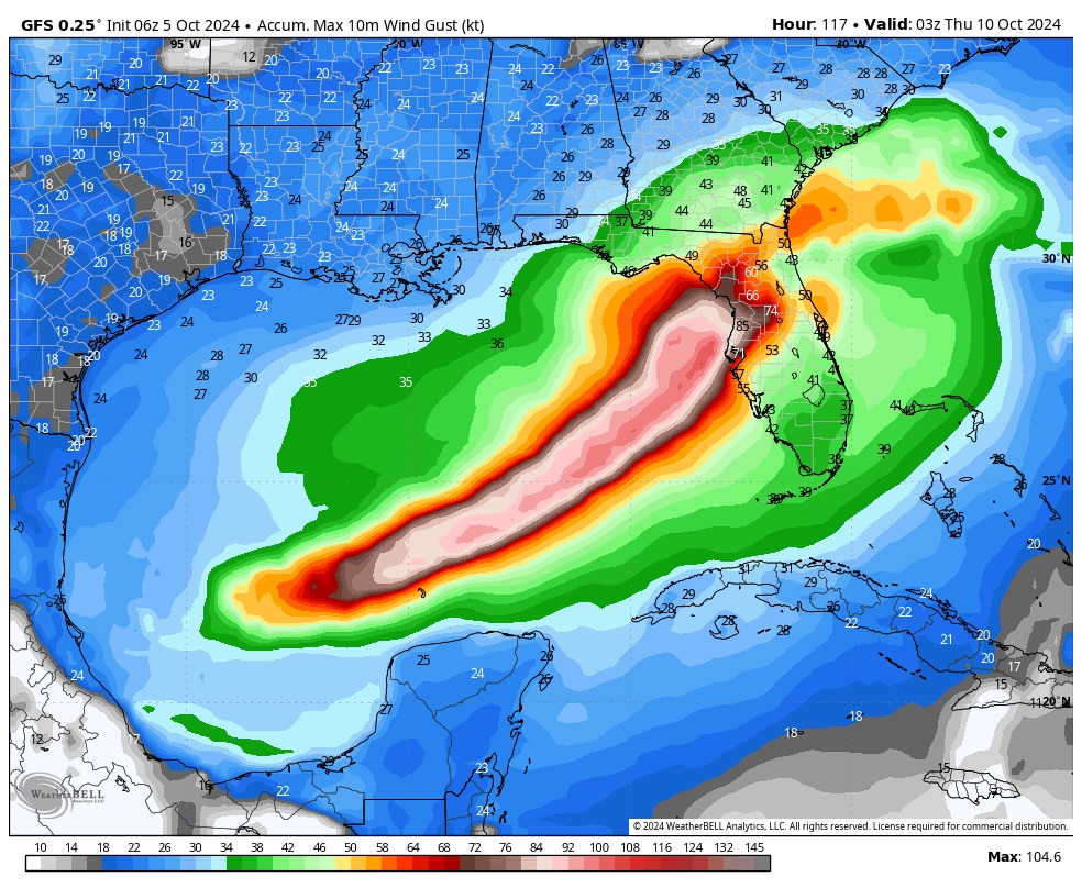
Here’s the American GFS model idea. This is the Wind Swath. Very interesting.
Thanks for reading the blog. The next scheduled blog will be Monday morning, Have a nice weekend!
–Rich
