MILTON EXPLOSIVELY INTENSIFIES WITH 175-MPH WINDS.
(1 pM CDT 10/7/24)
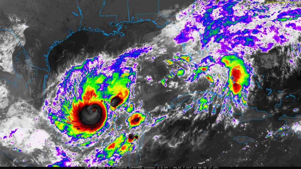
NHC MILTON 1PM:- MILTON EXPLOSIVELY INTENSIFIES WITH 175-MPH WINDS. Extreme rapid intensification from a 100 mph hurricane at 3PM to 175 mph at 1PM. Historic Extreme Rapid Intensification. Pressure has dropped to 911 mbs. (972 at 4AM). at 4AM) Expected to peak at 165 mph winds today. – 165 mph wind by evening. Milton will weaken some before landfall Wednesday – but still as a major hurricane at landfall on the Florida west coast Wednesday evening. with catastrophic storm surge. Potential worse case scenario for the west coast of Florida, including the greater Tampa Bay area.
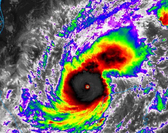
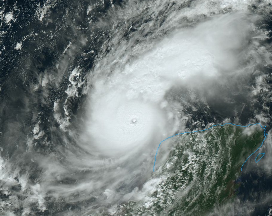
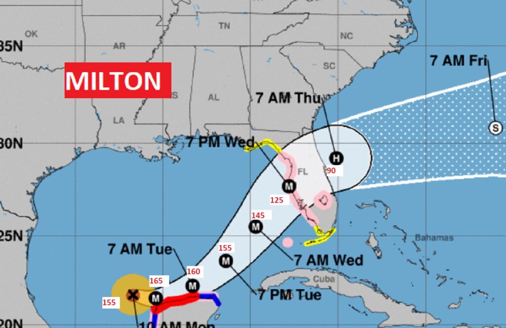
8AM BULLETIN: Milton has exploded in intensity! Winds have now increased to an incredible 150 mph (strong Cat4). https://nhc.noaa.gov/text/refresh/MIATCUAT4+shtml/071305.shtml…?
SPECIAL NHC 7AM UPDATE: Milton’s winds have increased to 125 mph. Rapid intensification underway. Expected to be close to Cat 5 intensity late tonight. https://nhc.noaa.gov/text/refresh/MIATCPAT4+shtml/071147.shtml…?
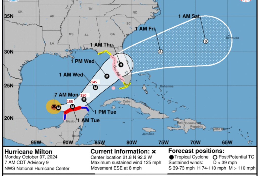
BULLETIN: NOAA Hurricane Hunter aircraft has found Milton is now a Major 120 mph – Cat 3 hurricane. Milton is exploding intensity. Rapid intensification. https://nhc.noaa.gov/text/refresh/MIATCUAT4+shtml/071100.shtml…?
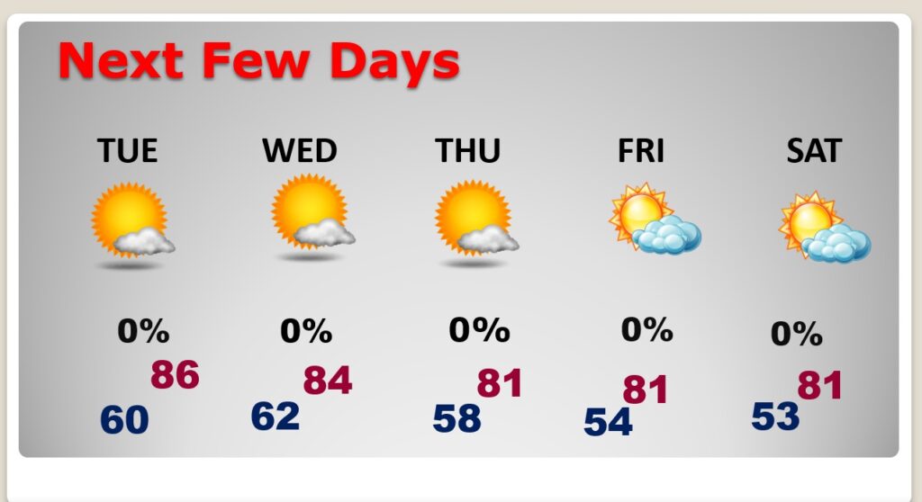
Good morning! The news is very good for US this week, even as powerful hurricane Milton, in the Gulf, heads for Florida. Much more on Milton below. For Alabama, it’s a quiet, dry forecast. Today will be very warm for October. Upper 80s to perhaps near 90. But, a cold front is on the way. By Wednesday through Friday, highs will be in the lower 80’s. The coolest air of the season is on the way. We’ll be in the 50’s Wednesday through Friday night a least. Perhaps low 50;s by Dawn Friday and Saturday mornings. Here’s my brief forecast discussion.
TODAY: Mostly Sunny. Warm for October High 88 to 90. Cloudy at times tonight. Cooler. Low near 60.
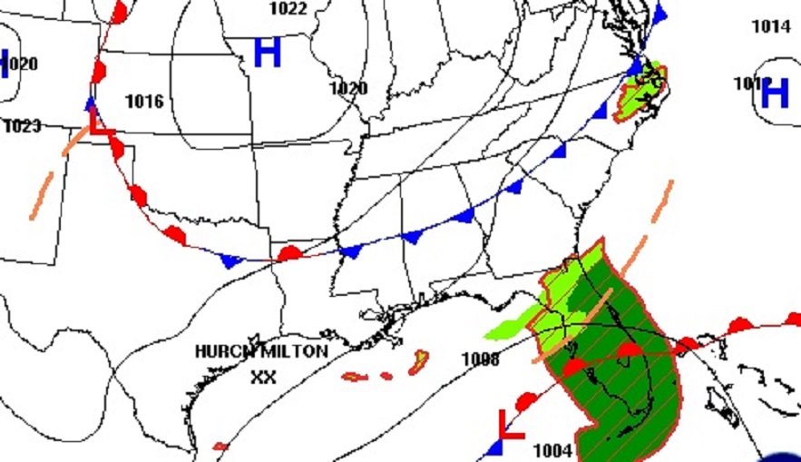
That cold front on the map will deliver fresh, fall air for us, and also will be a player in the future steering of Milton.
NEXT FEW DAYS: The coolest air of the season is on the way. By Wednesday through Friday, highs will be in the low 80’s. The coolest air of the season is on the way. We’ll be in the 50’s Wednesday through Friday night a least. Perhaps low 50;s by Dawn Friday and Saturday. It’sa dry forecast for several days.
.
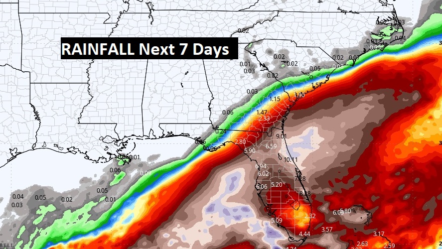
Here’s the expected rainfall through the next 7 days. Dry for us. Deep tropical moisture continues across the Gulf of Mexico for several more days due to Powerful Milton.
TROPICAL UPDATE: Milton is the only player in the tropics we care about. Not even going to talk about that other stuff in the Atlantic.
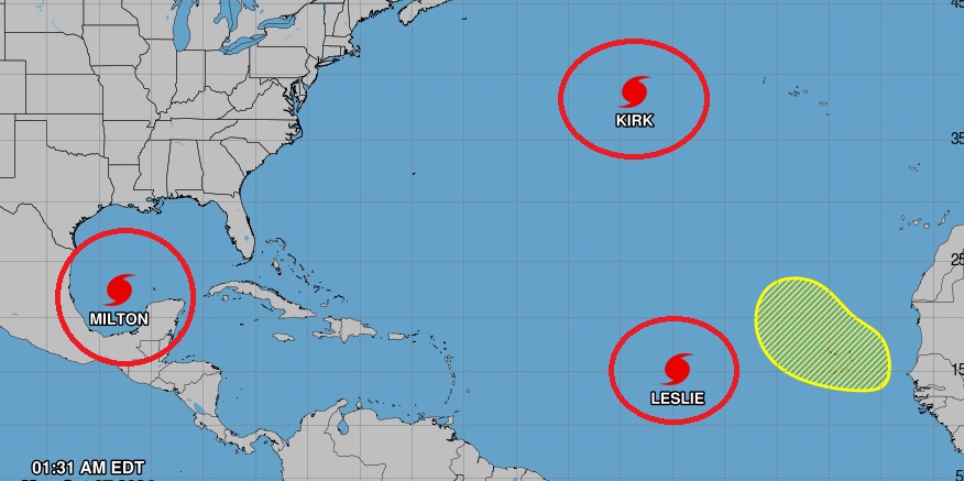
Milton is getting stronger in the Gulf, Rapid intensification is expected. Milton is expected to peak at least as a Cat. 4 hurricane in the warm Gulf waters. It is likely to arrive on the west coast of Florida Wednesday evening/Wednesday night still as a major hurricane. Devastating impacts are likely, including what could be catastrophic, life threatening storm surge and flooding rainfall.
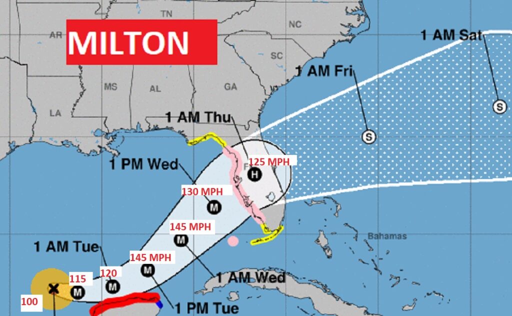
#Milton‘s Rapid Intensification has begun. Now a 100 mph Cat 2 Hurricane expected to reach Cat 3 status today and become a strong 145 mph Cat 4 tomorrow. Florida has not had back to back Major hurricanes in over 100 years. The All-time Tampa Bay benchmark hurricane was in 1921. NHC says storm surge in Milton could be “catastrophic” #FLwx
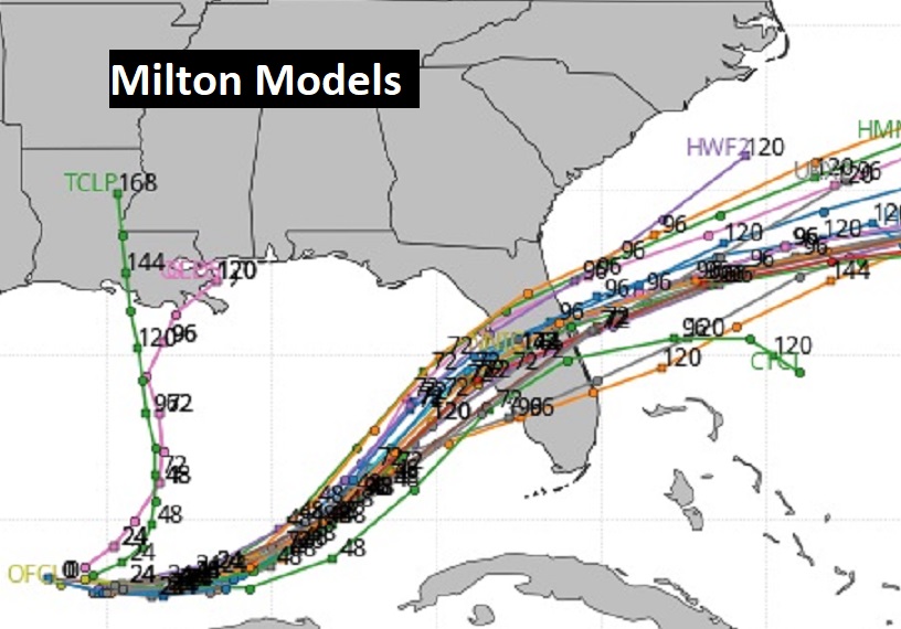
The so called Spaghetti Models are coming into much better agreement on the future track of powerful Milton. The news for Florida is potentially frightening.
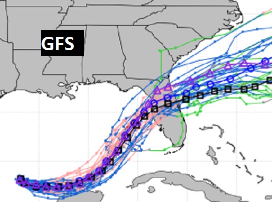
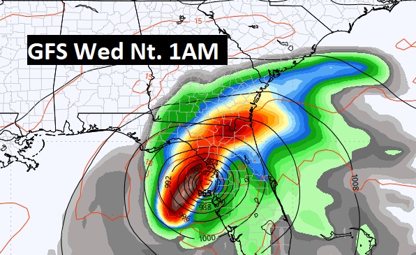
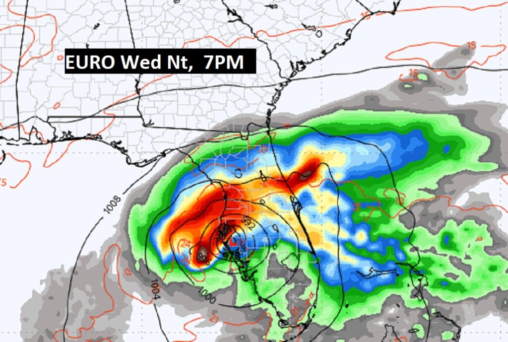
Here’s a couple of model snapshots of potential landfall from two of the major global models. These will probably shift some before landfall. But, what were looking at is a potential worst case scenario for the greater Tampa Bay area. The benchmark storm for Tampa is 1921. First is the GFS operational run, and below is the latest EURO operational.
Thanks for reading the blog. There will be another complete Blog update and video forecast discussion tomorrow morning. This morning, everything is normal including LIVE on the Radio from 6 to 9AM on NewsTalk 93.1 – WACV. Have a nice day!
–Rich
