‘!!AM NHC UPDATE:
Milton, hours from landfall tonight on the Florida coast as a Major Cat 3 hurricane with catastrophic non-survivable storm surge, Worst in FL West coast history. 11AM EDT: winds now 145 – Cat 4, pressure 933 mbs. 290 miles SW of Tamps, moving NE at 17 mph.
https://www.nhc.noaa.gov/text/refresh/MIATCPAT4+shtml/091456.shtml?
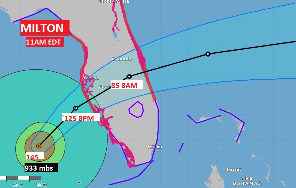
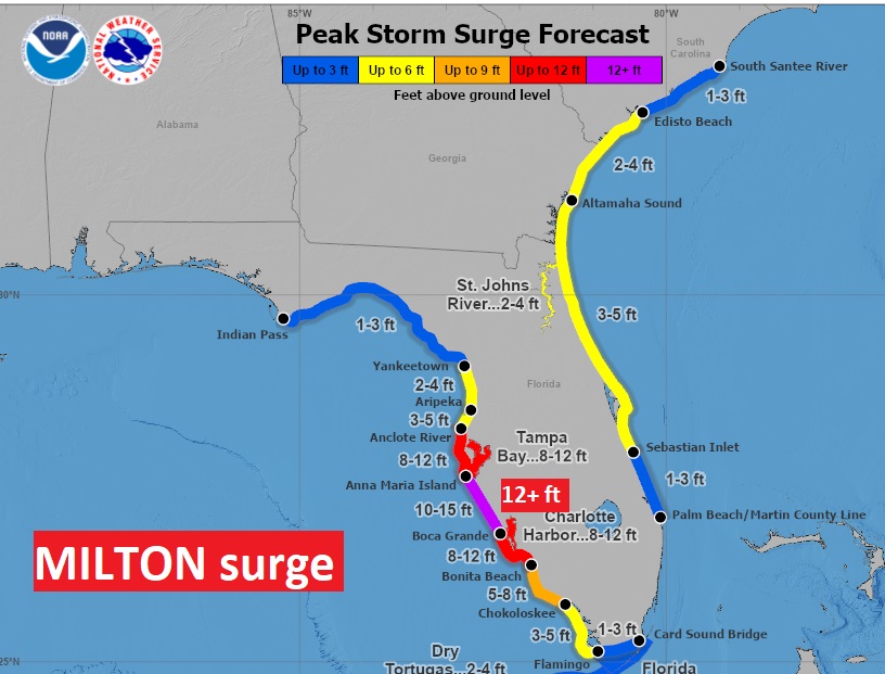
Good morning! Powerful Historic Milton will have a devastating impact along the Florida west coast tonight, perhaps arriving as a strong Cat 3 or even a Car 4 storm, Effects will begin late today as tropical storm fore winds begin. The storms surge near the point of landfall could reach an unthinkable 10 to 15 feet somewhere along the SW or central west coast of Florida, Milton will still be a hurricane as it reaches the Atlantic shore tomorrow morning. Milton will have zero effect on our weather, except for the substance or sinking air it will promote, which will keep our air dry and comfortable with extremely low humidity. The Days will be warm. Nights will be progressively cooler. By tonight through Monday, highs will be in the lower 80’s. The coolest air of the season is on the way. We’ll be in the 50’s tonight through Saturday night a least. Perhaps low 50’s by Dawn Friday, Saturday and Sunday mornings. Here’s my brief forecast discussion.
TODAY: Mostly Sunny. Warm for October High 86. but with low humidity. Mainly clear tonight. Cooler. Low near 58.
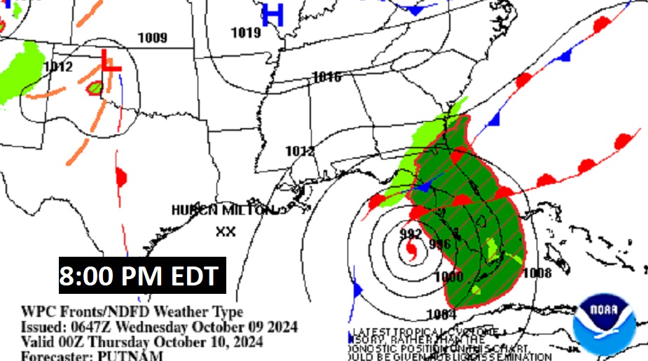
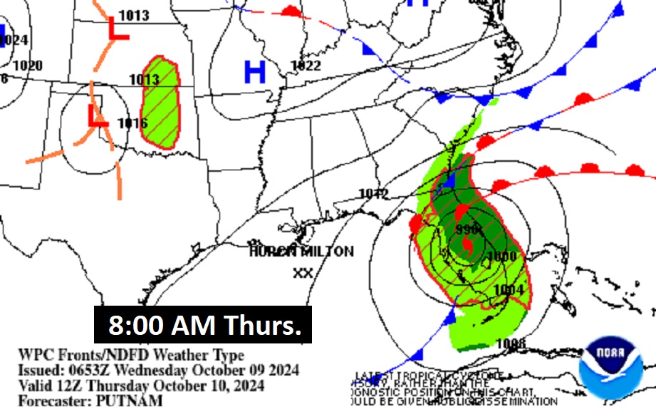
Here’s the map set up this afternoon and tomorrow morning. We see the front near the coast, and powerful Milton crossing Florida.
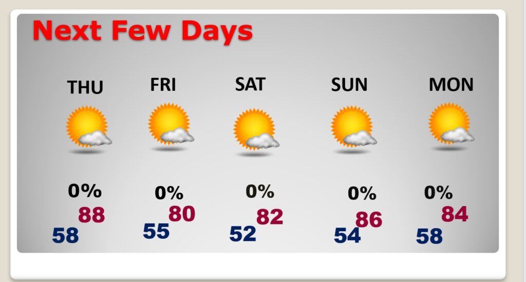
NEXT FEW DAYS: The coolest air of the season is on the way. By each day through Monday, highs will be in the lower 80’s. We’ll be in the 50’s each night through Sunday night a least. Perhaps lower 50;s by Dawn Friday, Saturday and Sunday. It’s a dry forecast for several days.
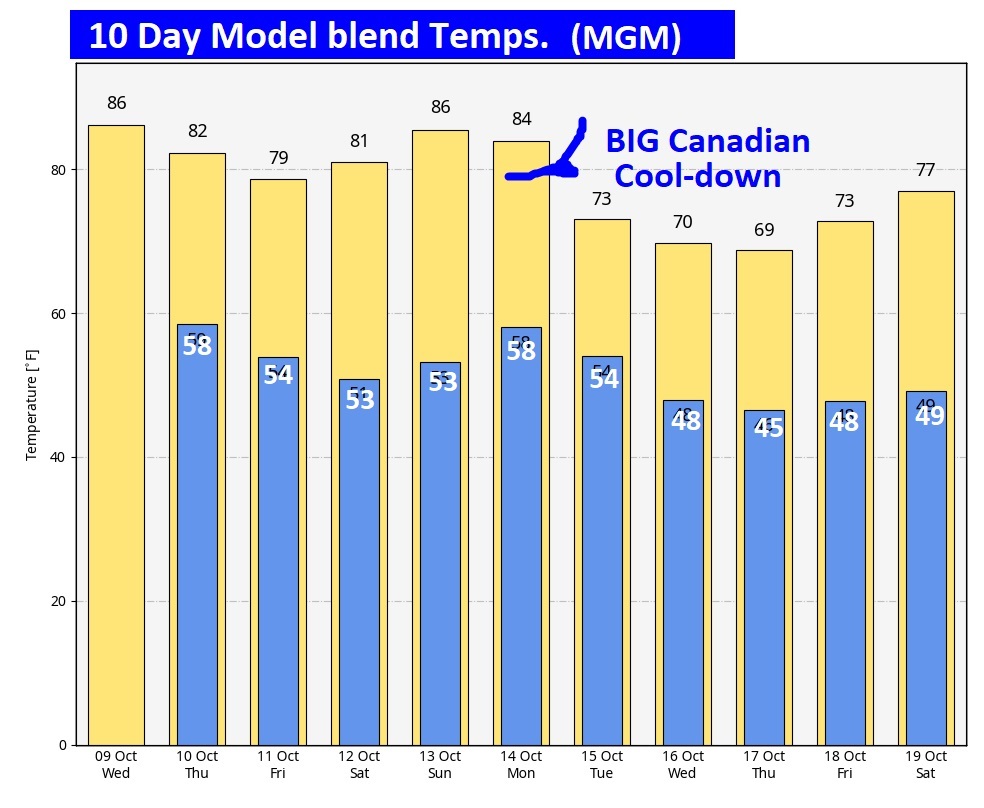
Cool weather fans – this will excite you. A strong Cold Front will move though the state next Monday. Get ready for some real-deal jacket weather at night. Look at the numbers. A few mornings in the 40’s. @alwx
.
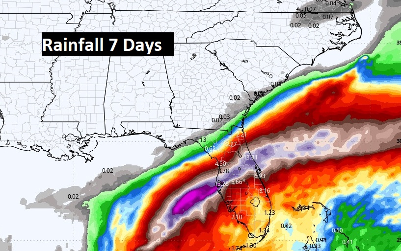
Here’s the expected rainfall through the next 7 days. Not a drop of rain for us. But, check out the corridor of flooding rainfall across Florida from Milton. Some shocking totals are possibel
TROPICAL UPDATE: Milton is the only player in the tropics we care about in the tropics. Although, there is that little Area to watch off the SE Florida coast, which is a precursor low in front of Milton.
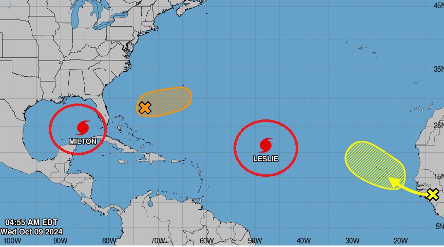
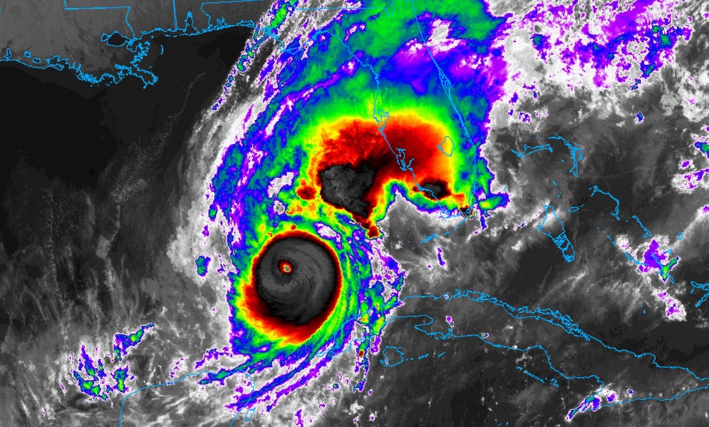
As of 5:00 AM EDT, this morning, Milton’s winds are now at 160 mph Cat 5, Pressure: an astounding 907 mbs. Moving: NE at 14, 300 miles SW of Tampa.
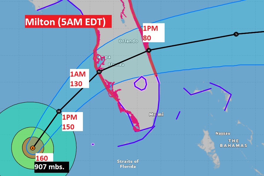
The cone has shifted a little southward. That will spare the heavily populated Tampa Bay area the maximum storm surge. The threat to the SW Florida coast has now increased a notch.
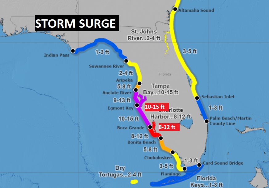
Milton will have a devastating impact along the Florida west coast tonight, perhaps arriving as a strong Cat 3 or even a Car 4 storm, Effects will begin late today as tropical storm fore winds begin. The storms surge near the point of landfall could reach an unthinkable 10 to 15 feet somewhere along the SW or central west coast of Florida,
If this storm surge map verifies these will be the highest numbers ever recorded for the western Gulf coast of Florida. NWS is calling this “unsuitable”. They warm Milton will be the worst hurricane in history for the west coast of Florida.
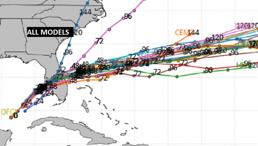
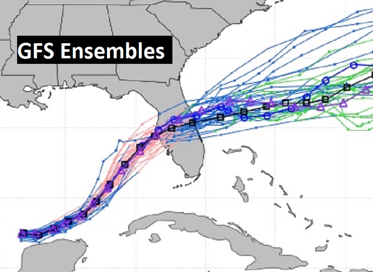
The Spaghetti Models are locked in on Milton’s track. Notice there has been a decided southward nudge since yesterday.
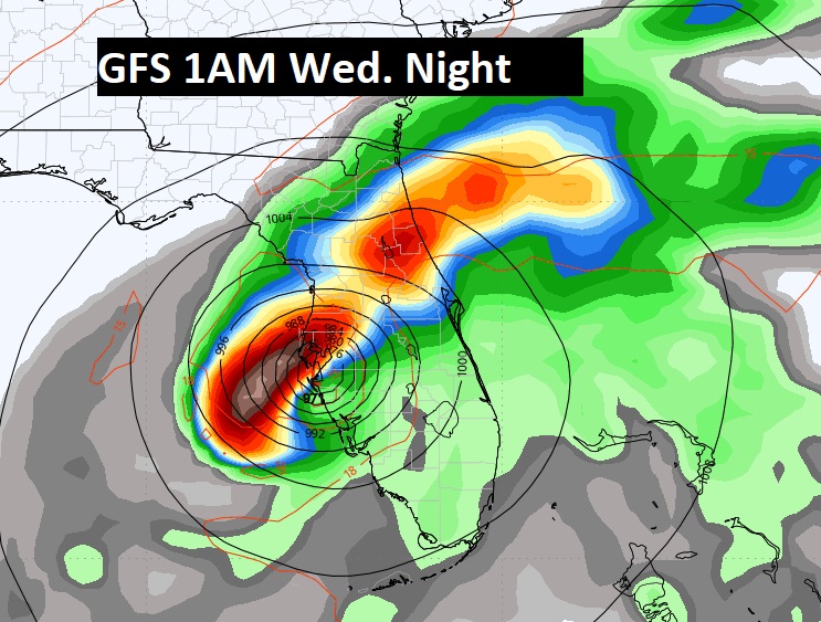
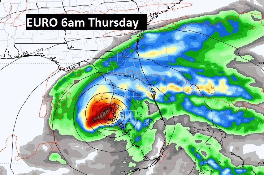
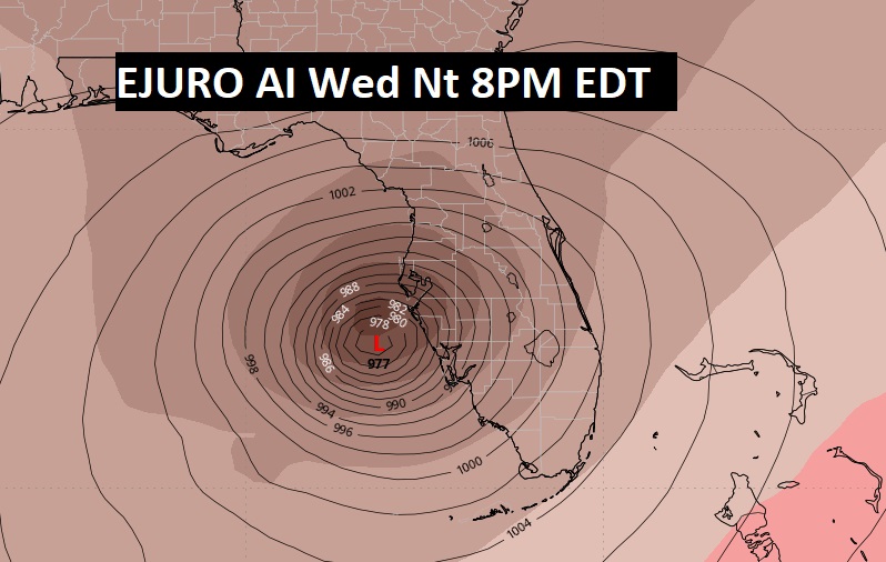
Here’s a couple snapshots of the GFS, the Euro and the EURO AI to give you an idea on timing differences.
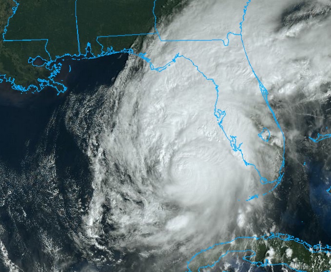
Early morning satellite view of classic, historic extremely dangerous Milton.
Thanks for reading the blog. There will be another complete Blog update and video forecast discussion tomorrow morning.
I’ll be also doing another Milton update on Sirius/XM Satellite radio a little after 6AM CDT on Chanel 73.
This morning, everything is normal including LIVE on the Radio from 6 to 9AM on NewsTalk 93.1 WACV. Have a nice day!
–Rich
