
Good morning! It’s quite chilly across Alabama for this early in the season. North Alabama has frost Advisory. But, even some south Alabama towns will fall into the 30’s by Dawn. We’re not done with the early season chill yet, but changes are on the way. The Canadian chill will fade by the weekend. We’ll be back to the upper 70’s by Saturday & near 80 by Sunday. Next week will be much warmer. This storm-free dry pattern will continue for several more days. Here’s my brief forecast discussion.
TODAY: Sunshine. Not quite as breezy. Still cool for October. High in the upper 60’s. NW wind 5 to 11 mph. Clear very chilly tonight. Cold again.. Low near 40. (Normal hi/Lo 80/55)
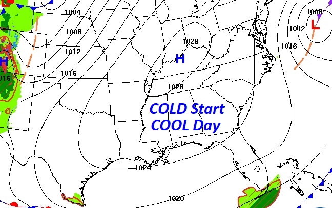
Massive Canadian High pressure dominates much of the eastern half of the nation.
The Full Hunter’s moon is spectacular early this morning.
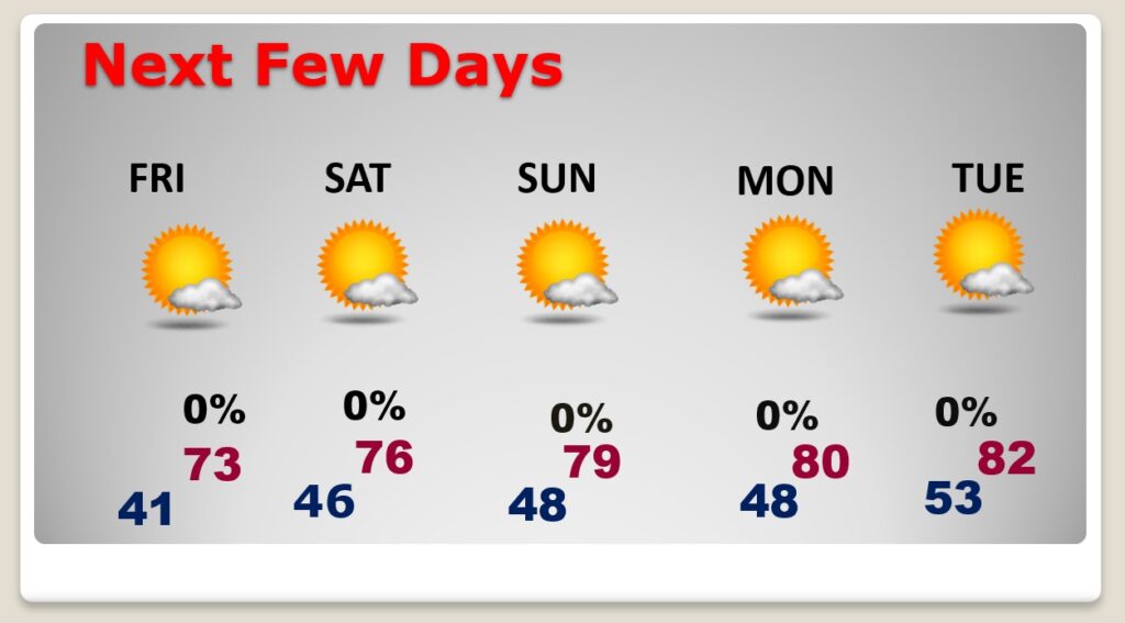
NEXT FEW DAYS: It’s a dry forecast for several more days. The Canadian chill will fade by the weekend. We’ll be back to the upper 70’s by Saturday & near 80 by Sunday. Next week will be much warmer. Shorts and tee-shirt weather will return.
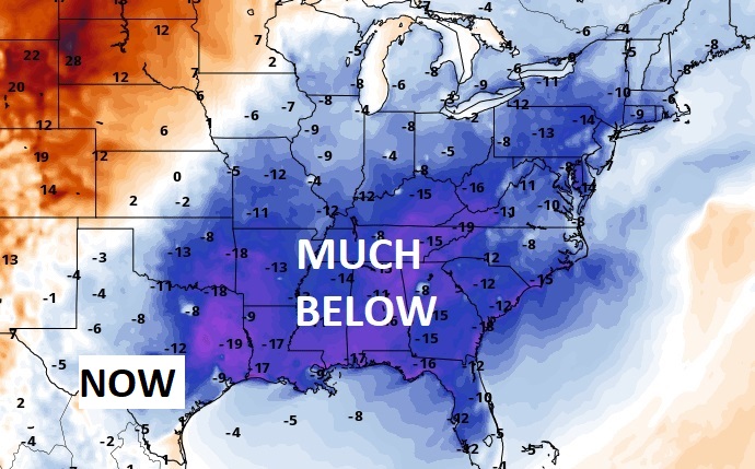
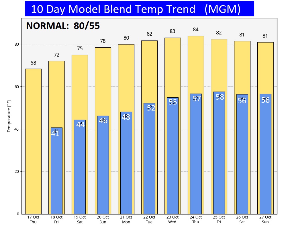
It’s COLD this morning, but a big turn around is on the way this weekend and beyond.
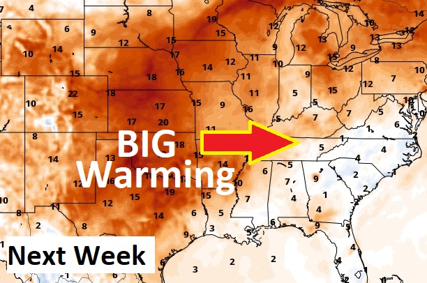
The 10 Day Model Blend Temperature Trend. Check out the major warming trend in our future, especially from the weekend through next week.
.
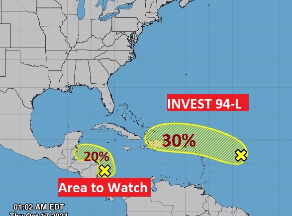
TROPICAL UPDATE: Invest 94-L has a lower 30% chance of future development as it heads toward the islands. Also, there’s a small Area to Watch in the west Caribbean.
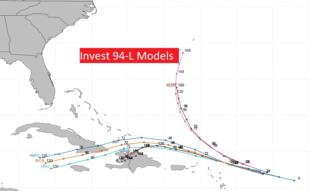
The models clearly indicate a potential threat to the islands, including the greater Antilles. Some models show this system falling apart,
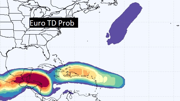
Here’s the EURO probability of tropical development.
Thanks for reading the blog. There will be another complete Blog update and video forecast discussion tomorrow morning. This morning, everything is normal including LIVE on the Radio from 6 to 9AM on NewsTalk 93.1 – WACV. Have a nice day!
–Rich