Good morning! Much of America is much warmer than normal. Our warm-up continues. Yesterday’s high was 84 degrees at MGM. By Thursday we’ll be in the upper 80’s. Even the nights are getting warmer. Meanwhile, our storm-free, dry pattern will continue for several more days. A weak cool front will move through the state by Sunday, but it looks like a dry front. Monday will be slightly cooler, But, the warmth will rebound next week. Rainfall prospects remain dim for several days. Here’s my brief forecast discussion.
TODAY: Sunny & warm. Comfortable humidity. High 86. NW wind 5 to 10 mph. Clear tonight. Milder. Low 55.
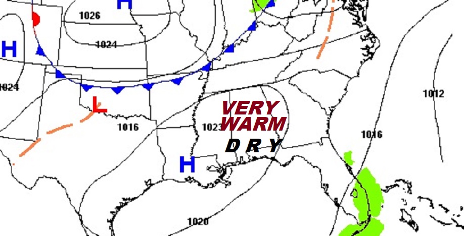
Yesterday’s low was 45 and the high was 84. (Normal hi/Lo 78/52) Rainfall for the month of October: .02”. Deficit for the month: -2.04.
.
NEXT FEW DAYS: It’s a dry forecast for several more days. The Warm-up continues. . By Thursday we’ll be in the upper 80’s. Even the nights are getting warmer. Meanwhile, our storm-free, dry pattern will continue for several more days. A weak cool front will move through the state by Sunday, but it looks like a dry front. Monday will be slightly cooler, But, the warmth will rebound next week. Rainfall prospects remain dim for several days.
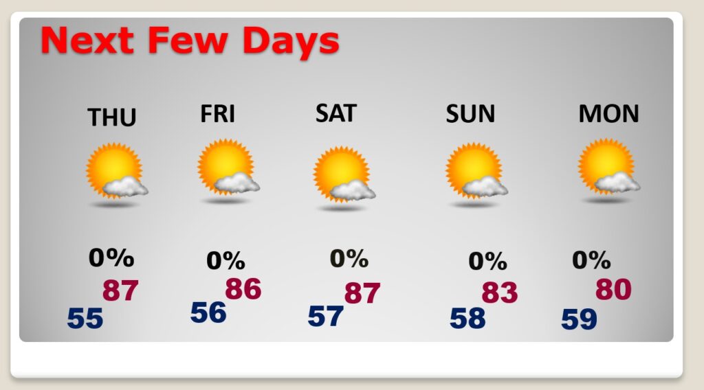
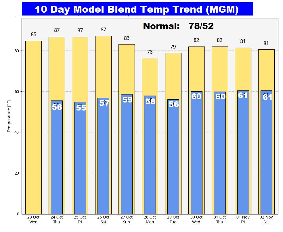
The 10 Day Model Blend Temperature Trend. It’s a very comfortable forecast. A weak cool front will move through the state by Sunday, but it looks like a dry front. Monday will be slightly cooler, But, the warmth will rebound next week
.
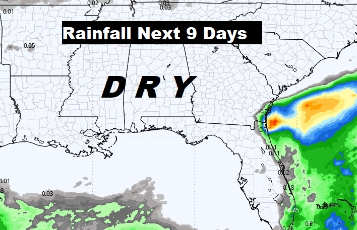
Expected rainfall in the next 7 to 10 days. Not good.
.
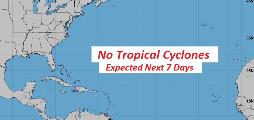
TROPICAL UPDATE: For the first time in several days, NHC is not tracking any potential tropical systems in the next 7 days.
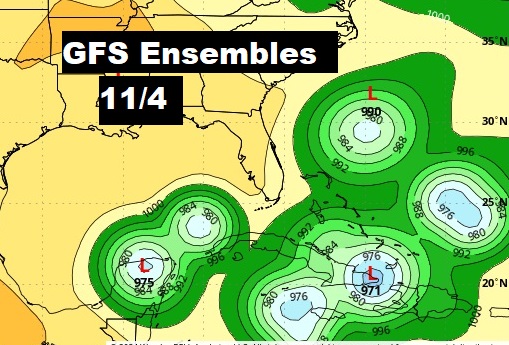
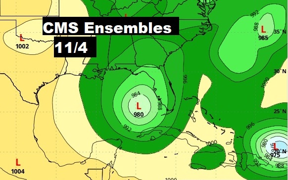
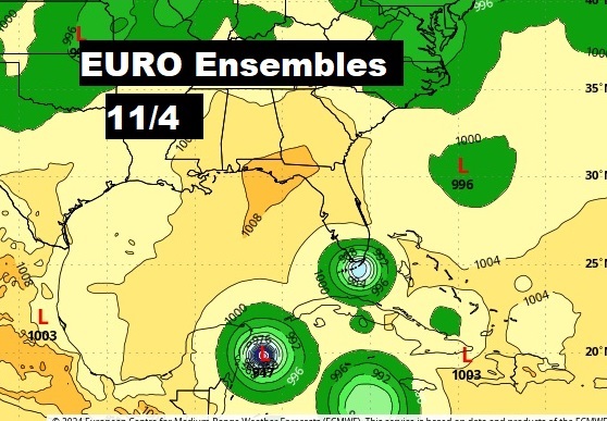
Just food for thought. Three major global models continue to hint at tropical mischief early in the first week of November, not far from the SE US coastline.
Thanks for reading the blog. There will be another complete Blog update and video forecast discussion tomorrow morning. This morning, everything is normal including LIVE on the Radio from 6 to 9AM on NewsTalk 93.1 – WACV. Have a nice day!
–Rich
