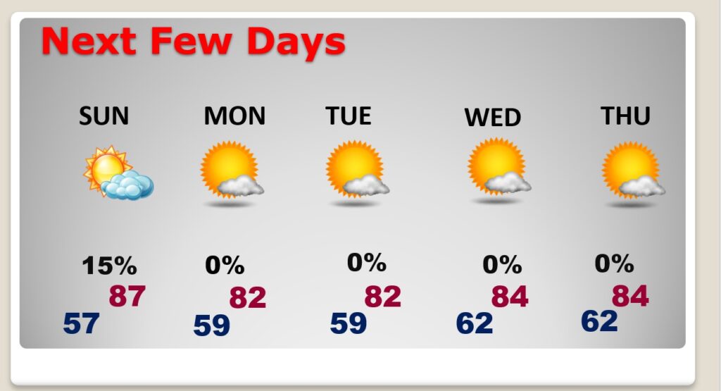
Good morning! The amazing late October warmth continues. Yesterday’s high was 90 degrees at MGM. That’s a new record, after we tied a record Thursday. Today we’ll flirt Record Territory. (The record is 90. I have us at 88) Even the nights are very mild for late October. A weak cool front will move through the state today into Sunday. Could there be a shower somewhere in the area along the front? I’ve added a 15% chance of a shower Sunday and Sunday evening. The October rainfall at MGM is currently .02”, one of the driest on record. Monday, behind the front, will be slightly cooler. We’ll be in the low 80’s Monday & Tuesday.
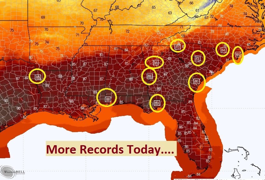
TODAY: Sunny and HOT for October. High 88. RECORD is 90 from 2010. West wind 4 to 8 mph. Partly cloudy tonight. Low 57.
Yesterday’s low was 55 and the high was Record High 90. Previous: 88 in 2016 and 1931, (Normal hi/Lo 77/50) Rainfall for the month of October: .02”. Deficit for the month: -2.32.
Southward moving front enters the state today and heads south. SHOULD be a dry front. Could there be a shower somewhere along the front Sunday or Sunday evening? I’ll add a 15% chance.
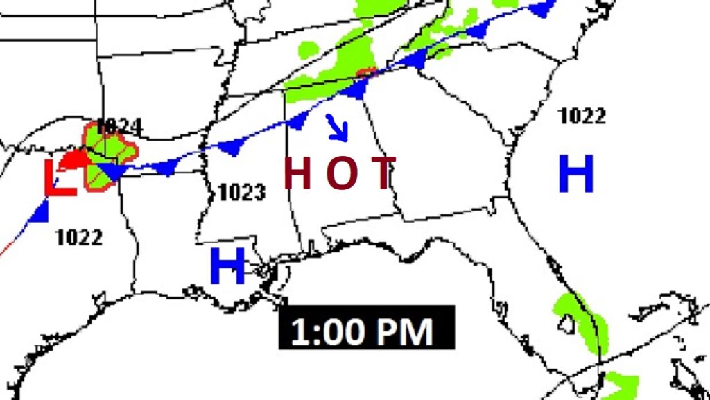
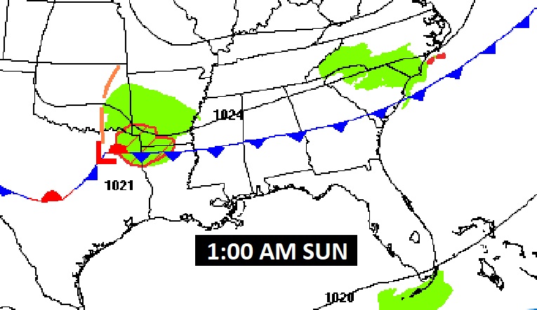
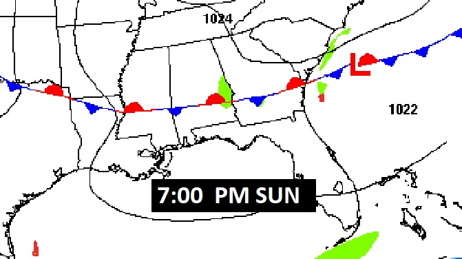
. Several Record Highs could be set across the South again today.
NEXT FEW DAYS: A weak cool front will move through the state today into Sunday. Could there be a shower somewhere in the area along the front? I’ve added a 15% chance of a shower Sunday and Sunday evening. We’ll be in the low 80’s Monday & Tuesday. Most of Halloween week will be dry and warm.
One of the driest Octobers on record:
Driest months in Montgomery (1872-present):
October 1904 — 0.00″
October 1891 — 0.01″
October 1978 — 0.01″
October 1963 — 0.02″
October 2024* — 0.02″
October 1886 — 0.03″
September 2019 — 0.05″
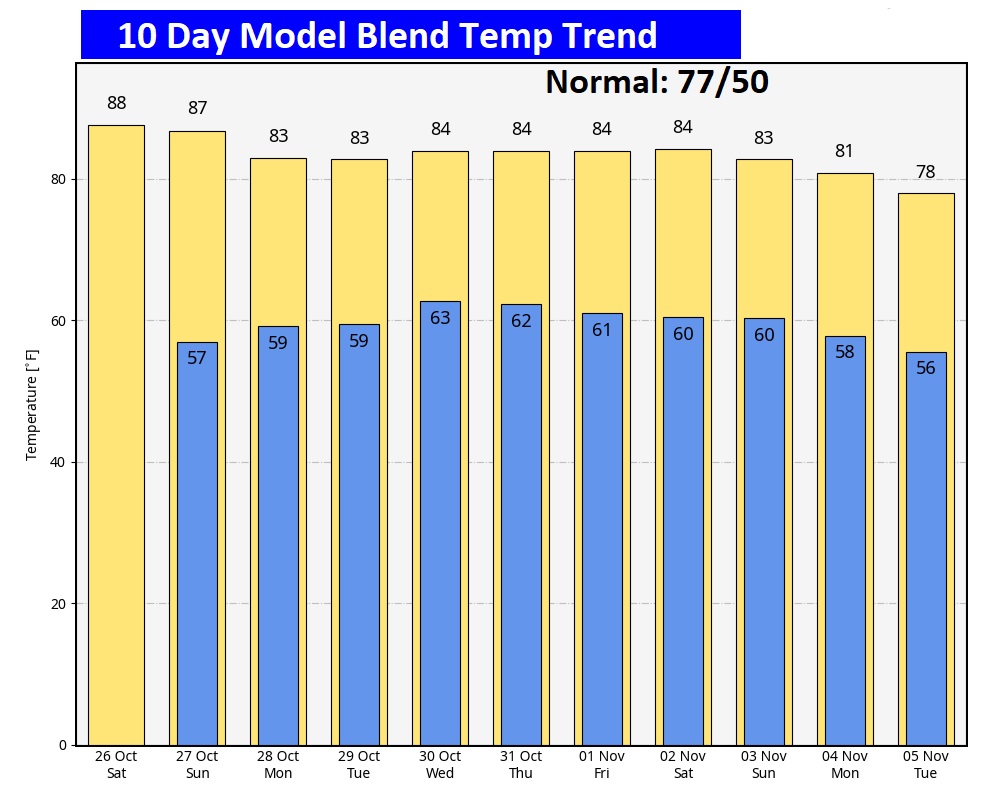
The 10 Day Model Blend Temperature Trend. I don’t see any chilly air through Tuesday, November 5th. (Election Day)
.
.
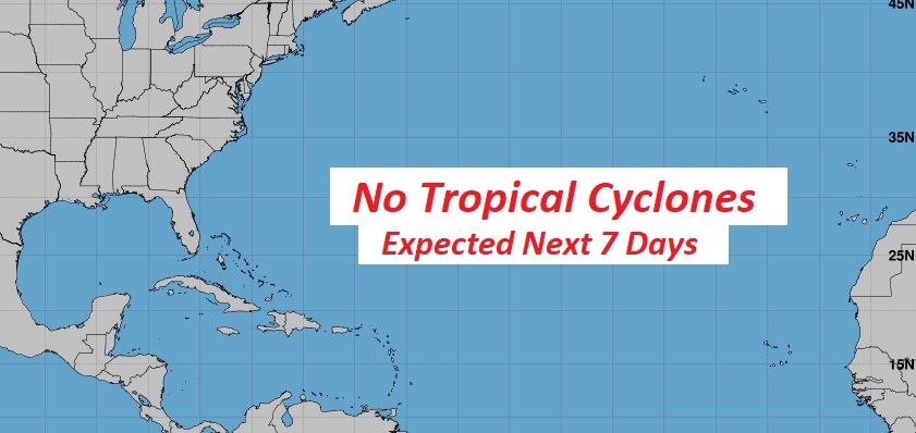
TROPICAL UPDATE: The tropics are quiet for now, NHC is not tracking any potential tropical systems in the next 7 days.
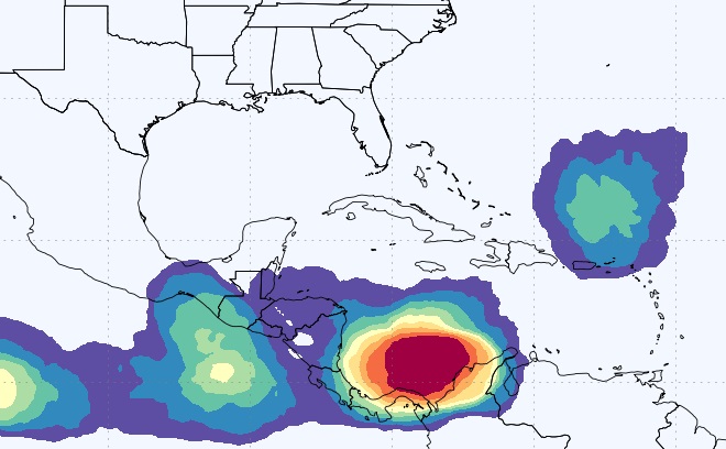
Major global models continue to hint at tropical mischief early in the first week of November in the SW Caribbean. Here’s the EURO T.D, Probability out 10 days.
Thanks for reading the blog. The next scheduled blog will be Monday morning, Have a nice weekend!
–Rich
