Good morning! Our extended string of warm, dry days continues. The days and nights will remain well above normal through the weekend. Highs will be in the 80’s. Lows at night in the lower 60’s through Sunday. The high on Halloween will be near 86. And, there’s still no rain drops in our future until perhaps Tuesday Night. Rain chances will start to improve late next week. Here’s my brief forecast discussion video.
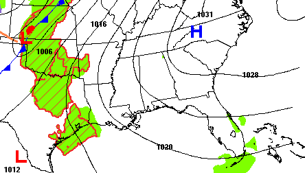
TODAY: Cloudy this morning. Gradually, sunshine later. High 84. SW wind 10 to 15 mph. Mostly cloudy tonight . Low 64. Rain chance today is best along the extreme eastern counties, where there is a small 20% chance. 10% chance for the rest of us.
.
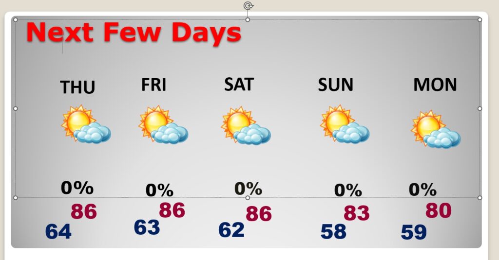
NEXT FEW DAYS: The warm and dry pattern continues for several more days. Highs in the low to mid 80’s days, and lower 60’s at night. Still dry through Saturday.
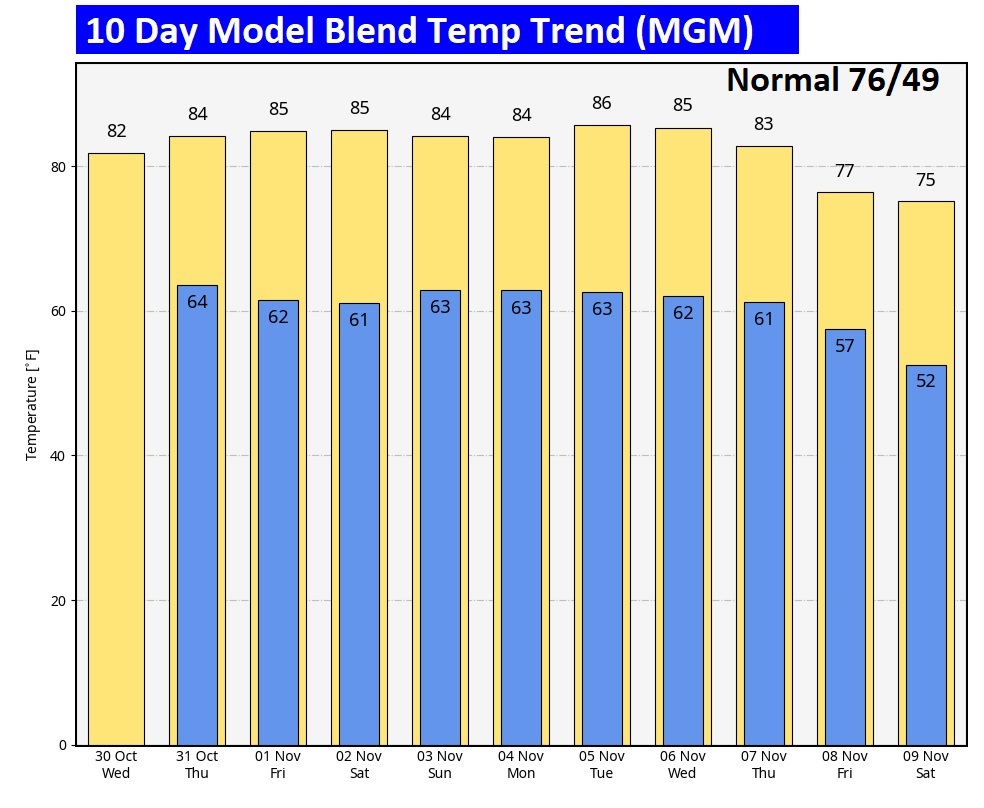
The 10 Day Model Blend Temperature Trend. There’s no chilly air expected. It’s an above normal forecast until somewhat cooler air filters in late next week.
.
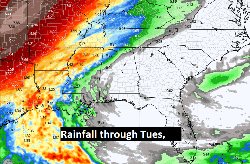
The Rainfall potential through Tuesday is not good for most of us, except for the northwest counties of Alabama. The rain prospects are getting closer, but upper level High Pressure continues strong, and is keeping the rain at bay.
.
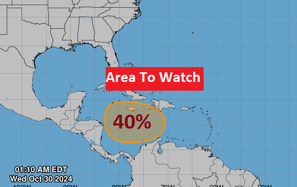
TROPICAL UPDATE: NHC is tracking and Area to Watch in the SW Caribbean. Although the potential for development this week, because of a hostile environment, the global models are in better agreement that an organized low pressure may start to develop late this week or this weekend and move northward in the west Caribbean.
FALL BACK THIS WEEKEND: This is the weekend we switch from CDT to CST.

Thanks for reading the blog. There will be another complete Blog update and video forecast discussion tomorrow morning. This morning, everything is normal including LIVE on the Radio from 6 to 9AM on NewsTalk 93.1 – WACV. Have a nice day!
–Rich
