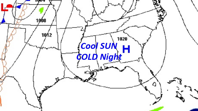
Good morning! Much cooler air is funneling into Alabama. Highs today may not reach 70. (Normal 70/43) Tonight will be quite chilly, but actually near normal. We’re in for a very nice November weekend with cool days and chilly nights. Monday will be warmer with upper 70’s. Next week is shaping up to be quite interesting. An approaching front and deep upper through will bring in our next significant rain chance, starting Late Monday night, Tuesday, Tuesday night into early Wednesday. We’re hoping for some decent rainfall totals. But, this does not look like a “Drought buster”. Right now this does not look like a severe weather event, for us. Sharply cooler air will follow the front for the later part of next week. Even Some nights in the 30’s. Coldest air of the season so far.
TODAY: Patchy morning fog. Otherwise, Abundant cool sunshine. High 72. (Normal 70/43) Southwest wind 6 to 12 mph. Clear and cold tonight. Low in the mid 40’s.
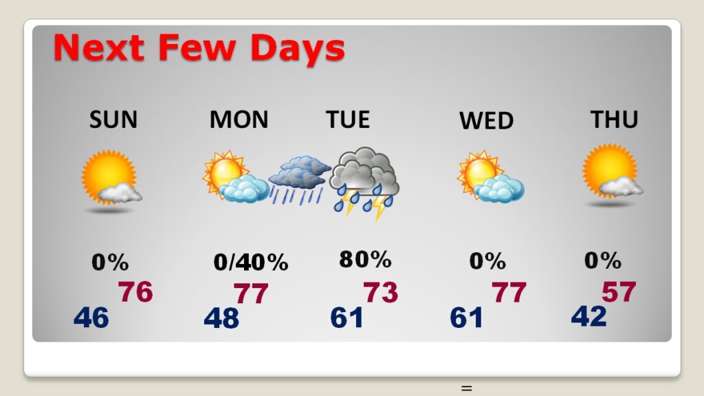
NEXT FEW DAYS: We are enjoying a great November weekend with near normal Temperatures. Sunday will be nearly perfect with middle 70’s in the afternoon after a cold start Monday will be warmer with upper 70’s. An approaching front and deep upper through will bring in our next significant rain chance, starting late Monday night, Tuesday, Tuesday night into early Wednesday. We’re hoping for some decent rainfall totals. But, this does not look like a “Drought buster”. Right now this does not look like a severe weather event, for us. Sharply cooler air will follow the front for the later part of next week. Even Some nights in the 30’s. Coldest air of the season so far.
A ”Big Deal” Cold Front front and deep upper through will bring in our next significant rain chance, starting Tuesday, and especially Tuesday night into early Wednesday.
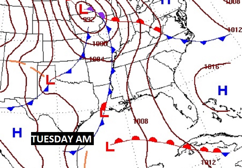
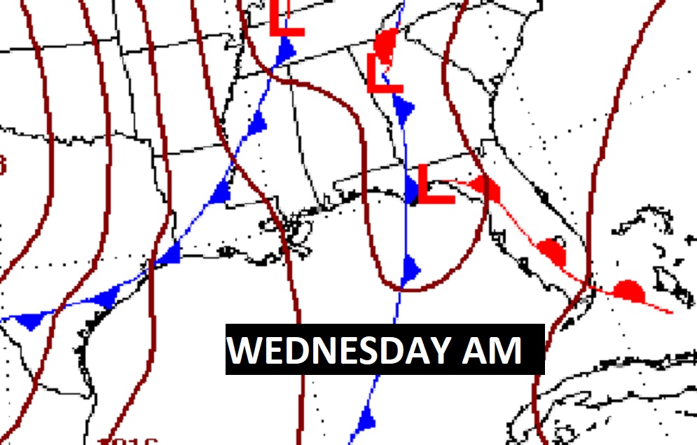
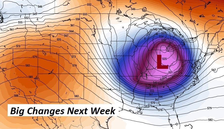
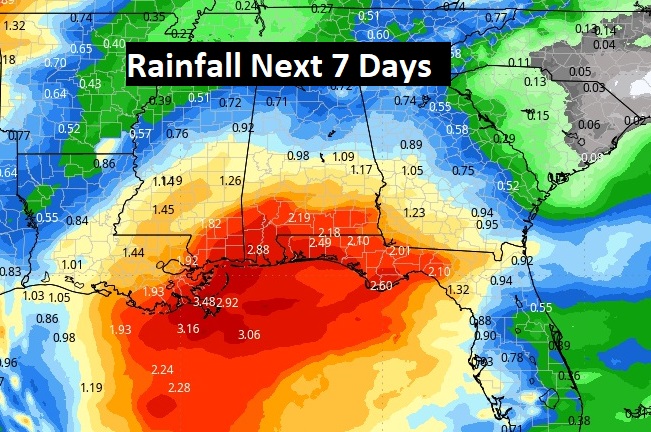
Fingers crossed. Thus next system will probably not be a “Drought Buster” but, I think some of us could see 1-2” of rain. That’ll help.
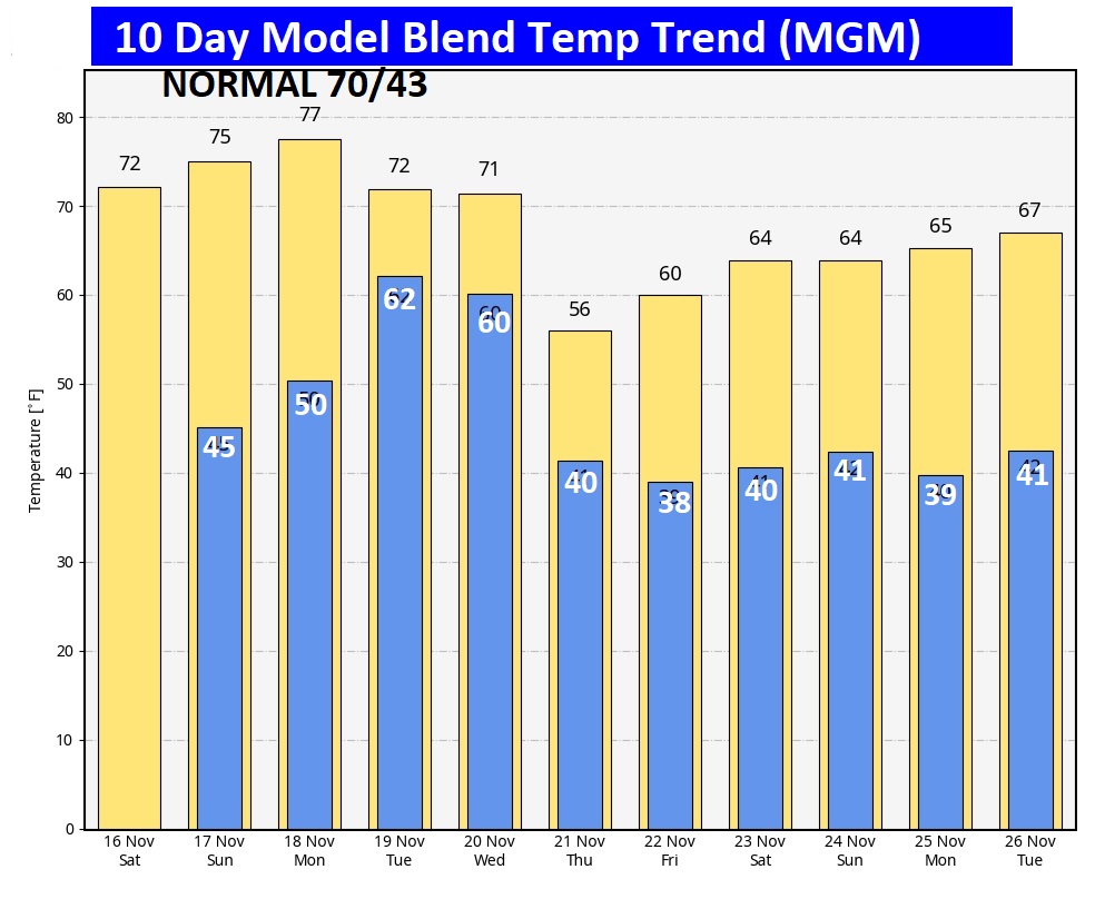
The 10 Day Model Blend Temperature Trend. Looks like the coolest air of the season so far will be in place by Wednesday night/ Thursday and beyond.
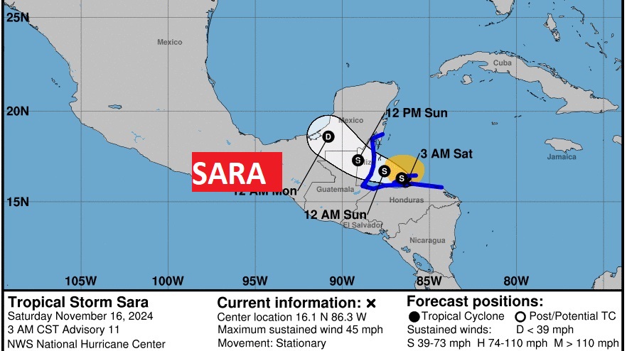
TROPICAL UPDATE: Tropical Storm Sara, with 45 mph wind, is expected to die over land this weekend as it moves inland over central America causing catastrophic rainfall.
Thanks for reading the blog. The next scheduled blog will be Monday morning, Have a nice weekend!
–Rich
