
Good morning! We are undergoing quite a change of climate. Today will be sunny, windy and rather brisk. A secondary reinforcing cold front will deliver even cooler air. Winds today will gust as high as 30 mph. We may not make it out of the 50’s on today and Friday. Many towns could see the first frost of the season by Saturday and Sunday morning. Highs over the weekend will be in the 60’s. We’ll be back to the 70’s by Monday and Tuesday. Here’s my brief video forecast discussion.
TODAY: Rather Brisk today. Cool Sunshine. Windy. High 59. West to NW wind15 to 20 gusting to 30 mph. Clear and cold tonight. Low 38.
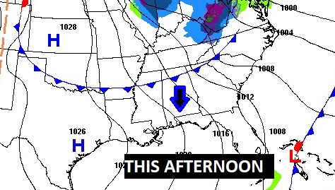
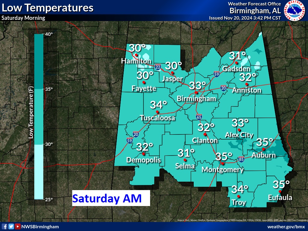
A reinforcing dry Cold Front sweeps through the state today. . Coldest nights will be Friday and Saturday Nights.
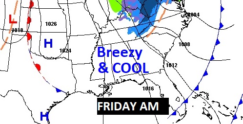
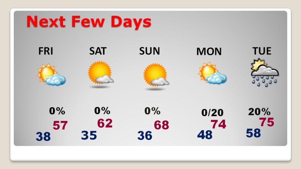
NEXT FEW DAYS: Cooler air is approaching. Friday will be breezy with highs in the 50’s. Highs over the weekend will be in the 60’s. Looks like the 70’s will be back to the 70’s Monday & Tuesday. We should be dry through Monday. The risk of showers will return Monday night and Tuesday.
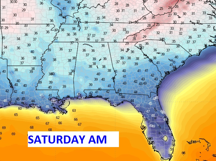
The Coldest morning will be Saturday with frost. Look at Florida. Could be 40’s even into central and south Florida.
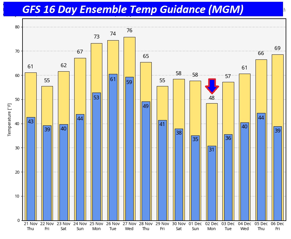
The 10 Day Model Blend Temperature Trend. After our Canadian Cool-down, we’ll be back in the 70’s Monday and Tuesday.
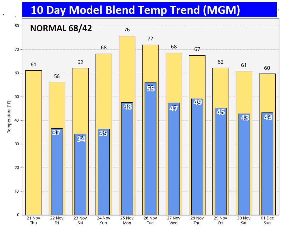
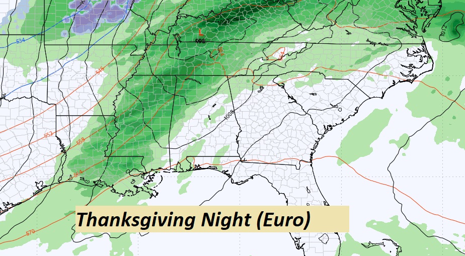
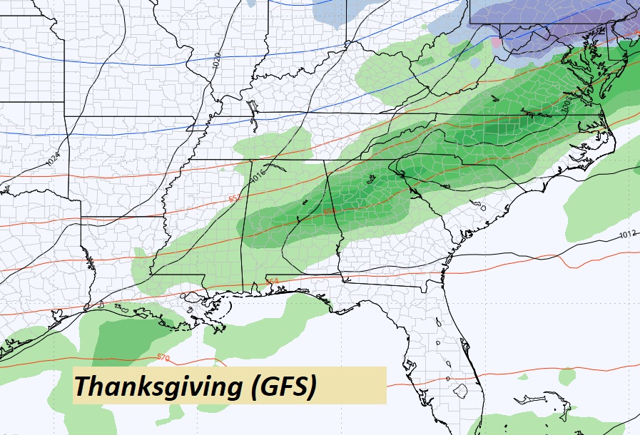
THANKSGIVING OUTLOOK: Will there be showers and thunderstorms on Thanksgiving? The GFS model says yes. The EURO holds off the rain till Thursday night. We’ll see. Model blend temperatures indicate a morning low of 49, and a Daytime high of 62.
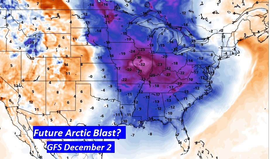
FUTURE ARCTIC BLAST?: This is WAY out there, but the GFS is advertising perhaps the first Arctic Invasion somewhere around December 2nd. Stay tuned.
Thanks for reading the blog. There will be another complete Blog update and video forecast discussion tomorrow morning. This morning, everything is normal including LIVE on the Radio from 6 to 9AM on NewsTalk 93.1 – WACV. Have a nice day!
–Rich