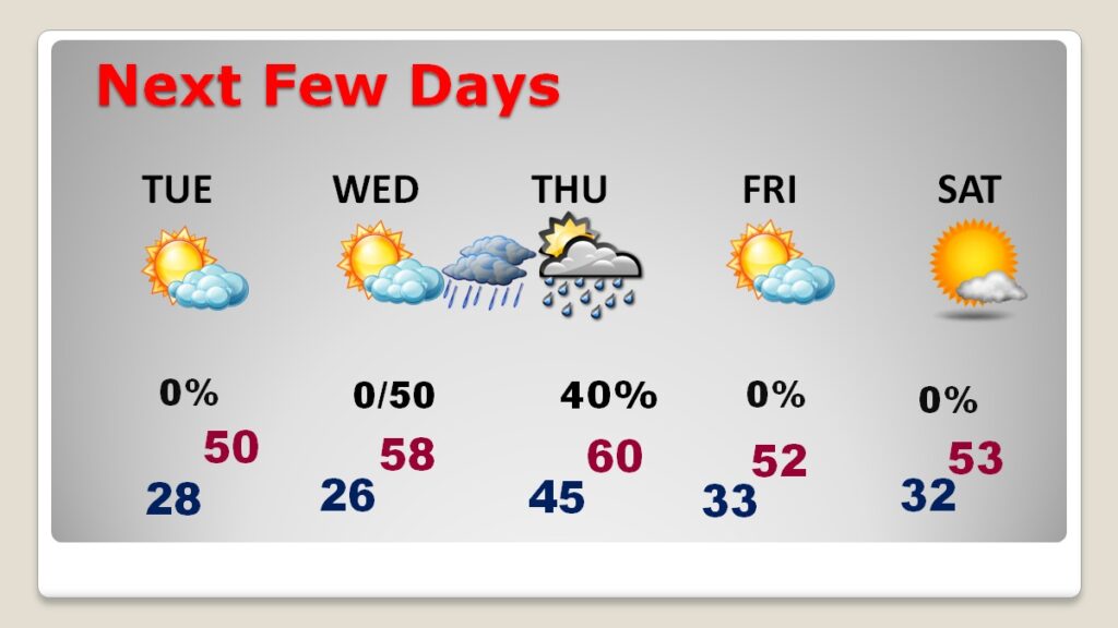
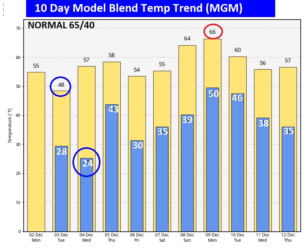
Good morning! We are still well below normal. And, really, before we start to recover, there’s yet another re-enforcing Cold Front on the way. This morning is the 4th sub-freezing morning. But, ahead, the coldest day in the series will be Tuesday. And, the coldest night will be Tuesday night. The model blend only has us at 48 for high on Tuesday and 24 Tuesday night. (Normal 65/40) Wednesday’s expected high of 60 sounds pretty nice, after this Arctic blast. Scattered showers return to the forecast Wednesday night and Thursday. Here’s my brief video forecast discussion.
TODAY: Cool sunshine. Light wind. West 6 to 12 mph. High 56. Clear and cold tonight. Low 28
NEXT FEW DAYS: The coldest day of this current Arctic adventure will be Tuesday and coldest night Tuesday night. The model blend only has us at 48 for high on Tuesday and 24 Tuesday night. Wednesday’s high is BETTER at 60, but that’s still below normal. We turn colder, again on Friday.

.
.
The 10 Day Model Blend Temperature Trend. After we reach rock bottom on Tuesday and Tuesday night, a mid week warm up on Wednesday will feel better. Look for another chill to arrive behind another front on Friday.

.
Thanks for reading the blog. There will be another complete Blog update and video forecast discussion tomorrow morning. This morning, everything is normal including LIVE on the Radio from 6 to 9AM on NewsTalk 93.1 – WACV. Have a nice day!
–Rich
