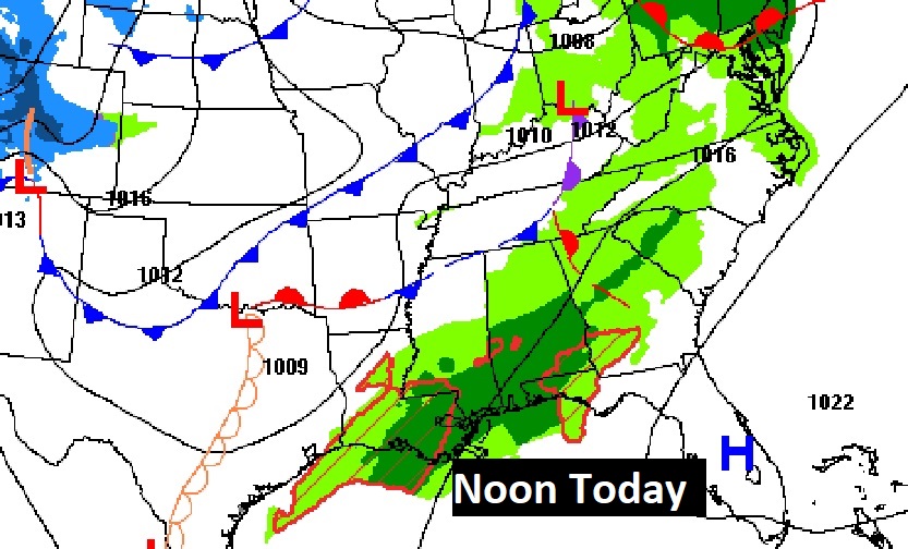
Good morning! There’s already rain on the radar this morning. We will be dealing with a “big deal” two-part storm system today, tomorrow and especially Tuesday night. Rain and thunderstorms are in the forecast, Some of the heaviest rainfall amounts will occur Tuesday and Tuesday night. Rainfall amounts could be excessive. Some storms could be strong possibly severe Tuesday and Tuesday night. There is a Marginal Severe risk. Behind the storms system, expect another sharp temperature plunge starting Wednesday. Here’s my brief forecast video discussion.
TODAY: Flash Flood Watch. Periods of showers and I can’t rule out a thunderstorm or two today and tonight. Mild today, High near 70. Periods of rain and possible thunderstorms tonight. Mild. Low 62


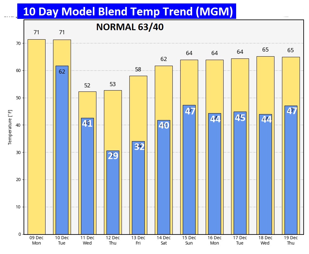
NEXT FEW DAYS: The warmest day will be Tuesday in the lower 70’s. Tuesday and Tuesday night will be wet and stormy. Especially Tuesday night, Rainfall will be locally heavy rainfall. Some storms could be severe. Expect another temperature plunge starting Wednesday. Expect sub-freezing nights Wednesday and Thursday nights. Right now it looks dry Wednesday through Saturday.

TUESDAY SEVERE RISK: Part 2 of this storm system tomorrow will be a bigger deal. SPC Has a Marginal (Level 1 out of 5) Severe Risk covering a big chunk of the state along and south of an Alex City Selma line. Damaging wind gusts are the main threat. But, a tornado or two can’t be ruled out.

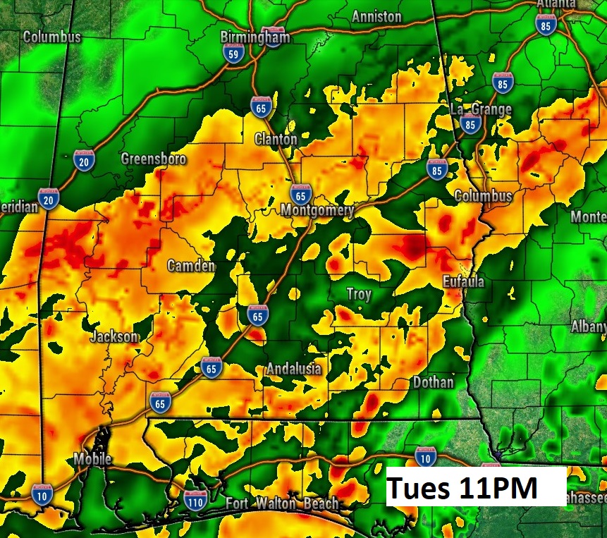
Here’s a couple of Future Radar snapshots of Tuesday and Tuesday night. Tuesday night especially will be wet and stormy,


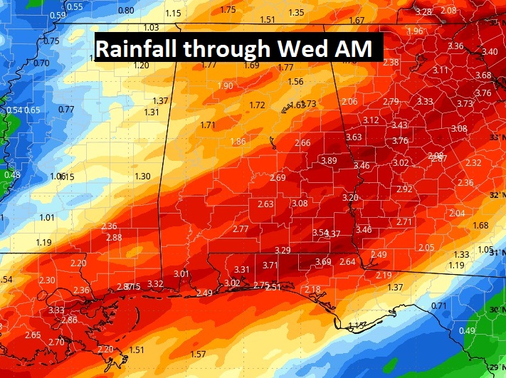
Here’s the expected rainfall with this storm system. Locally excessive. Flash Flood Watch. Rainfall amounts could reach up to 4” in some spots across eastern and southeast Alabama, especially along and SE of a line from Montgomery to Wedowee.

The 10 Day Model Blend Temperature Trend.. Expect another temperature plunge mid to late week before temperatures start to moderate.

Thanks for reading the blog. There will be another complete Blog update and video forecast discussion tomorrow morning. This morning, everything is normal including LIVE on the Radio from 6 to 9AM on NewsTalk 93.1 – WACV. Stay weather aware,
–Rich
