
Good morning! We have some very active weather ahead as s storm system approaches. The first round of storms will be tonight. There is a Marginal Severe Risk. Round 2 is a bigger deal Saturday afternoon and Saturday Night. There is an increasing Severe Risk of Severe storms & tornadoes, especially in the western half of the state There is a Level 3 Enhanced severe risk in the far west counties, closer to the Mississippi line. This also includes a fairly significant 10%+ Tornado threat in the far west counties. But, all of the area is at some risk level There’s more details contained in this Blog update. There could be some leftover showers Sunday morning before afternoon improvement. Much cooler/colder air arrives on New Years Day. Here’s my brief video forecast discussion.
TODAY: Cloudy. Risk of showers, especially after 3PM.. Breezy and mild. High 66. Gusty SE wind 10 to 15 gusting to 25 mph.
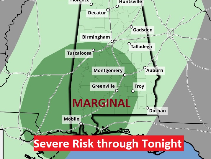
TONIGHT: Round 1 – Risk of showers and thunderstorms through about 3AM. Marginal Severe Risk, Damaging wind gusts ate the main threat. Mild. Low 59.
Here’s the set up for this evening threat. The greatest threat for strong to severe storms will be south of the northward moving warm front.

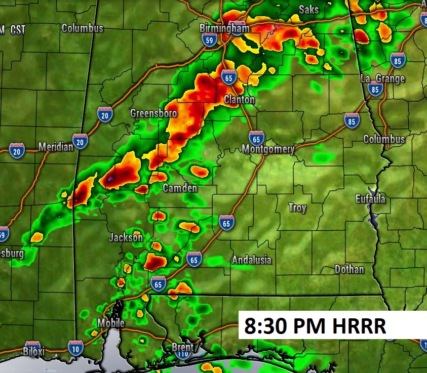
Here’s a Round 1 Future Radar Snapshot later tonight from the HRRR model,
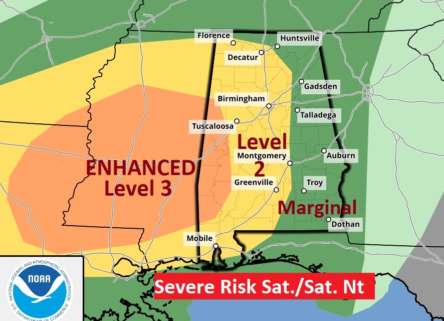
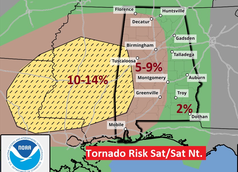
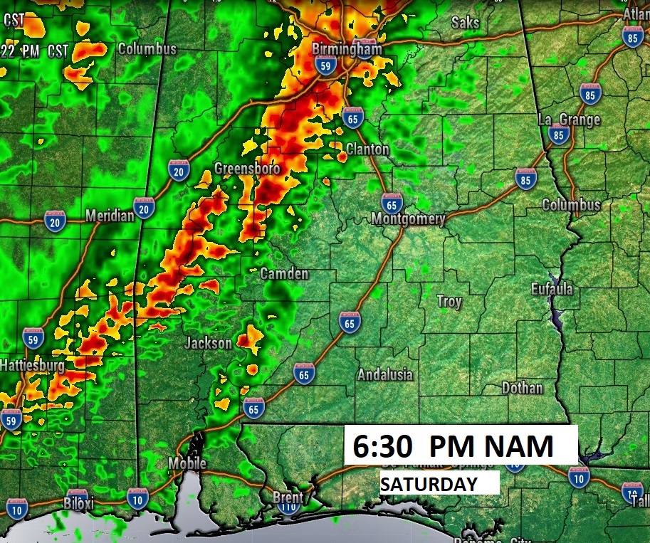
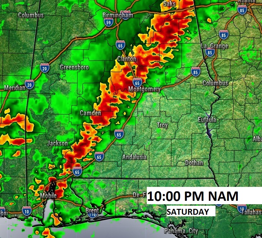
SEVERE THREAT SATURDAY & Sat. Night: All of the area has a severe threat Saturday afternoon and Saturday night. There is an increasing Severe Risk of Severe storms & tornadoes, especially in the western half of the state. In fact, there is a Level 3 Enhanced severe risk in the far west counties, closer to the Mississippi line. This also includes a fairly significant 10%+ Tornado threat in the far west counties.
Here’s a couple of high-res Future Radar Snapshots from the NAM model Saturday night.
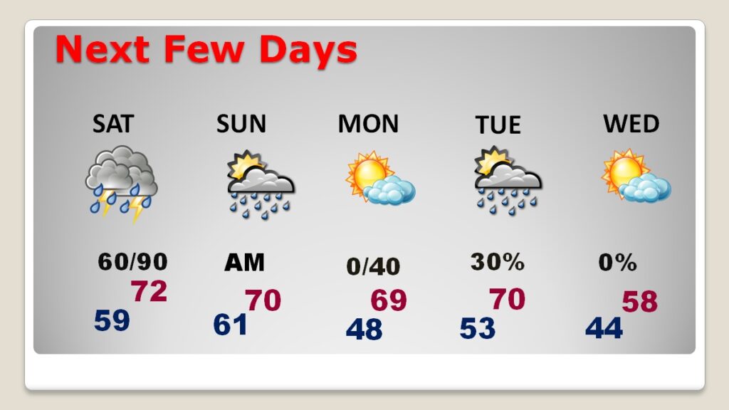
NEXT FEW DAYS: Beyond Sunday, there’s a risk of leftover showers Sunday morning before ending. Expect improvement Sunday afternoon, Mild weekend. High 72 Saturday. Near 70 on Sunday. The next round of showers comes in Monday night and Tuesday. It will begin to turn much cooler by New Years Day.
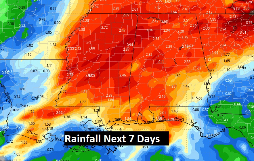
Herse’s the 7 day expected rainfall. Could be some significant rainfall amounts.
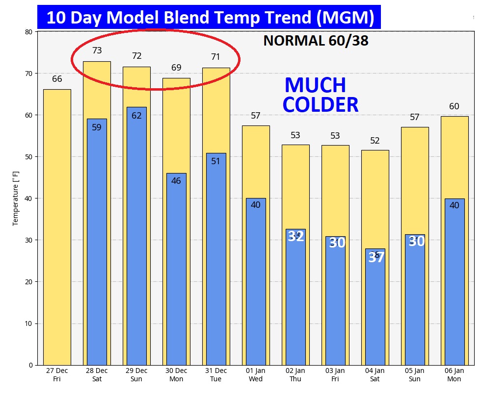
Here’s the 10 Day model temperature blend. We’ll be mild through the end of the year. Expect a big cool-down as 2025 begins.
Thanks for reading the blog. There will be another complete Blog update and video forecast discussion tomorrow morning. This morning, everything is normal including LIVE on the Radio from 6 to 9AM on NewsTalk 93.1 – WACV. Have a nice day!
–Rich