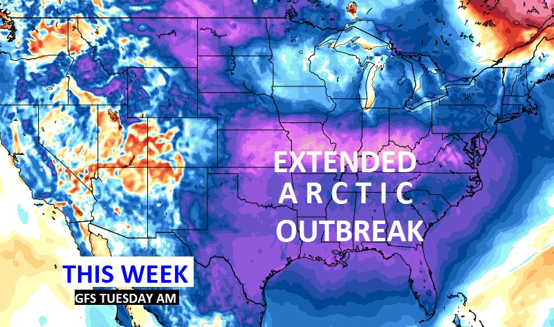
Good morning! Are you ready for Winter. The Arctic air is now funneling into the state. Here are the Main points.
Wind advisory in effect until 6PM. Winds could gust as high as 35 mph.
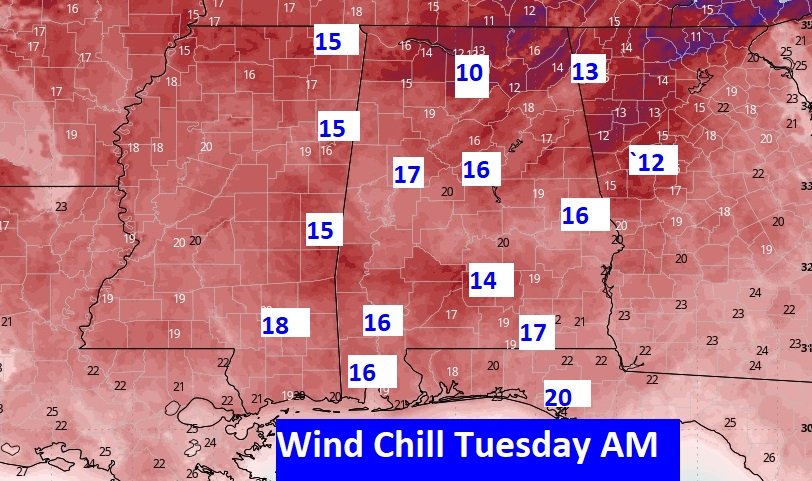
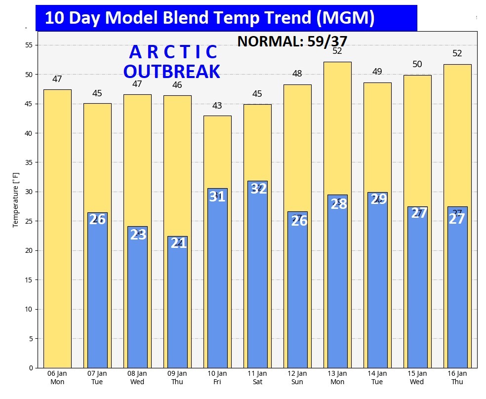
Extreme Arctic Temperature plunge is in our future. Highs only in the 40’s especially Tuesday through Saturday. Lows in the 20’s, Wind chill in the low to mid teens especially Tuesday and Wednesday morning.
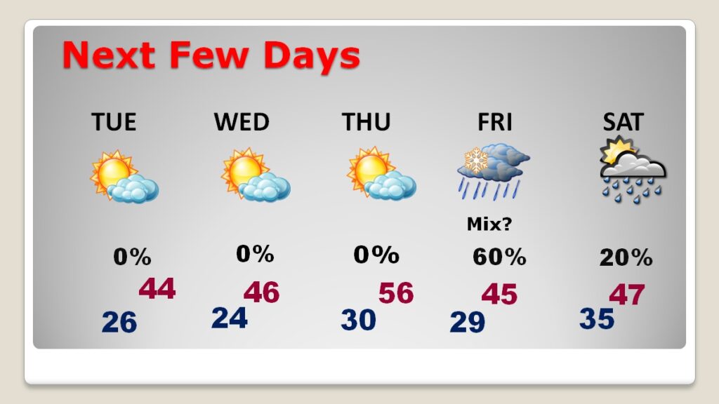
Wintry precipitation possible for parts of the state Thursday night/Friday AM and/or Friday night, especially in North Alabama. But there are still much uncertainty. Right now, we’ll call for a possible MIX of rain and freezing precipitation by Friday AM as far south as I-85.
Here’s my brief forecast discussion.
TODAY: WIND ADVISORY until 6PM. NW Wind gusts to 35 mph. Rain risk ends early. Windy & Colder with falling temperatures. As I type this at 4AM, it’s in the mid 60’s. Expect Upper 30’s by lunchtime. Then steady. Expect Mid 30’s by 5PM. Overnight Low tonight 26. Morning wind chill mid teens at least,
Major ARCTIC PLUNGE: Artic Air will dominate Alabama and a Huge chunk of America will have to endure an extended week long Arctic Outbreak. Highs only in the 40’s especially Tuesday through Saturday. Lows in the 20’s. Wind chill in the teens especially Tuesday and Wednesday morning.
Get ready to dress in layers this week. Here’s a sample of Tuesday morning projected Wind Chill. Wednesday AM will be similar.
NEXT FEW DAYS: Here’s the numbers. Still keeping a close eye on that Friday situation. Right now, it looks like primarily rain to me, but it’s early.
Take a look at the numbers on the 10 Day Model Blend Temperature Trend. The numbers speak for themselves. WINTER IS COMING.
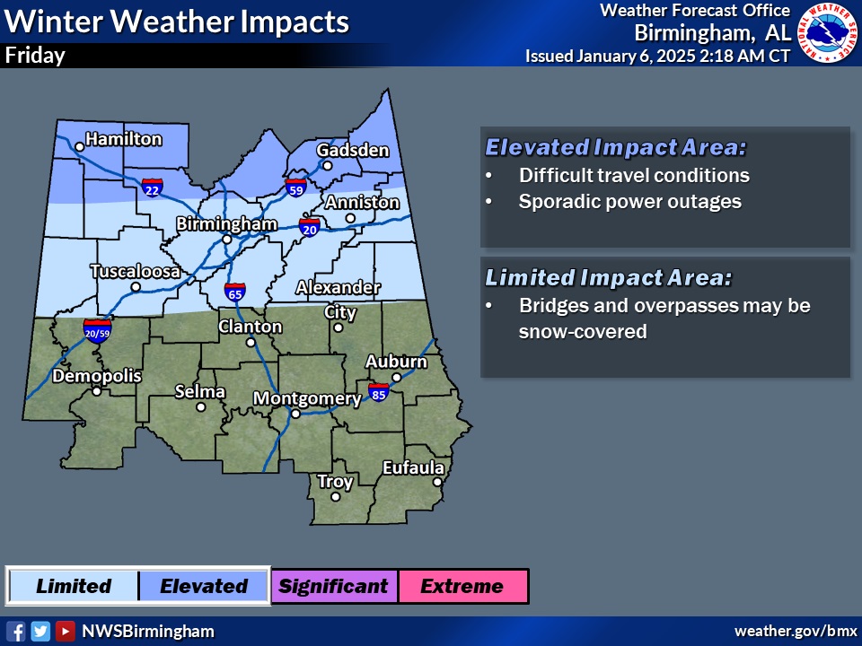
LATE WEEK WINTRY PRECIP. THREAT?: Wintry precipitation possible for parts of the state Thursday night/Friday AM and/or Friday night, especially in North Alabama. But there are still much uncertainty. Right now, we’ll call for a possible mix of rain and freezing precipitation by Friday AM as far south as I-85. NO MEASURABLE ACCUMULATION IS POSSIBLE.
Here’s where ther could be some Friday problems.
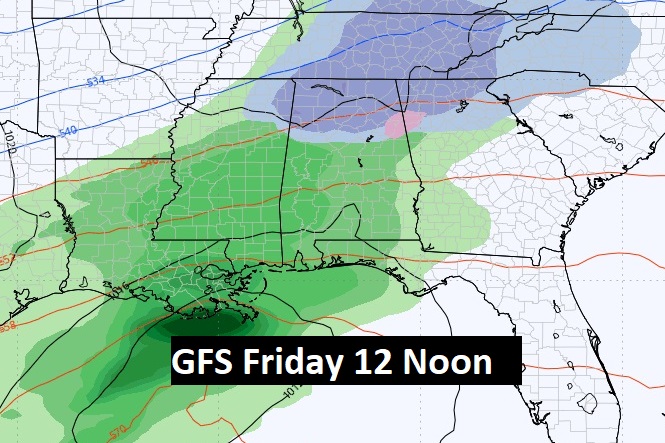
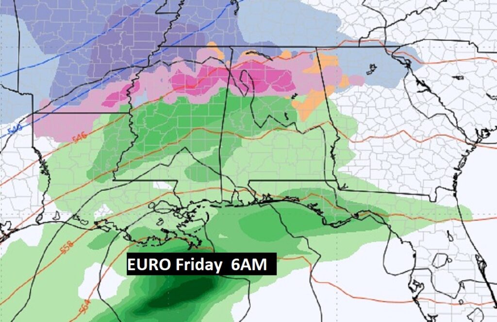
Here’s a couple of snapshots of the GFS and EURO on Friday AM.
.
Thanks for reading this special blog update. This morning everything is normal. We’ll be LIVE on NewsTalk 93.1. There will be another Blog Update and Forecast Video discussion in the 4’o’clck hour tomorrow morning. Have a good dau, despite the weather.
–Rich
