Good Morning! Cold Arctic Air still covers Alabama and a huge chuck of America. Meanwhile, a major winter storms is approaching. Low pressure will track eastward along the Gulf Coast. A wintry mix still appears likely for the northern 2/3 of the state especially Thursday night and Friday morning, then turning to a cold rain later in the day Friday. Some accumulation is not out of the question, even into central Alabama, depending on the model you consult. Details on the potential for the precipitation type and the potential of snow accumulation in our state is contained in this blog below. Details are still coming together Here’s my brief forecast discussion.
TODAY: Mosly sunny & cold. High 45. NW wind 7 to 14 mph. Clear and frigid tonight. Low 21.
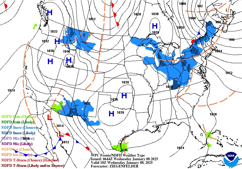
NEXT FEW DAYS: Thursday will b mostly sunny and chilly again. High 47, A major winter storms is approaching. Low pressure will track eastward along the Gulf Coast. A wintry mix still appears likely for the northern 2/3 of the state especially Thursday night and Friday morning, then turning to a cold rain later in the day Friday. Some accumulation is not out of the question, even into central Alabama, depending on the model you consult. Some of the models suggest a significant accumulation especially from Clanton no northward. The fine details will become clearer as we get closer to the event
LATE BREAKING: A Winter Storm Watch is now in effect from Chilton county northward Friday. NWS says eventually they may need to include an additional row of counties farther southward. Could be a highly impactful winter storm.
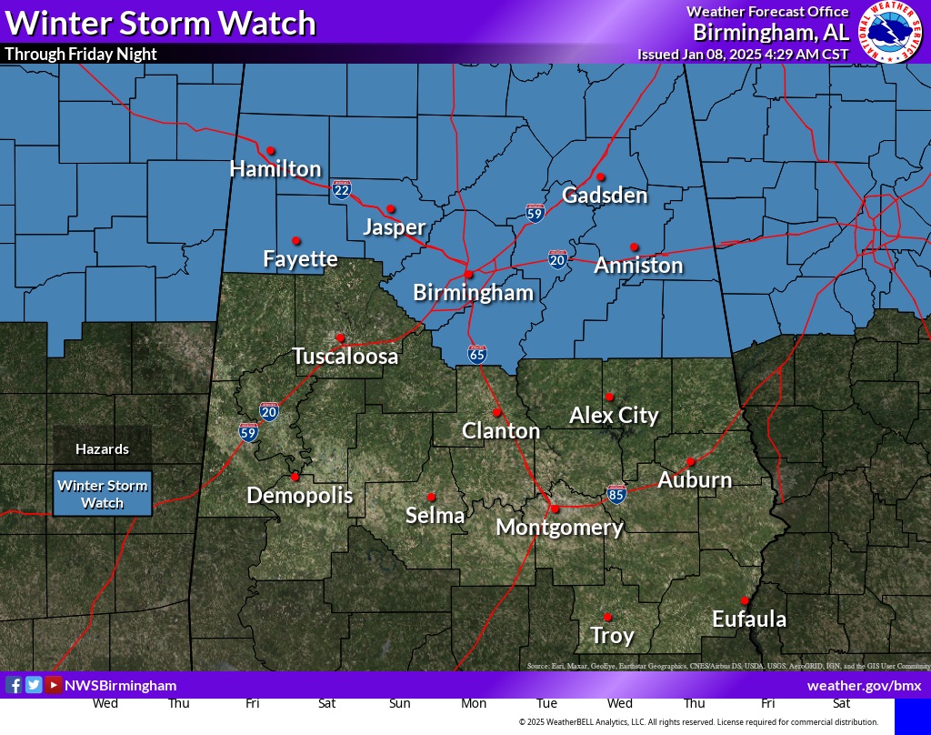
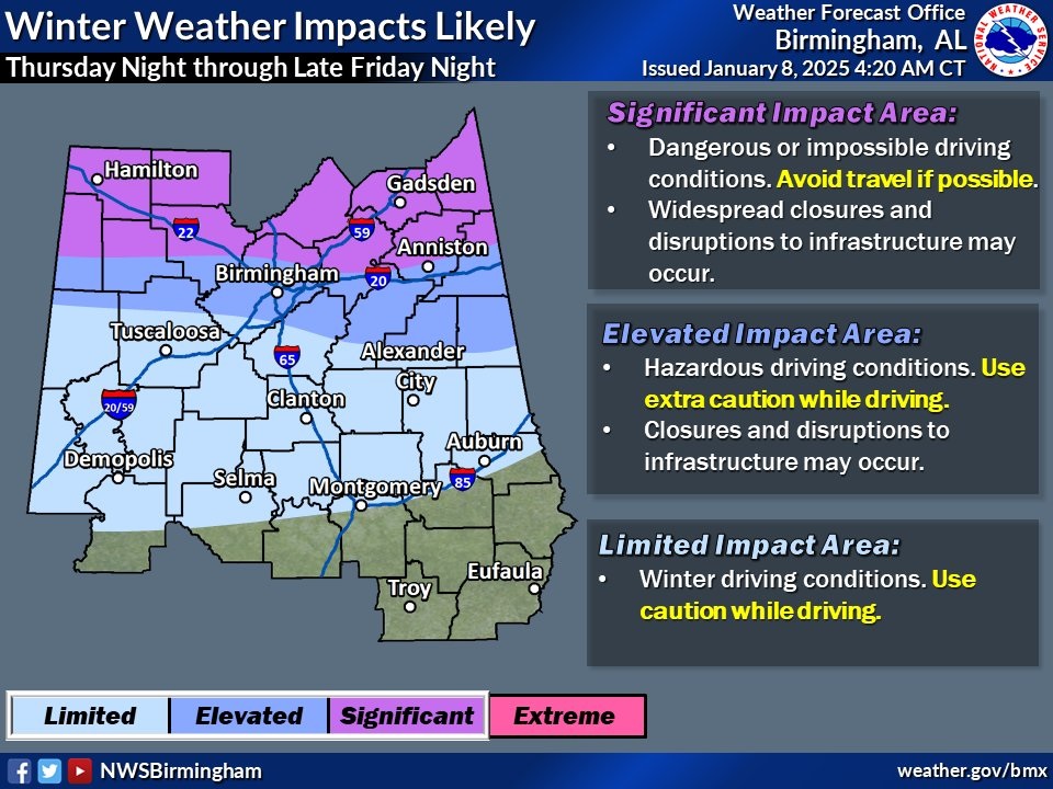
Would not be surprised if we eventually see a Winter Weather Advisory as far south as the I-85 corridor by Friday morning. We’ll see.
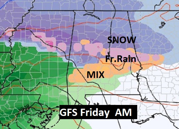
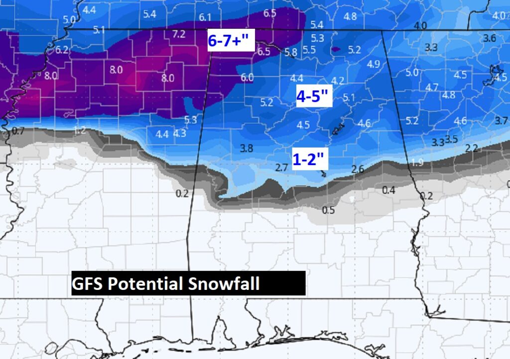
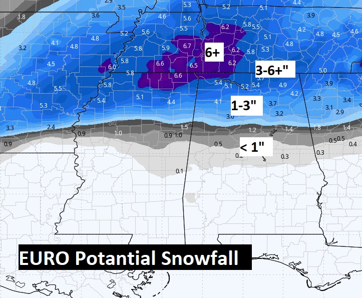
The GFS is most aggressive on the southern extent of the mixed precipitation. The EURO is conservatively father north.
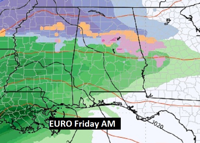
Here’s a sample of potential accumulation. The EURO is far more reasonable and believable.
WEATHER GEEKS: You may eat this up with a spoon. Here’s the highly TECHNICAL Forecast discussion this morning from NWS Birmingham (BMX)::
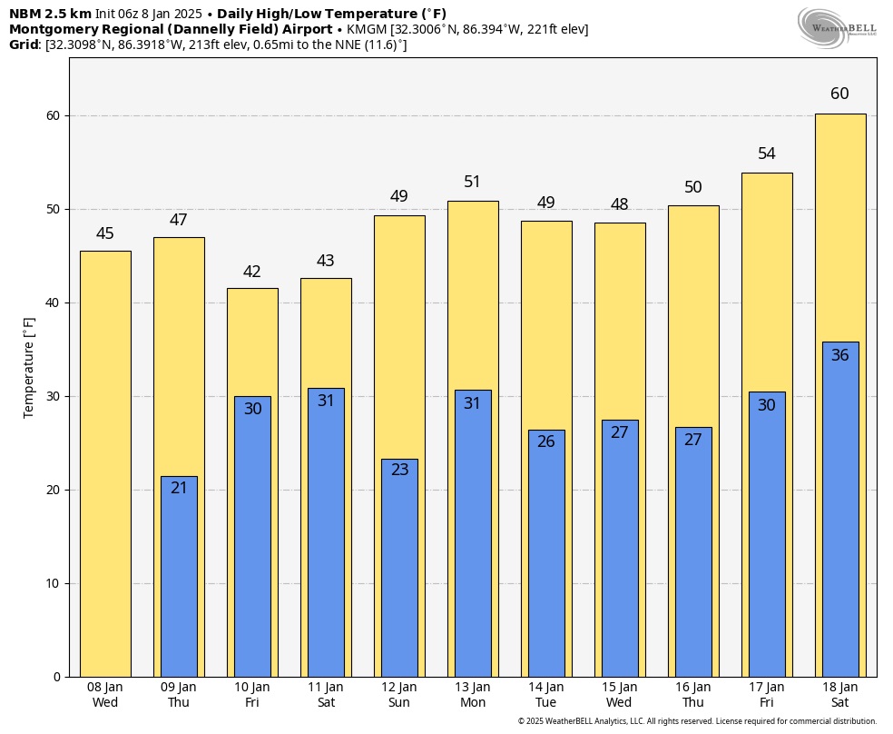
Here’s the 10 day model blend temperature trend. Looks like freezing temperatures for each of the next 10 days. The Arctic Grip continues, We should stay well below normal through Day 9.
.
Thanks for reading this special blog update. This morning everything is normal. We’ll be LIVE on NewsTalk 93.1. There will be another Blog Update and Forecast Video discussion in the 4’o’clck hour tomorrow morning. Have a good dau, despite the weather.
–Rich
