Good Morning! A major winter storm, currently in Texas, is headed for Alabama. Low pressure will track eastward along the northern Gulf Coast. A wintry mix still appears likely as far south as the US 80/I-85 corridor late tonight and for much of the Friday morning commute, then changing to a cold rain. Little or no accumulation is expected locally. However, snow accumulation becomes more likely the farther north you go in Alabama. Travel over about the northern third of state will become nearby impossible. Today’s Blog update is packed with graphics. It will detail the potential impacts, and the various Winter Weather alerts. It also includes the various anticipated snow accumulation forecasts. These maps will be updated as this day progresses. Here’s my brief forecast discussion.
TODAY: Mosly sunny, High 48. NW wind 5 to 10 mph.
TONIGHT: Chance of a rain/snow/sleet mix after Midnight and particularly after 3AM,
FRIDAY: Wintry mix during the morning commute, Mostly rain and snow mainly through 9AM, then just a Cold Rain. Little or no accumulation is expected. East wind 11 to 16 mph. High 39. Rain ending before 9PM. Wind gusts as high as 25 mph. Low 55.
Here’s the map set up as low pressure moves from Texas, then along the northern Gulf coast. This is the classic text book winter storn set-up for Alabama.
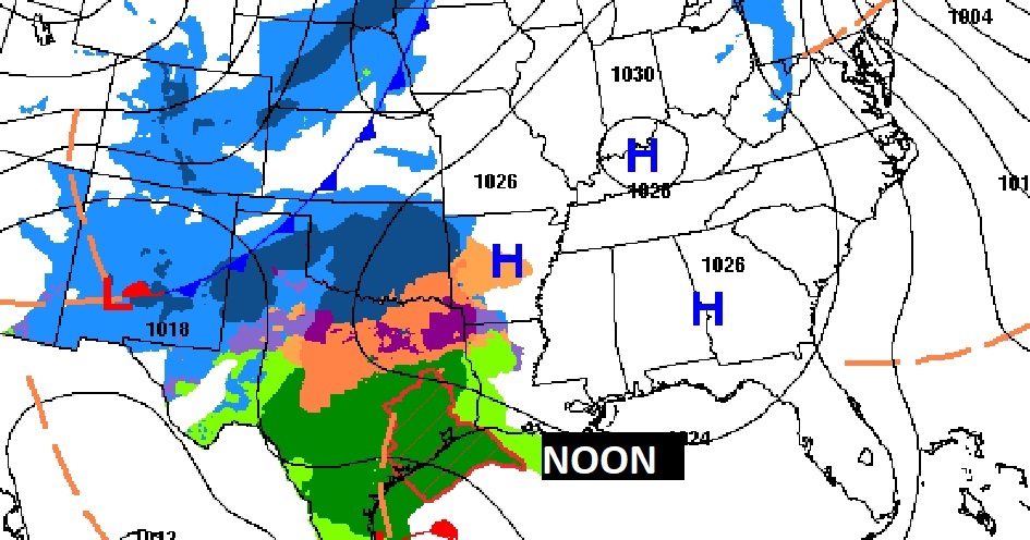
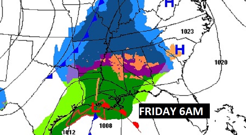
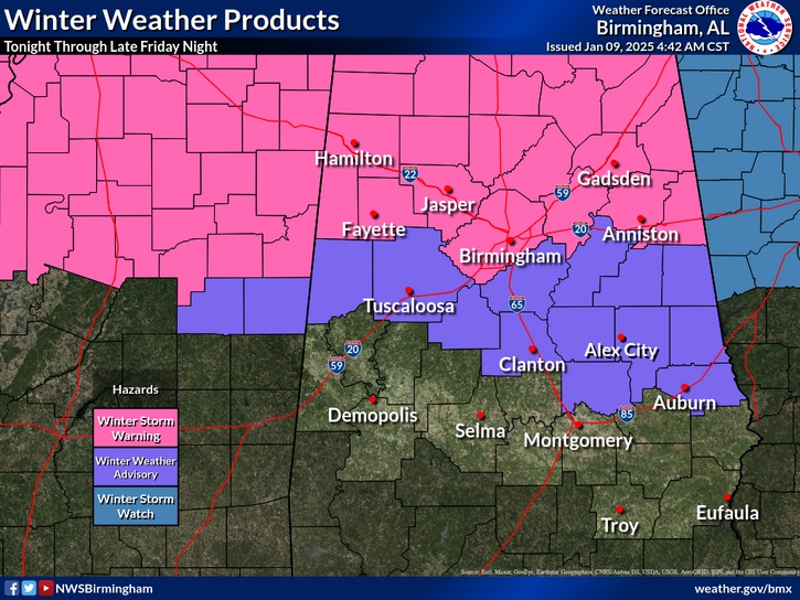
UPDATED WINTER ALERTS: Winter Storm Warning from Jefferson county northward, including Birmingham. WINTER WEATHER ADVISORY has far south as Elmore and Lee counties for potential hazardless travel on Friday AM.
IMPACT: Along the US 80/I-85 corridor, some slippery spots are likely, especially on bridges and overpasses through the morning commute hours. South of this area, mostly rain is expected.
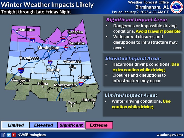
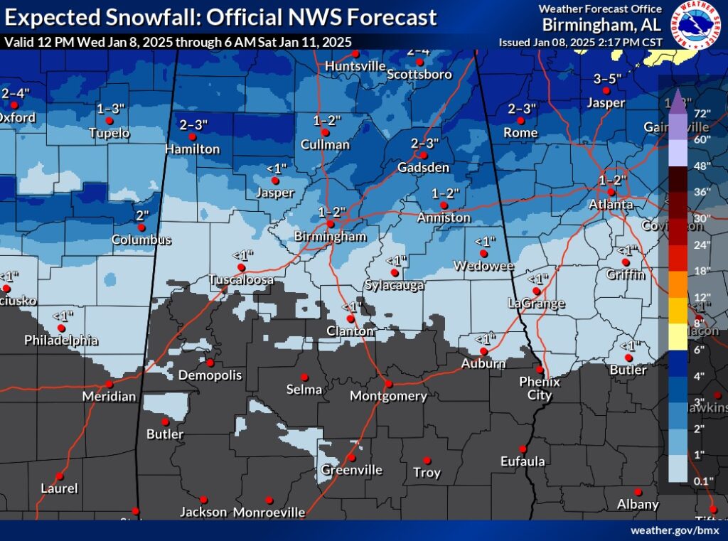
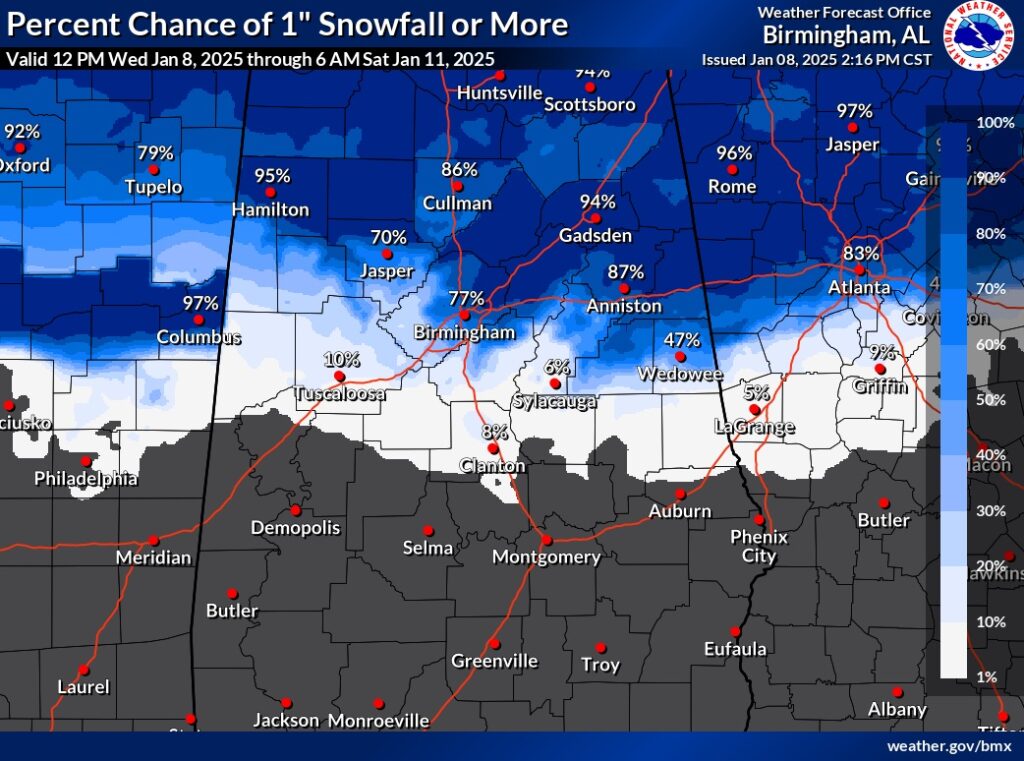
Note on the map as the impact level increases north of Clanton and through the Birmingham metro . Some road closures are possible. Some accumulations are a good bet. Farther north in the state, travel could become nearly impossible.
The GFS and EURO model are actually very similar on potential accumulation.
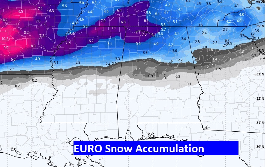
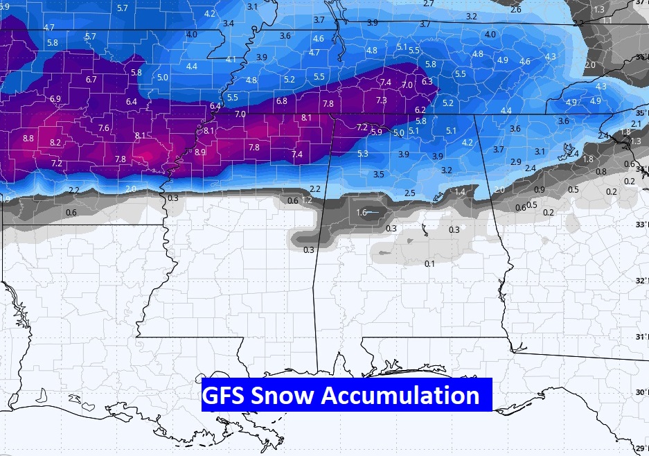
Here’s the NWS Birmingham’s adjusted model blend accumulation forecast and probability.
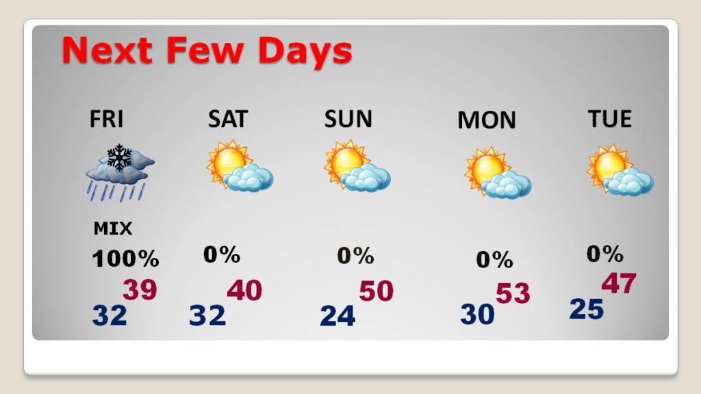
NEXT FEW DAYS: The weekend looks mostly sunny and cold. Saturday’s high will struggle to reach 40. Low 20’s are expected Sunday morning. The extended cold will continue Monday and Tuesday.
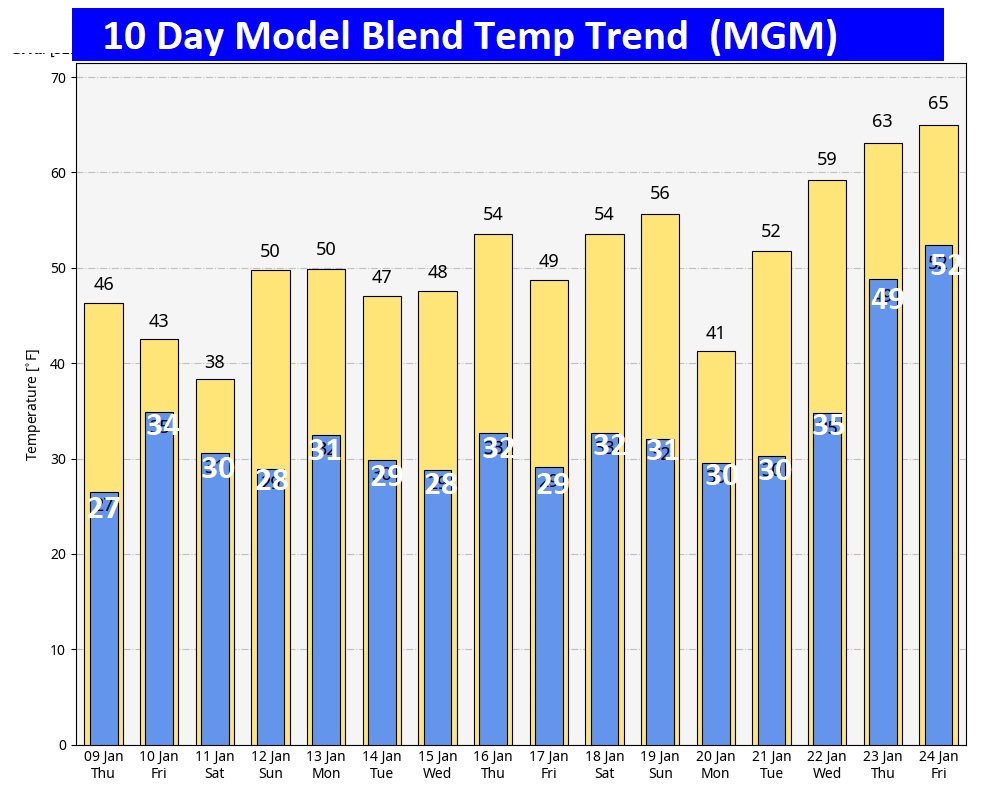
Here’s the 10 day model blend temperature trend. The Arctic Grip continues, Looks pretty dismal until late month, when temperatures become more reasonable.
.
Thanks for reading this special blog update. This morning everything is normal. We’ll be LIVE on NewsTalk 93.1. There will be another Blog Update and Forecast Video discussion in the 4’o’clck hour tomorrow morning. Have a good dau, despite the weather.
–Rich
