Good Morning! The relentless January chill continues. This morning we’re in the 20’s again. Today we’ will struggle to reach the lower 50’s. And, we’re headed for another freeze tonight. Temperatures will remain well below normal, until a brief warm-up Friday and Saturday, as the next storm system approaches. It’s a dry forecast through Thursday. Rain returns Friday Night. Saturday could be a soaker. Rain will exit by mid-day Sunday. Friday and Saturday will warm to the low 60’s. Here’s my brief forecast discussion,
TODAY: A good bit of sunshine, but too cold for Mid-January. High 52. Northwest wind 10 to 15 mph. Mostly cloudy tonight. Low 32.
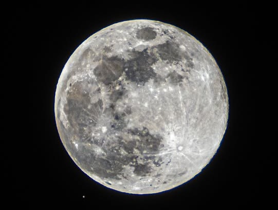
The Full Wolf moon this morning.
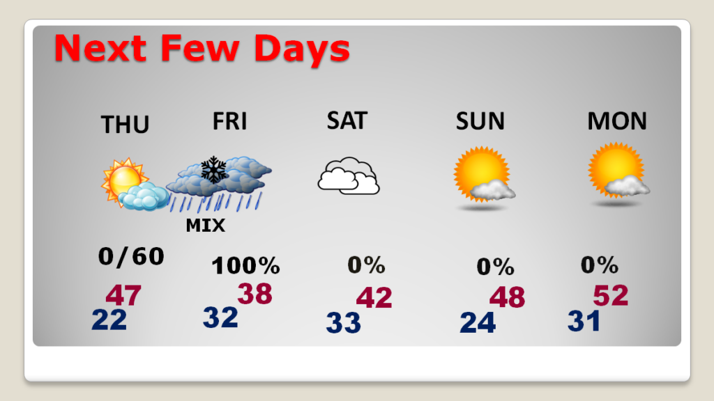
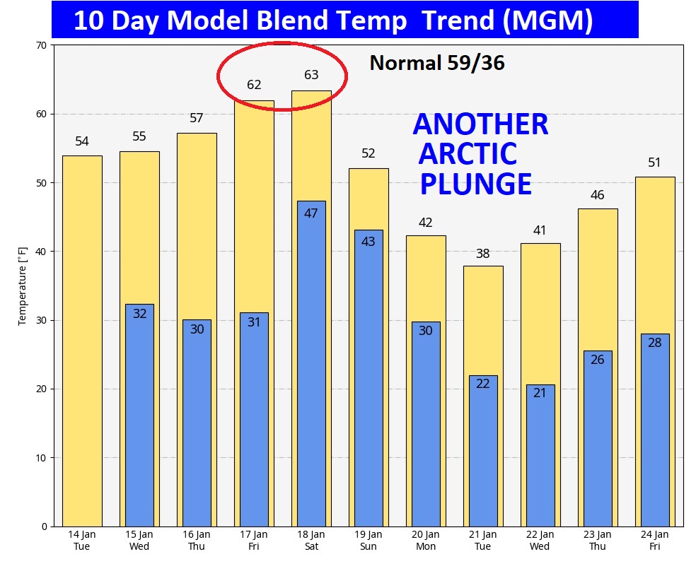
NEXT FEW DAYS: Not much new to tell you.Temperatures will remain well below normal, until a brief warm-up Friday and Saturday as the next storm system approaches. It’s a dry forecast through Thursday. Rain returns Friday Night. Saturday could be a soaker. Rain will exit by mid-day Sunday. Friday and Saturday will warm to the low 60’s.
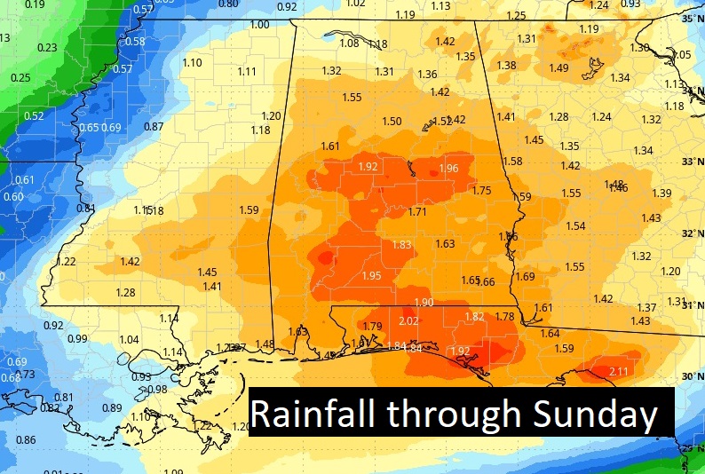
Friday night and Saturday look very wet indeed.
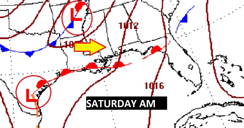
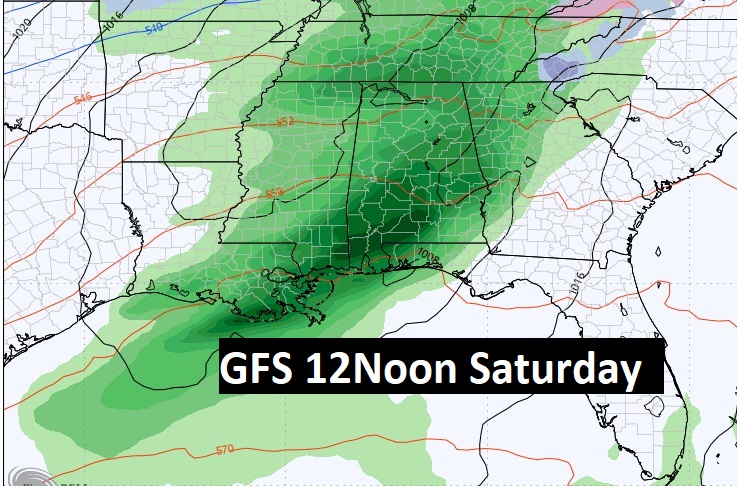
Here’s the expected rainfall through Sunday.
Here’s the 10 day model blend temperature trend. Depressing. Expect a brief warm-up Friday & Saturday. Most of the next 10 days will be well below normal. Look at that next Arctic Plunge next week.
It can’t get here soon enough. January has been depressing here in the Deep South on many levels,

Thanks for reading the blog. The next scheduled blog will be tomorrow morning, Have a nice day! Stay warm!
–Rich
