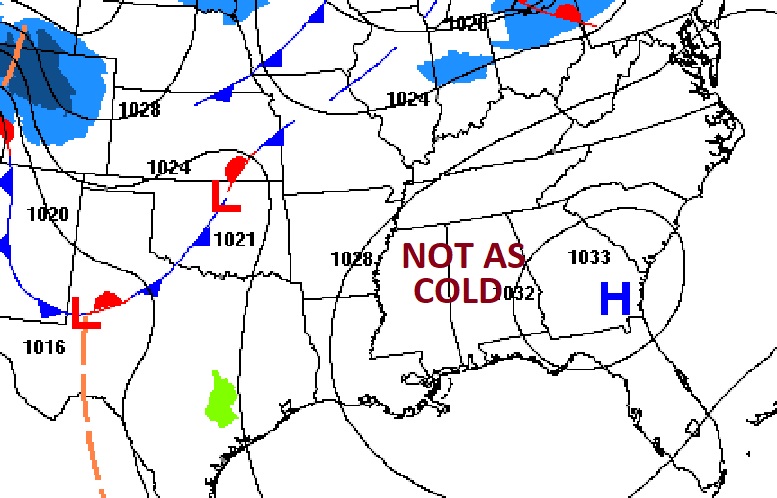
Good morning! Hang on ! There’s light at the end of the arctic tunnel. Normal hi/lo 60/37. Today’s high will be near 51. Mid 50s Sunday There’s warmer days ahead next week. By next Wednesday we may reach the middle 60’s. It’s been quite a long time since we saw numbers like that! The next chance of showers will be on Sunday and especially Sunday night and Monday as the next front approaches.
TODAY: Mostly sunny. Still way below normal . High 51. Northwest wind 6 to 12 mph. Partly cloudy. Another freeze tonight. Low 29.

.
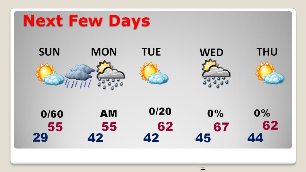
NEXT FEW DAYS: The Chill will start to fade. I have us in the mid 50’s by Sunday and Monday. Tuesday’s high will be near 60 and we are into the mid 60’s Wednesday. The next chance of showers will be on Sunday and especially Sunday night and Monday as the next front approaches.

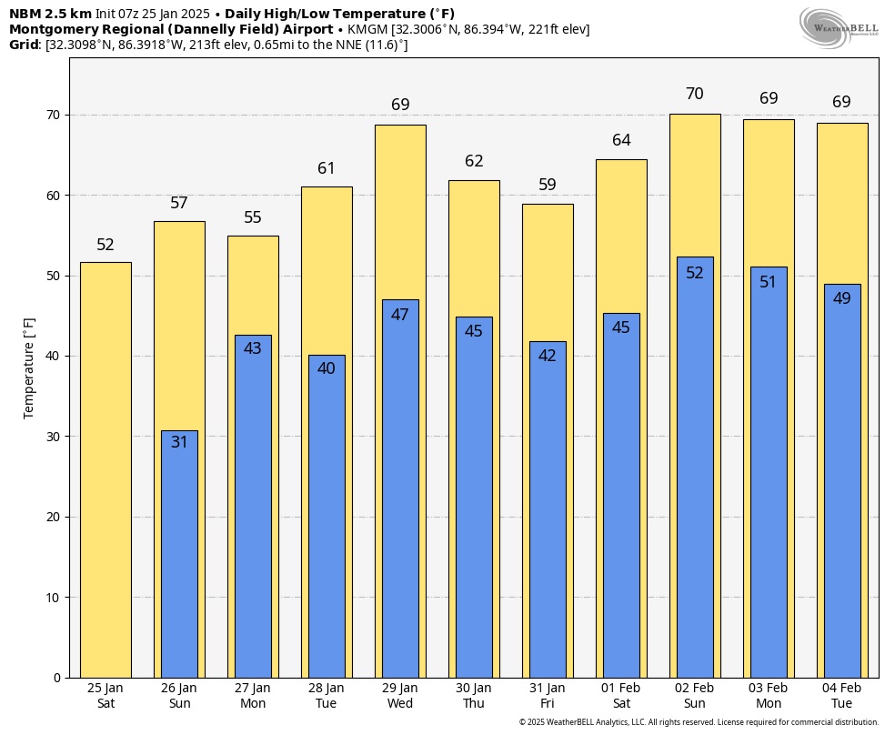
Here’s the 10 Day Model Blend Temperature Trend. Hang on! Next week will be a lot better. We’re headed back to the 60’s…finally!

Thanks for reading the blog. The next scheduled blog will be Monday morning, Have a nice weekend!
–Rich
