
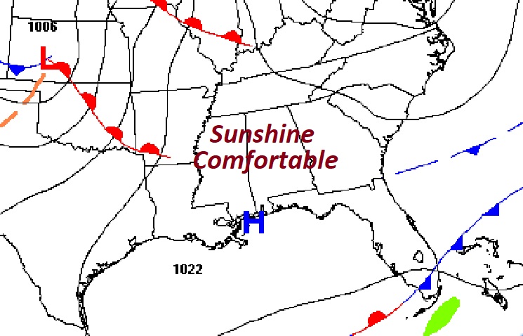
Good morning! Welcome to February. Timing is everything. Following the front that brought showers to the state yesterday, this first weekend of February looks rather remarkable. We’ll be in the 60’s today and lower 70’s on Sunday. In fact, next week looks amazingly warm for the first week on February. We could break 80 by mid-week. Winter is on hold. The next chance of showers arrives as a front approaches from the north.
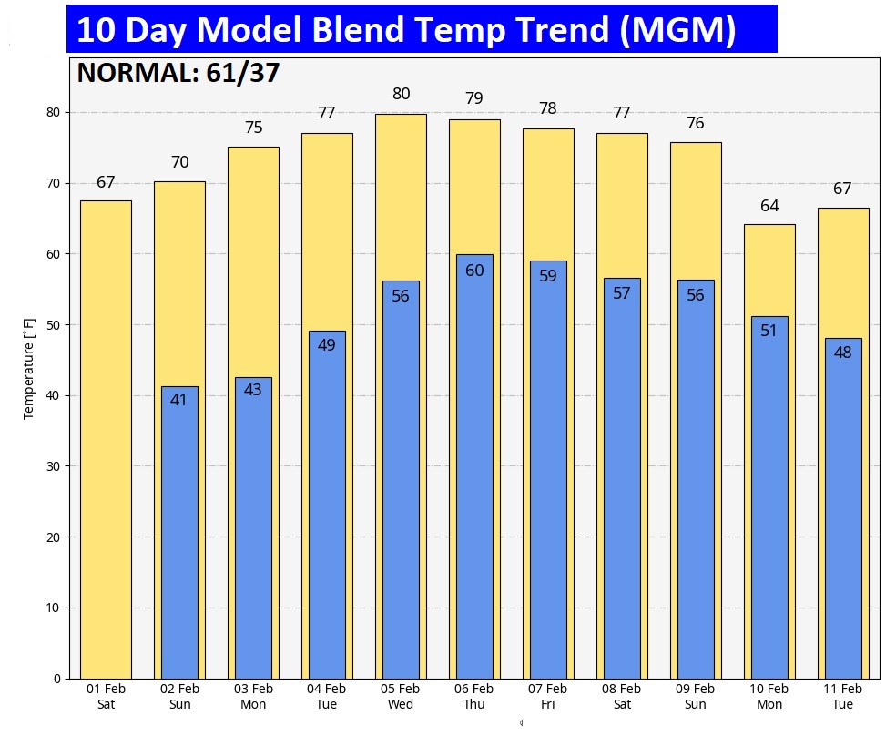
CLIMATE: Thursday’s high was 71, after a morning low of 51. (Normal 61/37) Rainfall at MGM: .11”. East Montgomery .26”
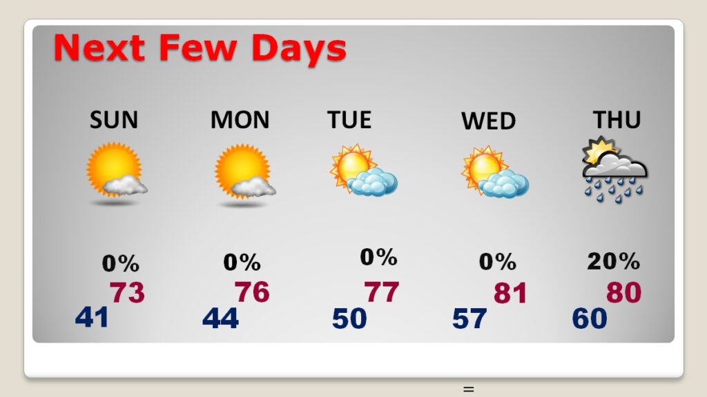
TODAY: Mostly sunny. Mild for the Dead of Winter. High 67. Light wind. Mostly clear tonight. Low 41.
NEXT FEW DAYS: Not bad for the Heart of Winter. In fact, it doesn’t end with the weekend. Monday through Wednesday looks dry and warm with highs possibly reaching the upper 70’s. We could break 80 by mid-week. Enjoy this remarkable pattern. We all know Winter will return.
Here’s the 10 day model blend temperature trend. Above normal temperatures appear to be locked in.
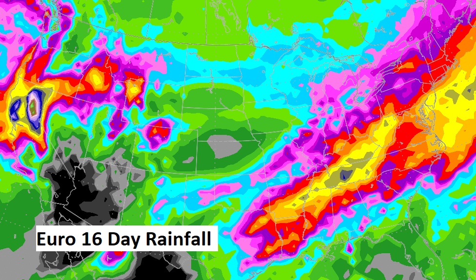
This is the EURO Ensembles over the next 16 days.
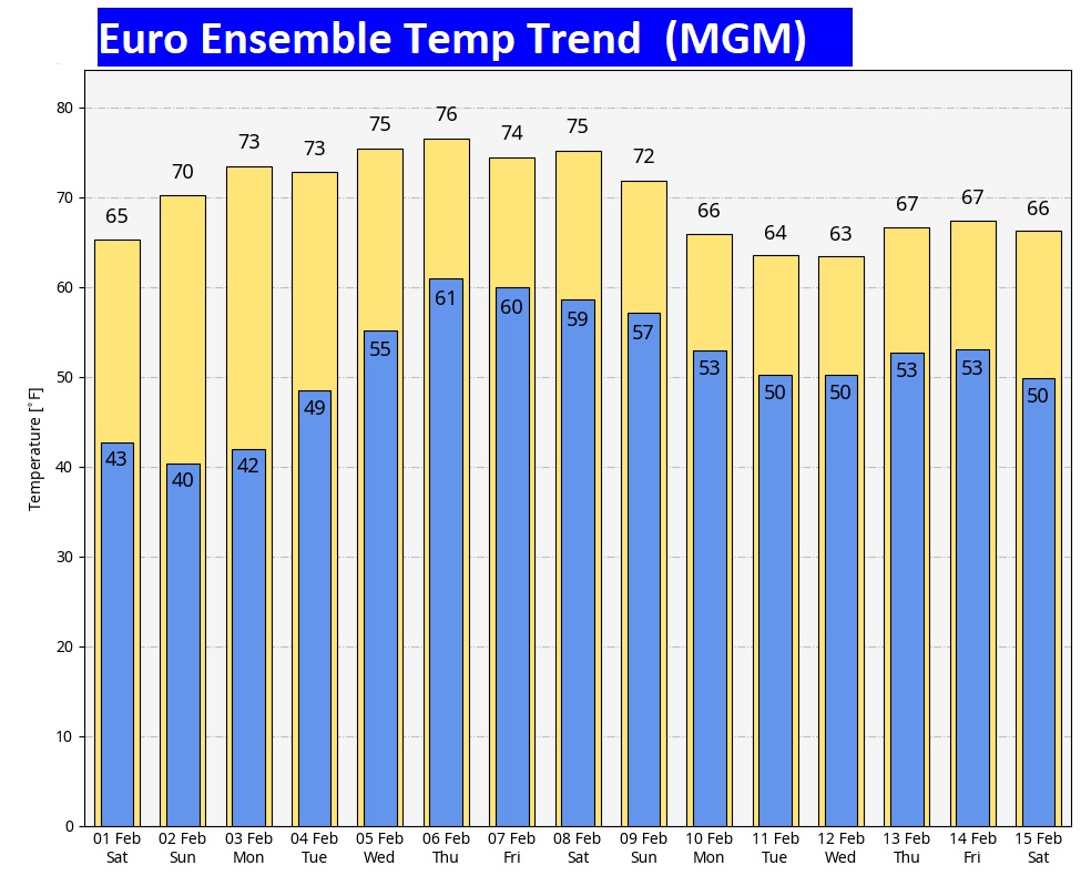
While much of the week ahead looks rather quiet, it looks like things will get a lot for active from about February 8 to 18th. Hang on. Looks like we could get busy.
WELCOME to February! The Days are getting longer. Sunrise is at 6:41. Sunset 5:18. Today: 10 hours, 39 mins. and 46 seconds long. That’s 1 minute and 35 seconds longer than yesterday. 46 days till the Vernal Equinox. #alwx
Thanks for reading the blog. The next scheduled blog will be Monday morning. Have a nice weekend!
–Rich