
Good morning! There are some showers on the radar this morning. Spotty showers are possible today and Friday. Nothing widespread or heavy. Meanwhile, our amazing Winter Thaw will continue at least through the weekend. We should be near 80 Friday. Lower 80’s Saturday would be a record. Even Sunday should be near 80. More widely scattered showers are possible Sunday Monday. Showers and storms will become likely by Tuesday and Tuesday night. Here’s my video forecast discussion.
CLIMATE: Yesterday the low at MGM was 52. High 76. Rainfall: Trace
Normal 68/38.
TODAY: Considerable cloudiness through mid-day. Limited sunshine this afternoon. Continued warm. High 78. Risk of a few scattered showers this afternoon and this evening. Cloudy, mild tonight. Low 59.
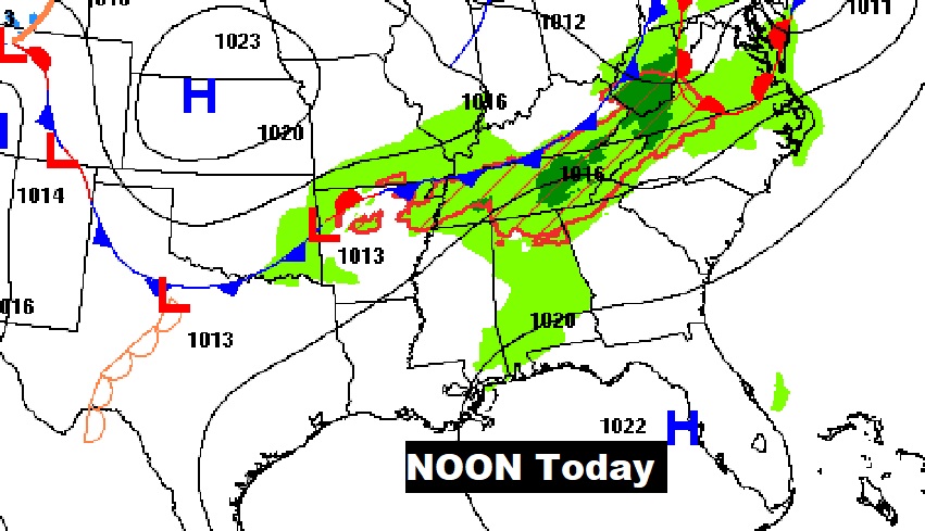
Here’s the set-up today. The front to the north will continue to influence our forecast with spotty showers.
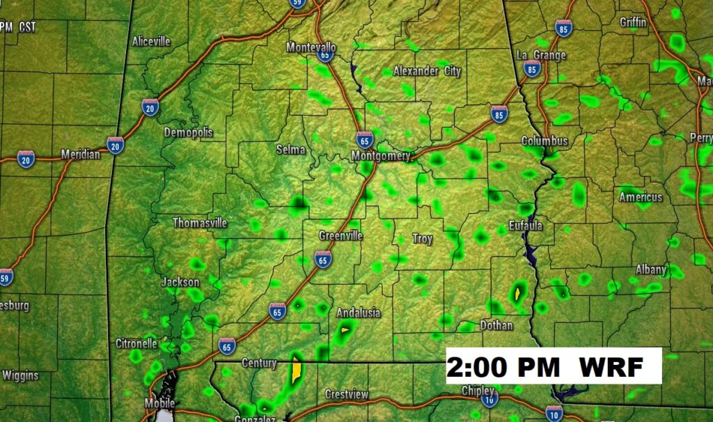
Future Radar snapshot on the WRF model at mid afternoon Widely scattered showers. Nothing widespread.
NEXT FEW DAYS: Springtime in February continues. We’ll continue well above normal through Monday. (Normal 68/38).
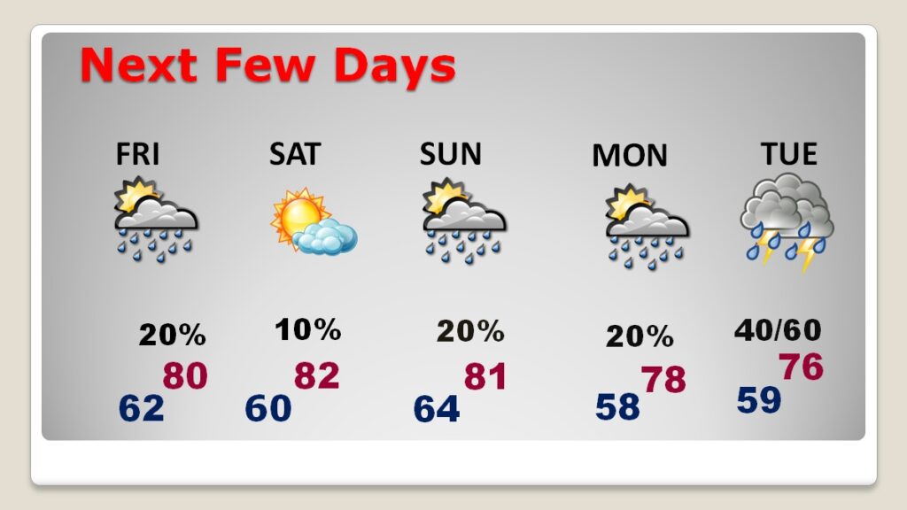
Spotty showers are possible Friday. Saturday looks dry. More widely scattered showers Sunday and Monday. Showers and storms will become likely by Tuesday and Tuesday night.
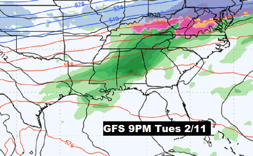
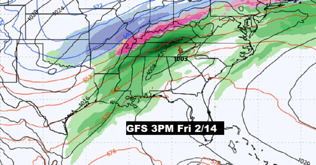
Getting busy next week? Looks like a couple notable storm systems Tuesday night and again towards Friday February 14.
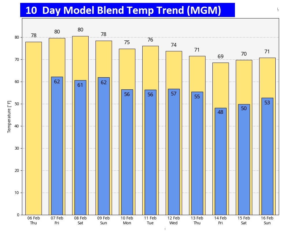
Here’s the 10 day model blend temperature trend. Very warm this week. Somewhat cooler next week, but not cold.
Looking way out, the GFS is suggesting a taste of the arctic toward February 18. Don’t take this to the bank yet. We’re just looking.

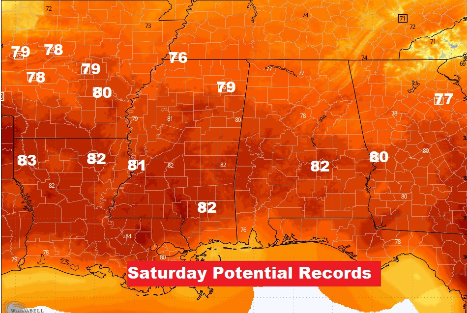
THREATENING RECORDS?:
The unusual Spring-like warmth continues. Best chance of tying a record could be Saturday.
Thanks for reading this blog update. This morning everything is normal. We’ll be LIVE on NewsTalk 93, from 6 to 9AM. There will be another Blog Update and Forecast Video discussion in the 4’o’clck hour tomorrow morning. Have a good day.
–Rich