
Good morning! Our amazing Winter Thaw will continue at least through the weekend. We should be near 80 today. Lower 80’s Saturday would be a record. Even Sunday should be near 80. More isolated showers are possible today, and again Sunday and Monday. Showers and storms will become likely by Tuesday afternoon and Tuesday night. That’s just a start of a very active weather week next week. Here’s my video forecast discussion.
CLIMATE: Yesterday the low at MGM was 58. High 80. Trace of rain. Normal 63/39.
TODAY: Considerable cloudiness through mid-day. Gradual clearing this afternoon. Continued warm. High 80. (Record 81 2019) Risk of a few isolated showers this afternoon and this evening. Cloudy, mild tonight. Low 60.
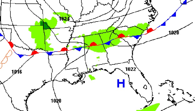
Here’s the set-up today. The stationary front to the north will continue to influence our forecast with spotty showers.
NEXT FEW DAYS: Springtime in February continues. We’ll continue well above normal through Monday. (Normal 63/39).
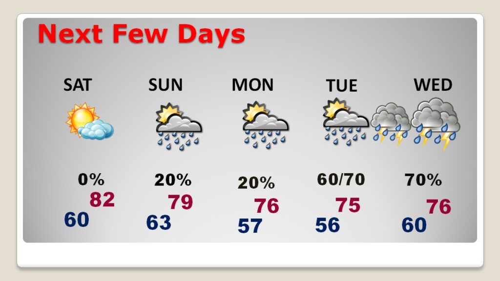
Saturday looks dry. More widely scattered showers Sunday and Monday. Showers and storms will become likely by Tuesday and Tuesday night. Saturday’s record of 81 from 1923 is also in jeopardy.
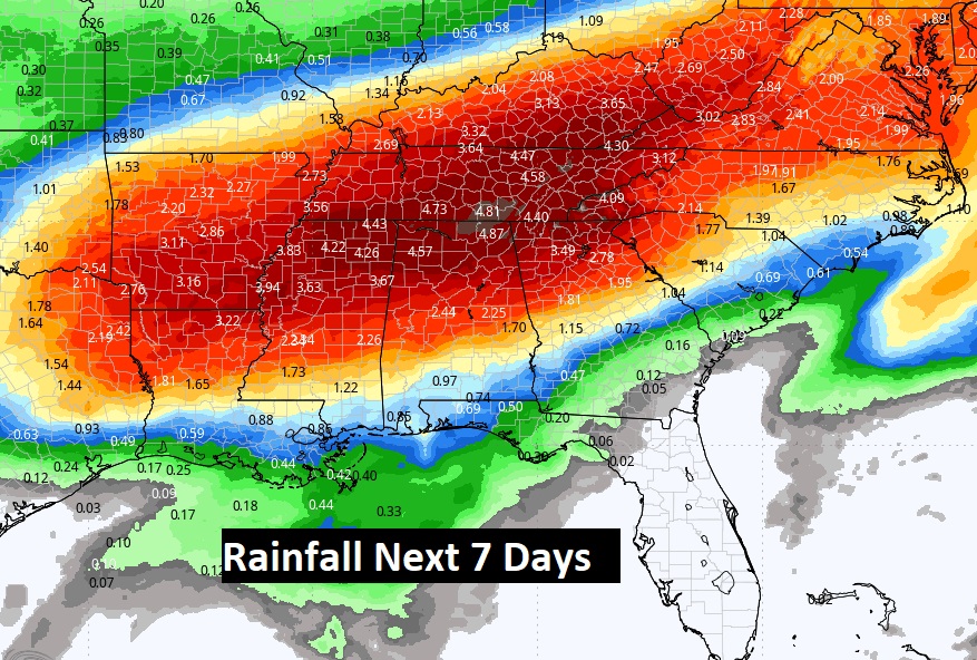
Busy times next week. Looks like a couple notable storm systems Tuesday night and again Thursday night/Friday. And perhaps yet another disturbance the following weekend.
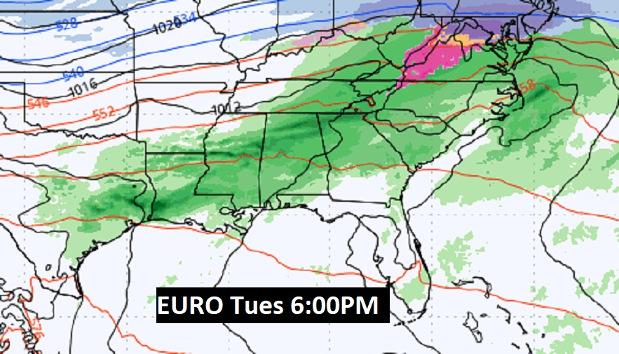
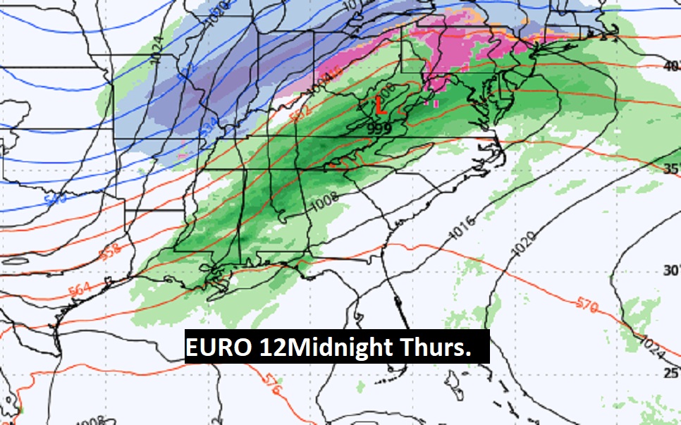
Here’s the expected rainfall over the next 7 days.
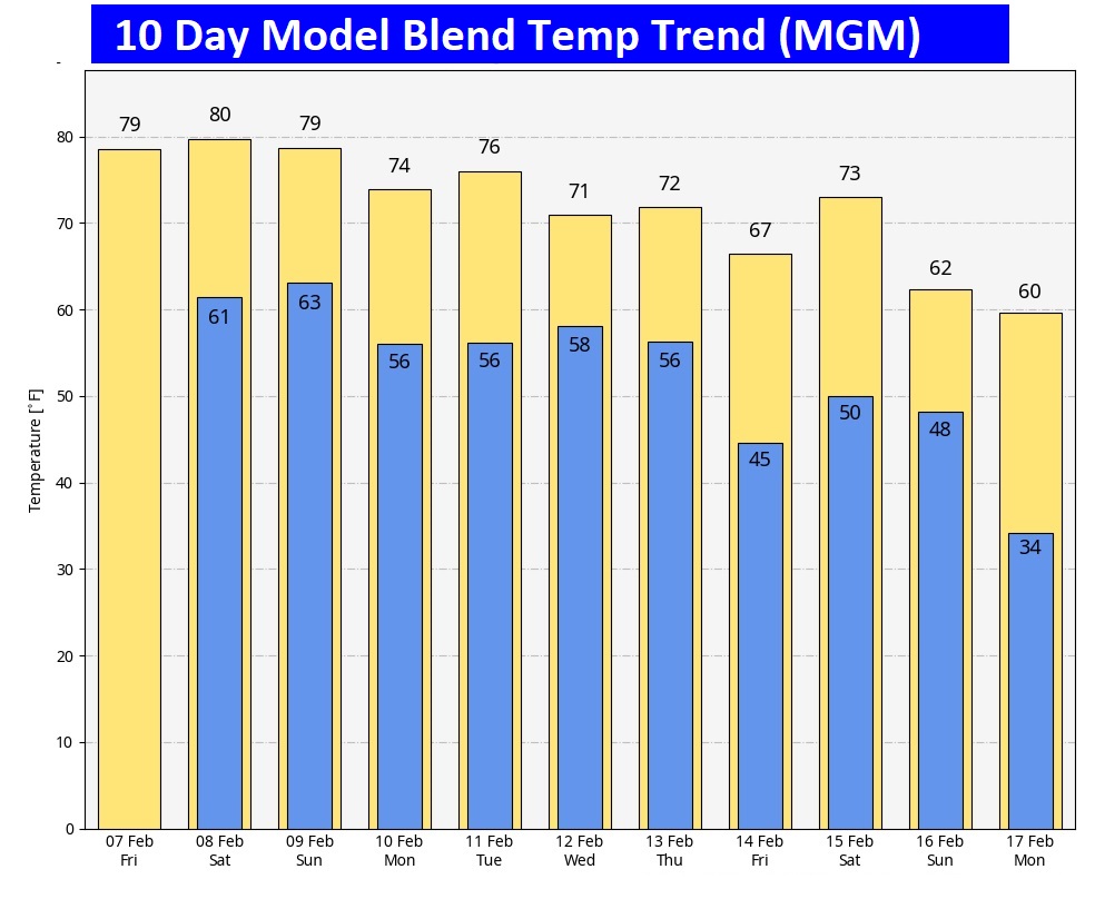
Here’s the 10 day model blend temperature trend. No arctic air is indicated at this point.
Thanks for reading this blog update. This morning everything is normal. We’ll be LIVE on NewsTalk 93, from 6 to 9AM. There will be another Blog Update and Forecast Video discussion in the 4’o’clck hour tomorrow morning. Have a good day.
–Rich