
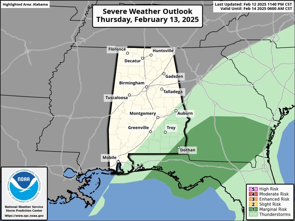
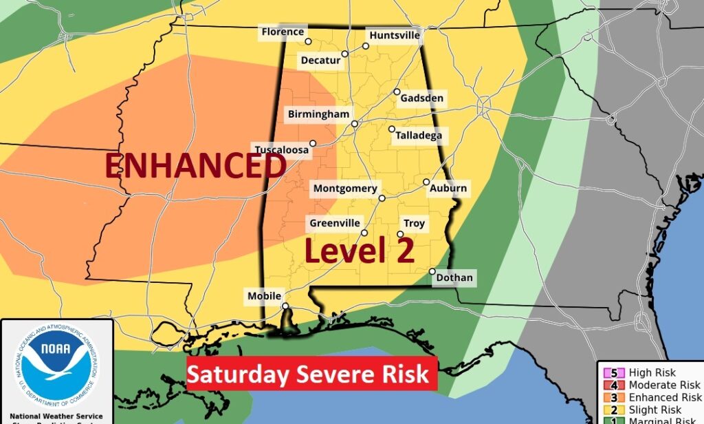
PLEASE forgive me. I’ve had very little sleep due to the storms. This will be a very abbreviated blog, I promise there will be more later in the day as we approach a serious Severe Threat Saturday night.
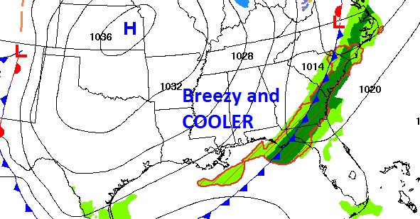
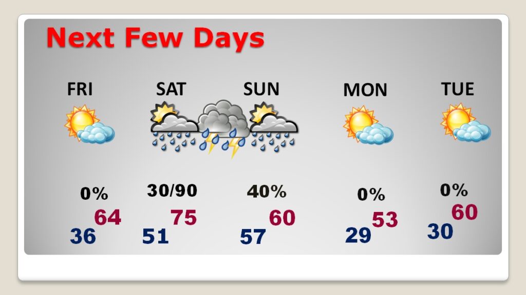
Good morning! The front that brought the big storms and drenching rain will exit the state early today. It’ll be cloudy until mid-day, but expect improvement as the day goes on. We’ll see some sun later. Breezy and cooler today. We’re headed for the 30’s tonight. Friday will feature a fair amount of sun, but hang on. The next storm system moves in by Saturday evening and Saturday night with yet another rather potent severe weather threat, including a significant tornado risk . Behind this system, it will turn sharply colder Sunday into Monday. We’ll be in the upper 20’s by Monday Dawn. Monday’s high will struggle to reach the low 50’s.
.CLIMATE: Wednesday high was 73 at Midnight.. MGM Rainfall: 2.87. East Montgomery 1.97″
TODAY: Cloudy through mid-day. Gradual clearing later. Breezy and cooler. High 64. Northwest wind 10-15 gusting to 25 mph. Partly cloudy and colder tonight. Low 36.
NEXT FEW DAYS: Friday looks quiet. Lots of sunshine. High in the low to mid 60’s. But stand-by. The next storm system moves in by Saturday evening and Saturday night with yet another rather potent severe weather threat, including a significant tornado risk . Behind this system, it will turn sharply colder Sunday into Monday. We’ll be in the upper 20’s by Monday Dawn. Monday’s high will struggle to reach the low 50’s. Another freeze is expected Monday night.
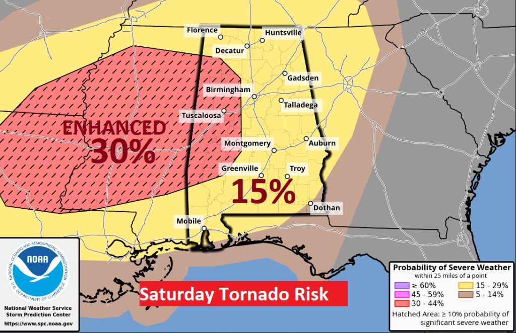
SPC has been advertising a Saturday night Severe Weather Threat for several days now. I’ll have more on this threat later today. Could be a significant late night risk of squall line (QLCS) tornadoes . But, something bothers me. The EURO is hinting of some possible thunderstorm development in the afternoon. Discrete Supercells can’t be ruled out. That would increase the threat of potentially strong tornadoes.
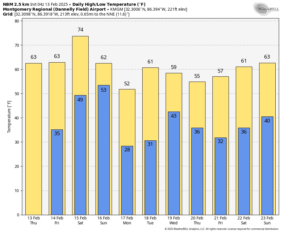
Here’s the 10 day model blend temperature trend.
Thanks for reading this special blog update. This morning everything is normal. We’ll be LIVE on NewsTalk 93.1. There will be another Blog Update and Forecast Video discussion in the 4’o’clock hour tomorrow morning. Have a good day.
–Rich